


Refine your search for walks in Col de L'Aiguille (1340m)
Col de L'Aiguille (1340m) walks


 Association / Club / Walk leader
Walks near Col de L'Aiguille (1340m)
 The Crête de Peyre Non
 Visorando Member
 4.60 mi
 +2,162 ft
 -2,251 ft
 4h 00
4h 00
 Moderate
 Departure from La Roche-de-Rame (Hautes-Alpes)
Pleasant circular walk on the western side of the Durance Valley.
Route around Le Ponteil
 4.23 mi
+1,791 ft
-1,729 ft
3h 30
Moderate
Departure from Champcella (Hautes-Alpes)
4.23 mi
+1,791 ft
-1,729 ft
3h 30
Moderate
Departure from Champcella (Hautes-Alpes)
A route starting from Le Ponteil that goes round the large, unnamed peak near the Tramouillon hut.
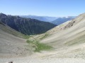
The Lacs de l’Ascension and the Pic de Haut Mouriare
 10.06 mi
+4,252 ft
-4,259 ft
8h 20
10.06 mi
+4,252 ft
-4,259 ft
8h 20
 Difficult
Departure from La Roche-de-Rame (Hautes-Alpes)
Difficult
Departure from La Roche-de-Rame (Hautes-Alpes)
A hike with some very steep and vertiginous sections! This hike is a variation on the one marked as PR®.
Wild crossing of the Écrins
 73.32 mi
+28,494 ft
-29,314 ft
7 days
73.32 mi
+28,494 ft
-29,314 ft
7 days
 Very difficult
Departure from L'Argentière-la-Bessée (Hautes-Alpes)
Very difficult
Departure from L'Argentière-la-Bessée (Hautes-Alpes)
This 7-day trek is for hikers who are used to camping in tents.Although there are a few refuges along the route, the stages are designed for those who wish to sleep in the heart of nature.The circuit crosses the Écrins massif and offers total immersion in the alpine landscape, where you can encounter local flora and fauna.Ideal for walkers who are used to the mountains, it is a complete adventure that will challenge you with its significant elevation changes and occasional technical or unmarked sections.
Argentière station - Ravin des Serres
 11.12 mi
+4,564 ft
-223 ft
9h 05
Difficult
Departure from L'Argentière-la-Bessée (Hautes-Alpes)
11.12 mi
+4,564 ft
-223 ft
9h 05
Difficult
Departure from L'Argentière-la-Bessée (Hautes-Alpes)
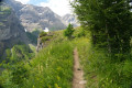
For this first stage, you will begin your journey at the Argentière-les-Écrins train station. The hike follows the GR®54A, taking you through the Fournel valley and the Deslioures biological reserve. You will finally arrive at a plateau that is ideal for camping.
Please note: landslide in July 2025
Moussière - Alpage de la Selle
1.89 mi
+1,283 ft
-59 ft
2h 00
Moderate
Departure from Saint-Crépin (Hautes-Alpes)
Access from the alpine hamlet of Moussière to the bivouac area located between the Selle and Crousas mountain pastures. This mountain pasture overlooks the Cabane Sainte-Marie, where the sheep are kept at night.
Alpage de la Selle - Moussière
4.92 mi
+358 ft
-1,581 ft
2h 35
Moderate
Departure from Saint-Crépin (Hautes-Alpes)
This pleasant second day begins with a climb to the Col de Moussière before passing by the very pleasant Lac du Lauzet, then taking the long forest track back to the Moussière car park.
The Col des Terres Blanches
11.81 mi
+4,259 ft
-3,822 ft
9h 10
Difficult
Departure from Freissinières (Hautes-Alpes)
From Dormillouse to Prapic via the Col des Terres Blanches.
Furfande – Souliers
 11.69 mi
+2,339 ft
-3,858 ft
7h 25
Difficult
Departure from Arvieux (Hautes-Alpes)
11.69 mi
+2,339 ft
-3,858 ft
7h 25
Difficult
Departure from Arvieux (Hautes-Alpes)
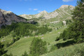
This walk, starting from the Furfande refuge, will take you past the magnificent barns and chalets of Furfande and lead you along a path running along a ridge above the Queyras valley, where the River Guil winds its way through, then on to Souliers via an ascent from the hamlet of Les Moullins in the Arvieux valley.
Vallouise - Pré de la Chaumette Mountain Hut
 13.54 mi
+5,381 ft
-3,255 ft
10 hrs
Very difficult
Departure from Vallouise (Hautes-Alpes)
13.54 mi
+5,381 ft
-3,255 ft
10 hrs
Very difficult
Departure from Vallouise (Hautes-Alpes)
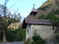
The Col de l'Aup Martin and the Pas de la Cavale from the Onde Valley, leading into the Champoléon Valley.
The Aup Martin – what a pass!
Note: This route is a stage of the Tour de l'Oisans but it is very challenging, particularly in early summer when there is still snow on the Col de l'Aup Martin. For this reason, a diversion has been put in place starting from Vallouise, passing through Puy Saint-Vincent, the Col de la Pousterle and the Fournel valley. You then join the Pas de la Cavale (GR®54A).