


Refine your search for walks in Col de Durbize (543m)
Col de Durbize (543m) walks


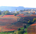
 Red Loop in Chiroubles
 Visorando Member
 10.24 mi
 +1,929 ft
 -1,923 ft
 6h 25
 Moderate
 Departure from Chiroubles (Rhône)
17 km loop in the commune of Chiroubles. Alternating paths through the vineyards, meadows and woods. Magnificent views over the Saône plain and as far as Mont Blanc.
Boucle Bleue in Chiroubles
 6.55 mi
+1,260 ft
-1,243 ft
4h 05
Moderate
Departure from Chiroubles (Rhône)
11 km loop in the commune of Chiroubles. Alternating paths through the vineyards, meadows and woods. Magnificent views. Blue markings.
From Chiroubles to the Col de Durbize
 3.88 mi
+758 ft
-764 ft
2h 25
 Easy
Departure from Chiroubles (Rhône)
A short walk to get in shape through the Beaujolais vineyards.
Over hills and through Vauxrenard
 13.06 mi
+2,385 ft
-2,385 ft
8h 05
 Difficult
Departure from Vauxrenard (Rhône)
Vauxrenard is one of the most beautiful sites in the Beaujolais region. The village clings to the edge of a natural amphitheatre, sloping towards Juliénas and the Saône valley. This hike offers a varied route through sloping vineyards, magnificent forests and panoramic views stretching as far as the Alps on a clear day.
Walks near Col de Durbize (543m)
Panoramic views of the rocky outcrops and châteaux of the Mâconnais vineyards
6.25 mi
+348 ft
-1,404 ft
3h 10
Moderate
Departure from Solutré-Pouilly (Saône-et-Loire)
This stage begins opposite the Roches de Solutré and Vergisson, classified as a Grand Site de France, with a panoramic view of the Jura mountain ranges and Mont Blanc. You pass through two natural areas of ecological, faunistic and floristic interest (ZNIEFF) and renowned vineyards (Pouilly-Fuissé, Pouilly-Vinzelles), overlooking the châteaux of Chasselas and Vinzelles.
The Beaujolais Vert via the highest point in the Rhône department
13.04 mi
+2,064 ft
-2,080 ft
7h 45
Difficult
Departure from Saint-Igny-de-Vers (Rhône)
Within the UNESCO Global Geopark of Beaujolais, the route passes through three natural areas of ecological, faunistic and floristic interest (ZNIEFF). As you climb to the summit of Mont Saint-Rigaud, which towers over the region at an altitude of 1,009 metres, you can enjoy a 360° panoramic view from the orientation table at the top of the viewpoint. On your way down to the Col de Crie, stop off to sample some local specialities.
 From La Collonge to Montenet
 4.88 mi
+909 ft
-696 ft
1.5 hrs
Easy
Departure from Saint-Nizier-d'Azergues (Rhône)
A short walk, shared with walkers and perhaps… cyclists on ‘the viaduct route’. The marked route is about 8 km long and offers plenty of variety, alternating between hamlet crossings (with a bit of tarmac to navigate…) and woodland paths with little elevation gain.