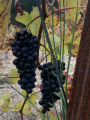
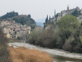
Col de Chabrière and view of Mont Ventoux

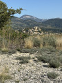
The route takes you first through vineyards, olive groves and apricot orchards, then through the pine forest to the Col de Chabrière. A return trip to a viewpoint, ideal for a picnic, offering views of Entrechaux Castle and Mont Ventoux.

Details

43590396
Creation:
Last update:
Last review:
  • Walking
    Activity: Walking
  • ↔
    Distance: 2.37 mi
  • ◔
    Average duration: 1h 25 
  • ▲
    Difficulty: Easy

  • ⚐
    Back to start: Yes
  • ↗
    Ascent: + 420 ft
  • ↘
    Descent: - 417 ft

  • ▲
    Highest point: 1,243 ft
  • ▼
    Lowest point: 837 ft

Description of the walk

Park in the car park on the right-hand bend as you approach from the Roman bridge at Entrechaux, after the sign for Hameau de Cabrières.

(S/E) Return towards the sign and take the path on the left alongside the vineyards. At the end of the plot, you’ll reach a lane lined with olive trees.

(1) Head down to the right and then walk alongside the apricot orchards. Then turn left, walking alongside another apricot orchard. You’ll reach a T-junction.

(2) Head uphill to the left towards the pine forest. Continue uphill through the pine forest to reach the Col de Chabrière.

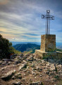
(3) Take the path on the left to reach the highest point.

(4) Return along the same route to the pass.

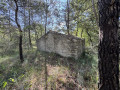
(3) Head downhill to the left, passing the ruins of an old shelter. Descend through the pine forest and along a stony path, going round the hillock, passing alongside the Darbousset ravine, then arriving at a crossroads near the vineyards.

(5) Take the small path on the left uphill, then head downhill until you reach the car park (S/E).

Waypoints

  1. S/E : mi 0 - alt. 843 ft - Car park at the bend
  2. 1 : mi 0.19 - alt. 886 ft - Allée Oliviers. Overlooking the - Ouvèze (rivière)
  3. 2 : mi 0.56 - alt. 955 ft - T-junction
  4. 3 : mi 0.92 - alt. 1,198 ft - Junction. Return via the summit - Col de Chabrière (365m)
  5. 4 : mi 1.09 - alt. 1,243 ft - Summit
  6. 5 : mi 1.77 - alt. 889 ft - Vineyards
  7. S/E : mi 2.37 - alt. 843 ft - Car park at the bend

Notes

Please note: you will be passing through apricot orchards; please respect the area and do not touch the trees.
Best done in spring when the apricot trees are in bloom.

Worth a visit

(4) Highest point of the walk: enjoy the view of Entrechaux Castle and Mont Ventoux. You can have a picnic at the summit; there are plenty of rocks to sit on.

Reviews and comments

4.8 / 5
Based on 2 reviews

Reliability of the description
4.5 / 5
Ease of following the route
5 / 5
Route interest
5 / 5
User 4182589

Overall rating : 4.7 / 5

Date of your route : Mar 24, 2026
Reliability of the description : ★★★★☆ Good
Ease of following the route : ★★★★★ Very good
Route interest : ★★★★★ Very good
Very busy route : No

A rather pleasant walk with stunning views of the vineyards, olive trees, apricot trees and… the famous Mont Ventoux.
One downside: the return journey along a very stony downhill path, not ideal for the knees.
For that reason, I’d say it’s not quite as easy as described.

Machine-translated

bm.chluda
bm.chluda

Overall rating : 5 / 5

Date of your route : Jan 08, 2024
Reliability of the description : ★★★★★ Very good
Ease of following the route : ★★★★★ Very good
Route interest : ★★★★★ Very good
Very busy route : No

A lovely little walk with a beautiful view of Mont Ventoux, but you absolutely must have a sat-nav as there are no signposts along this route

Machine-translated

Other walks in the area

For more walks, use our search engine .

The GPS track and description are the property of this route's author. Please do not copy them without permission.