


Refine your search for walks in Cirque d'Anglade
Cirque d'Anglade walks


 Cirque d'Anglade
 Visorando Member
 2.06 mi
 +1,089 ft
 -1,089 ft
 1h 55
1h 55
 Moderate
 Departure from Couflens (Ariège)
A short but steep climb leads to this cirque with the remains of the Anglade mines.
The Cirque d'Anglade and the Saubé Hut
6.48 mi
+3,238 ft
-3,225 ft
5h 50
 Difficult
Departure from Couflens (Ariège)
Difficult
Departure from Couflens (Ariège)
This hike offers a variety of landscapes, with woods giving way to mountain pastures as you climb higher, and the beautiful Cirque d'Anglade site to discover.Visorando app recommended.
Walks near Cirque d'Anglade
Refuge du Pinet - Montcalm/Estats/Verdaguer Peaks - Refuge Vallferrera
7.84 mi
+3,786 ft
-4,790 ft
6h 55
 Very difficult
Departure from Auzat (Ariège)
Very difficult
Departure from Auzat (Ariège)
The second day is a high-mountain stage passing through the highest point of this itinerary: Pic d'Estats, as well as two other peaks over 3,000 m nearby, Pic du Montcalm and Pic de Verdaguer. The route is largely over scree and rocky terrain, which will greatly appeal to mineral enthusiasts. The trail largely follows the Porta del Cel hike and the GR®T61. Although not particularly technical, this stage should not be taken lightly due to its altitude (three peaks over 3,000 metres), its length, its elevation gain and its trails composed of loose stones that can make progress difficult.
Bassiès-Port de Lers mountain hut via the Étang d’Alate and Mont Ceint
 3.97 mi
+1,883 ft
-2,313 ft
3h 30
Difficult
Departure from Auzat (Ariège)
3.97 mi
+1,883 ft
-2,313 ft
3h 30
Difficult
Departure from Auzat (Ariège)
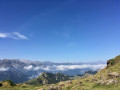
Before heading back, there is the option of a return trip to the Étang de Bassiès from the refuge, leaving some of your luggage at the refuge.A fairly short second stage, with two steep ascents (19% to 38%): one from the Refuge de Bassiès to the Port de Bassiès, and the even more challenging one from the Port de Saleix to the Pic de Girantès or Mont Ceint. In fact, it is a rather gruelling, up-and-down stage, classified as difficult. The ascents and descents are on challenging trails (pebbles, rocks, scree). The whole day is spent in open country with stunning panoramic views. The route passes the beautiful Étang d’Alate.The relative altitude, between 1,520 m and 2,100 m, means this day’s walk is feasible even in the height of summer.
Vallferrera Refuge - Pic de Comapedrosa - Comapedrosa Refuge
6.88 mi
+3,727 ft
-2,549 ft
6h 25
Very difficult
Departure from Alins (Lleida)
Third stage passing through the highest point in Andorra: Pic de Comapedrosa. A high-mountain stage with no particular difficulties apart from the climb to Portella de Baiau over scree and the descent along the somewhat exposed ridge of Pic de Comapedrosa.
Port de Lers–Bassiès Refuge via Pas du Roc, Étang de Labant, Col Fouzès
 7.46 mi
+2,927 ft
-2,493 ft
6h 00
Difficult
Departure from Suc-et-Sentenac (Ariège)
7.46 mi
+2,927 ft
-2,493 ft
6h 00
Difficult
Departure from Suc-et-Sentenac (Ariège)
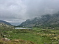
The first day takes you to the Bassiès Refuge, passing huts, a valley, mountain passes, an old mine, a pond, and various cols and mountain passes. The stretch from the Col de las Fouzès to the Port de Bassiès is particularly beautiful.The route follows paths and tracks that are difficult due to their terrain (rock, scree, unmarked).See practical information * From (3) to (6), an unmarked path with gradients of 15% and 25%, with Patou sheep present from (4). From (12) to (18), a marked path with gradients of 16% to 30%.Allow approximately 6 hours for the walk.