Route from the old bridge in Vigeois

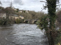
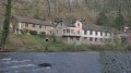
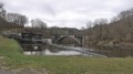
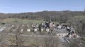
A walk starting from Vigeois that alternates between paths and quiet roads. The walk offers views of the old medieval bridge over the Vézère. It is extremely well signposted with yellow markings.

Details

2814203
Creation:
Last update:
Last review:
  • Walking
    Activity: Walking
  • ↔
    Distance: 5.51 mi
  • ◔
    Average duration: 3h 20 
  • ▲
    Difficulty: Moderate

  • ⚐
    Back to start: Yes
  • ↗
    Ascent: + 902 ft
  • ↘
    Descent: - 912 ft

  • ▲
    Highest point: 1,184 ft
  • ▼
    Lowest point: 817 ft

Photos

Description of the walk

(S/E) Start from the car park next to the abbey church in Vigeois. Head down Rue des Bijoux, then immediately turn right onto Rue de l’Ancien Hôpital. At the end of the street, continue along a path veering slightly to the left and cross over the railway line. Turn right into the street just past the railway line. When you reach the houses, immediately take a path leading down to the left. Go round the electricity substation, then turn right to head back up alongside the Vézère. Cross the Vézère via the old medieval bridge.

(1) After the bridge, follow the path to the right which runs alongside the Vézère. When you reach the road, cross it and continue along the path opposite. On the uphill stretch, veer left onto a path not marked on the map and join a road which you should take on the left.

(2) Leave the road via a path that climbs to the right. When you reach the hamlet of Lavaud, take the road on the left. Carry on, ignoring a road that climbs to the right.

(3) At the junction, head down the road to the right towards the Vézère. Pass the first junction (Bellevue), then cross the D7 and continue along a narrow lane that veers slightly to the right.

(4) At the junction near the bridge, carry on along the road which gradually moves away from the Vézère as it climbs. Pass the hamlet of Pont Peyroulier. Join the D3 and turn left onto it as it climbs.

(5) At a right-hand bend, leave the D3 immediately by taking a track on the left.

(6) At the junction, ignore a track leading off to the right and continue on to the hamlet of Viallevaleix.

(7) In the hamlet of Viallevaleix, continue along the road on the right until you reach the D3.

(8) Carry on to the right along the D3 and head downhill to the first junction.

(9) Then take a path on the right and rejoin the path you took on the way up.

(6) Turn left to return along the route you took on the way up, but this time heading down. Carry on to the bridge and head back up to the abbey church (S/E).

Waypoints

  1. S/E : mi 0 - alt. 1,014 ft - Vigeois Abbey Church
  2. 1 : mi 0.47 - alt. 833 ft - Medieval bridge - Vézère (rivière)
  3. 2 : mi 1.03 - alt. 1,115 ft - Path leading uphill to the right
  4. 3 : mi 1.34 - alt. 1,171 ft - Crossroads
  5. 4 : mi 1.94 - alt. 846 ft - Crossroads near the bridge
  6. 5 : mi 2.51 - alt. 1,086 ft - Start of the path on the left
  7. 6 : mi 2.63 - alt. 1,076 ft - Junction with return route
  8. 7 : mi 3.27 - alt. 1,093 ft - Viallevaleix
  9. 8 : mi 3.45 - alt. 1,119 ft - D3 road
  10. 9 : mi 4.23 - alt. 1,102 ft - Crossroads
  11. S/E : mi 5.51 - alt. 1,014 ft - Vigeois Abbey Church

Notes

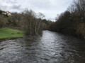
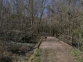
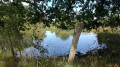
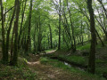
The photos were taken in December; the Vézère was slightly overflowing onto the path. The route is shorter than indicated on the sign next to the abbey church.

Reviews and comments

4.7 / 5
Based on 2 reviews

Reliability of the description
5 / 5
Ease of following the route
5 / 5
Route interest
4 / 5
Celineetfrederic
Celineetfrederic

Overall rating : 4.7 / 5

Date of your route : Aug 31, 2024
Reliability of the description : ★★★★★ Very good
Ease of following the route : ★★★★★ Very good
Route interest : ★★★★☆ Good
Very busy route : No

Please note that the path mentioned in point 1 is closed due to a rockslide.

Machine-translated

mr_robot19
mr_robot19

Overall rating : 4.7 / 5

Date of your route : Dec 30, 2019
Reliability of the description : ★★★★★ Very good
Ease of following the route : ★★★★★ Very good
Route interest : ★★★★☆ Good

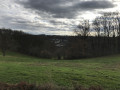
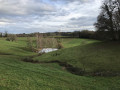
A lovely walk, with beautiful panoramic views, around the Vézère and the village of Vigeois. A bit too many roads for my liking, but they’re generally quiet. I’m thinking of doing it again, but when it’s a few degrees warmer!

Machine-translated

Other walks in the area

For more walks, use our search engine .

The GPS track and description are the property of this route's author. Please do not copy them without permission.