Country:

 City:
City:


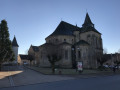
Start from the abbey church in Vigeois; there are plenty of parking spaces nearby.
(S/E) Take Rue de l’Hirondelle, which continues from the church square, then turn right into the first street. Continue straight on along the track until you reach the D156.
(1) Turn right onto the D156, cross it, then turn into the first path on the left.
(2) When you reach the road, take the path directly opposite. Stay on the main path, keeping to the left, until you reach a junction.
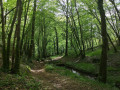
(3) At the junction, leave the Blue route and theGR® de pays on your right and follow the yellow markings on your left. Follow the path until you reach the road.
(4) When you reach the road, turn left onto it and follow it until you reach the D7.
(5) Follow the D7 to the right until you reach the junction for the hamlet of Poncharal.
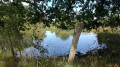
(6) At the junction, you can continue straight on towards Lac de Pontcharal. A 3km path goes round the lake. Follow the road towards Pontcharal, then take a path on the left.
(7) Near the hamlet of La Roche, the track continues straight on to the road, diverging slightly from the route shown on the IGN map. Take the road on the left. Continue straight on along a track passing between the houses at the first bend on the right. Cross a street and continue along the track to the Vigeois care home.
(8) Continue along Rue des Pouleaux. Turn left onto Route de Brive and immediately take Route de Perpezac-le-Noir opposite. Turn right onto Rue de Villeneuve. Turn right onto Rue du Vieil If. Turn left onto the main street and continue to the abbey church (S/E).

 Visorando Member
 Moderate