The Fox Route above Fameck

A short walk suitable for children aged five and over, with a slight climb.

Details

n°14551735
Creation:
Last update:
Last review:
  • Walking
    Activity: Walking
  • ↔
    Distance: 2.20 mi
  • ◔
    Average duration: 1h 20 
  • ▲
    Difficulty: Easy

  • ⚐
    Back to start: Yes
  • ↗
    Ascent: + 394 ft
  • ↘
    Descent: - 384 ft

  • ▲
    Highest point: 1,056 ft
  • ▼
    Lowest point: 705 ft
  • ⚐ Country: France
  • ⚐ City: Fameck (57290)
  • ⚑
    Start/End: N 49.299775° / E 6.097611°
  • ❏
    IGN map(s): Ref. 3312E
  • Hour-by-hour weather

Description of the walk

Park on Rue Guy de Maupassant, at the top of the Domaine de la Forêt housing estate.

(S/E) Follow the tarmac path leading into the forest.

(1) Enter the forest via the stony path on the right. The path then climbs quite steeply. Ignore the path on the left – which you’ll take on the way back – and continue for about fifty metres.

(2) Take the path on the right, the one that doesn’t go uphill. You’ll stay at the same altitude throughout this part of the walk.

(3) Take the path on the left and climb steeply once more. Further up, take another path on the left which also climbs. A bench marks the summit of this walk.

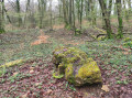
Follow the path to the left and continue along the rocky spur. Taking advantage of the natural shape of these rocky outcrops (horseshoe-shaped), people from the third millennium BCE onwards turned them into fortified settlements. This was undoubtedly the case here.

Follow the path as it winds along the barrier-like spur. Once you reach the cleared section of the forest (currently being replanted following damage caused by bark beetles), take the path on the left.

(4) At the crossroads, take the sunken path on the left which leads back down.

(2) Carry on straight ahead. About fifty metres further on, follow the middle path. The distance will be the same as on the way up, but the descent is a little steeper.

(1) Once you reach the edge of the forest, rejoin the tarmac road to return to civilisation and find your car park (S/E).

Waypoints

  1. S/E : mi 0 - alt. 712 ft - Rue Guy de Maupassant
  2. 1 : mi 0.1 - alt. 738 ft - Junction of the circular loop
  3. 2 : mi 0.53 - alt. 945 ft - Common junction for out-and-back route
  4. 3 : mi 1.02 - alt. 886 ft - Path on the left
  5. 4 : mi 1.54 - alt. 1,050 ft - Crossroads, turn left
  6. S/E : mi 2.2 - alt. 712 ft - Rue Guy de Maupassant

Reviews and comments

5 / 5
Based on 1 review

Reliability of the description
Not used
Ease of following the route
5 / 5
Route interest
5 / 5
nolive73
nolive73

Overall rating : 5 / 5

Date of your route : Dec 28, 2021
Reliability of the description : Not used / Not applicable
Ease of following the route : ★★★★★ Very good
Route interest : ★★★★★ Very good
Very busy route : No

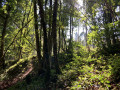
A lovely little walk through a beautiful forest mainly populated by beech trees (some of which, as you head deeper into the woods, are truly ancient).
Be warned, there’s a steep climb shortly afterwards (1), but it doesn’t last very long. Bear this in mind if you’re with young children, or when the path is muddy.

Machine-translated

Other walks in the area

For more walks, use our search engine .

The GPS track and description are the property of this route's author. Please do not copy them without permission.