Nancray Mill Route

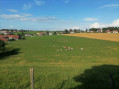
Explore Nancray, its water springs, its old mill, the Bois de la Côte, and finally return via the Forêt des Landes. And of course, take the opportunity to visit the Nancray Open-Air Ecomuseum of Comtois Houses, featuring around thirty typical rural houses from Franche-Comté.

Details

2853327
Creation:
Last update:
Last review:
  • Walking
    Activity: Walking
  • ↔
    Distance: 6.06 mi
  • ◔
    Average duration: 3h 15 
  • ▲
    Difficulty: Moderate

  • ⚐
    Back to start: Yes
  • ↗
    Ascent: + 538 ft
  • ↘
    Descent: - 554 ft

  • ▲
    Highest point: 1,614 ft
  • ▼
    Lowest point: 1,309 ft

Photos

Description of the walk

Park at the Musée des Maisons Comtoises car park.

(S/E) Head towards the roundabout, walk past the motorhome site on your right, then take the path through the woods on your left, located roughly two-thirds of the way along the car park.

(1) Once you reach the village, cross the D464 road at the pedestrian crossing and take the first road on the left towards the town hall. Walk past the village hall and continue straight ahead.

(2) At the crossroads, in front of the large stone house, continue along the road opposite which winds its way through the farmhouses.

(3) At the junction marked by a cross, continue along the road on the left, then keep right, following the signs for Moulin Neuf.

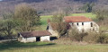
(4) When you reach the hamlet, take a look at the old workshop, then turn left before the farm at the roundabout.

(5) Follow the signpost directing you to turn left and continue along the forest track through the undergrowth.

(6) At the clearings covered with wild mulberry trees, which produce delicious berries in autumn, turn left onto the grassy single-track path that descends, veering left then right.

(7) Cross the Route des Landes and continue along the forest track opposite. 100 m further on, at the hunting car park, the track branches off to the left before climbing up to your right. Follow the markings and tackle the two short, steep sections in quick succession before reaching a junction of forest tracks.

(8) Turn left, following the signposts. Further on, at the edge of the woods, let a path branch off to the left.

(9) Turn left and continue to the village. At the wash house, take the road on the left, Rue du Pont.

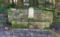
(10) Head up Rue des Fontaines on the right after the bridge over the Vaizot to enjoy the various springs and fountains of Nancray.

(2) Turn right to follow the outward route in the opposite direction to the ecomuseum car park (S/E).

Once you reach the car park, do pop in to explore the 15-hectare Ecomuseum grounds, if you’ve still got a bit of energy left.

Waypoints

  1. S/E : mi 0 - alt. 1,460 ft - Starting point: Maisons Comtoises Open-Air Museum
  2. 1 : mi 0.47 - alt. 1,362 ft - Crossing the D464
  3. 2 : mi 0.73 - alt. 1,329 ft - Crossroads of the circular loop
  4. 3 : mi 1.02 - alt. 1,342 ft - Cross
  5. 4 : mi 1.62 - alt. 1,319 ft - The Old Mill
  6. 5 : mi 2.21 - alt. 1,427 ft - Signpost
  7. 6 : mi 3.18 - alt. 1,614 ft - Junction
  8. 7 : mi 3.71 - alt. 1,322 ft - Junction with the Route des Landes
  9. 8 : mi 4.12 - alt. 1,430 ft - Crossroads
  10. 9 : mi 4.93 - alt. 1,345 ft - Return to the village
  11. 10 : mi 5.24 - alt. 1,322 ft - Rues des Fontaines
  12. S/E : mi 6.06 - alt. 1,460 ft - Finish: Maisons Comtoises Open-Air Museum

Notes

Follow the blue/yellow markings.

Worth a visit

(S/E) The Nancray Open-Air Ecomuseum of Comtois Houses, featuring around thirty typical rural houses from Franche-Comté spread across 15 hectares of land, recreating scenes from rural life of yesteryear with cows, beehives, a trail with a workshop, an exhibition and an events programme available on the website
Open to visitors from April to November, with motorhome parking.
More information at https://www.maisons-comtoises.org/

Discover the many springs and fountains of old Nancray.

Reviews and comments

4 / 5
Based on 7 reviews

Reliability of the description
4 / 5
Ease of following the route
4.1 / 5
Route interest
3.7 / 5
Benny1954
Benny1954

Overall rating : 5 / 5

Date of your route : Aug 01, 2024
Reliability of the description : ★★★★★ Very good
Ease of following the route : ★★★★★ Very good
Route interest : ★★★★★ Very good
Very busy route : No

In the second part, when you come to ‘(6) At the clearing covered with wild mulberry trees bearing
delicious berries in autumn, turn left onto the grassy
single track that descends, veers left then right”: this path is almost invisible; we had to retrace our steps because we didn’t see it; it is almost impassable, truly a single track, with hardly any trace of a path, grass up to our thighs – really impractical, especially with a dog on a lead. This path is completely unmaintained all the way to the road.

Machine-translated

T.Denis
T.Denis

Overall rating : 2.7 / 5

Date of your route : Aug 07, 2023
Reliability of the description : ★★☆☆☆ Disappointing
Ease of following the route : ★★★★☆ Good
Route interest : ★★☆☆☆ Disappointing
Very busy route : No

A rather uninteresting walk, unless you’re visiting Nancray.

Machine-translated

Paps
Paps

Overall rating : 4.7 / 5

Date of your route : May 19, 2023
Reliability of the description : ★★★★★ Very good
Ease of following the route : ★★★★★ Very good
Route interest : ★★★★☆ Good
Very busy route : No

It’s a pleasant route with a lovely view over the valley. In wet weather, the path after crossing the Route des Landes is very difficult to walk on and is barely passable. On the way back, a visit to the Musée des Maisons Comtoises can be a really enjoyable addition to the walk.

Machine-translated

LABJIM
LABJIM

Overall rating : 4 / 5

Date of your route : Mar 06, 2021
Reliability of the description : ★★★★☆ Good
Ease of following the route : ★★★★☆ Good
Route interest : ★★★★☆ Good
Very busy route : No

The route is clearly marked in yellow and blue. You need to pay close attention to spot point 6, where you need to turn. It’s harder to spot if you’re chatting. Between points 6 and 7, the final right-hand bend is at the edge of a pine forest; you can see the pines from a distance.
We rounded off the route with a visit to the Fontenis spring, which is easy to find with the map.

Machine-translated

reitop
reitop

Overall rating : 3 / 5

Date of your route : Jul 19, 2020
Reliability of the description : ★★★☆☆ Average
Ease of following the route : ★★★☆☆ Average
Route interest : ★★★☆☆ Average
Very busy route : No

Hello, it’s a nice route, except at the clearing – you have to spot the path down to the right! Thanks.

Machine-translated

ghislaine25360
ghislaine25360

Overall rating : 4.7 / 5

Date of your route : Mar 16, 2020
Reliability of the description : ★★★★★ Very good
Ease of following the route : ★★★★★ Very good
Route interest : ★★★★☆ Good

A very well-signposted, easy walk. Points of interest include the old mill, the viewpoint in the woods, the village of Nancray near the wash house, and finally the fascinating Museum of Comtois Houses.

Machine-translated

henri57
henri57 ★

Hello,

Thank you for your comment.

As regards signposting, neither Visorando nor the authors are responsible for this. Signposts are often included in the descriptions when they are present on the ground, but they may disappear, so you should rely on the description and the map instead.

Visorando provides a detailed description (which could be improved) and an IGN 1:25,000 route map. And, if signposting is essential for you, Visorando offers a virtual signposting tool: a GPS app.

This tool, offered free of charge by Visorando, allows you to verify waypoints and thus resolve any doubts regarding navigation.

See you soon

Machine-translated

CPoty
CPoty

Overall rating : 3.7 / 5

Date of your route : Feb 10, 2020
Reliability of the description : ★★★★☆ Good
Ease of following the route : ★★★☆☆ Average
Route interest : ★★★★☆ Good

On the way up through the forest, there are tree-felling works taking place and the turn-off leading down a small path isn’t clearly signposted. It would be worth putting up several markers, as our group didn’t spot it.
A few extra markers at certain junctions on the way up would be welcome.
Thank you in advance

Machine-translated

Netra
Netra ★

Hello Piedpouce,

Thank you for pointing this out: the elevation gains were greatly exaggerated! This is usually the case with downloaded GPS tracks.

I’ve just carried out a new automatic calculation of the altitudes: the elevation gains are indeed around 150m.

Machine-translated

PIEDPOUCE
PIEDPOUCE

The elevation gain and loss stated in the description are incorrect; the elevations need to be recalculated: +150 // -150

Machine-translated

Other walks in the area

For more walks, use our search engine .

The GPS track and description are the property of this route's author. Please do not copy them without permission.