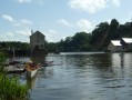
The towpath route starting from Azé

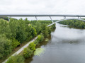
The towpath route is a relatively short circular route (just over two hours) that will take you from the village of Azé to the La Bavouze dam; then, heading back up the valley, you’ll return to Azé with a lovely view of the River Mayenne.

Details

n°379321
Creation:
Last update:
Last review:
  • Walking
    Activity: Walking
  • ↔
    Distance: 4.74 mi
  • ◔
    Average duration: 2h 15 
  • ▲
    Difficulty: Easy

  • ⚐
    Back to start: Yes
  • ↗
    Ascent: + 52 ft
  • ↘
    Descent: - 52 ft

  • ▲
    Highest point: 154 ft
  • ▼
    Lowest point: 85 ft

Photos

Description of the walk

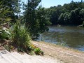
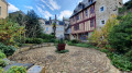
(S/E) From Azé town hall, head to the banks of the Mayenne via the gardens or via Rue du Port, situated to the east of the town hall. Turn left towards the east and follow the towpath for about 3.5 km to the La Bavouze dam.

(1) About 100 metres from the dam, the path curves to the left; follow it for about 150 metres until you reach a small tarmac road. Turn left and continue straight on for about 400 metres until you reach a T-junction with another road. Turn right and continue for between 150m and 200m. You will then arrive at a place known as Les Pâtis, with a stony car park on the right and a grassy track on the left.

(2) Take this grassy path for about 300 metres until you reach a T-junction with another path. Turn left and continue for about 400 metres until you come out onto a small tarmac road.

(3) Turn right onto the small road and continue for just under 1.3 km. You will then reach the ‘entering built-up area’ sign and a grassy track branching off to the left just before the first house in the village.

(4) Turn left onto the grassy track and follow it for about 200 metres to reach the banks of the Mayenne. Turn right and walk along the river for just under 1 km to reach Azé Town Hall (S/E).

Waypoints

  1. S/E : mi 0 - alt. 102 ft - Azé Town Hall, Rue du Port - Mayenne (rivière)
  2. 1 : mi 2.23 - alt. 89 ft - On the left before the Bavouze dam
  3. 2 : mi 2.72 - alt. 141 ft - Turn left onto the path at a place called Les Pâtis
  4. 3 : mi 3.18 - alt. 108 ft - Turn right onto the small tarmac road
  5. 4 : mi 3.98 - alt. 154 ft - Turn left onto the path at the entrance to Azé.
  6. S/E : mi 4.74 - alt. 102 ft - Azé Town Hall, Rue du Port

Notes

Parking spaces are available near Azé Town Hall.

Reviews and comments

4.7 / 5
Based on 1 review

Reliability of the description
5 / 5
Ease of following the route
5 / 5
Route interest
4 / 5
Mali49
Mali49

Overall rating : 4.7 / 5

Date of your route : May 23, 2020
Reliability of the description : ★★★★★ Very good
Ease of following the route : ★★★★★ Very good
Route interest : ★★★★☆ Good
Very busy route : No

A very pleasant first section along the Mayenne,
Then a bit too much tarmac for my liking, but amongst the wheat fields. Lovely scenery in the Mayenne countryside.

Machine-translated

Other walks in the area

For more walks, use our search engine .

The GPS track and description are the property of this route's author. Please do not copy them without permission.