Brusc Route

Notre-Dame du Brusc is a Catholic church where archaeological excavations have uncovered an early Christian cemetery and a baptismal font dating from the 6th century.
In the 11th century, a large Romanesque church with a basilica layout was built. Partially destroyed during the Wars of Religion, it has undergone successive restorations to give it its current appearance. The church and the land to the south have been listed as Historic Monuments since 20 August 1986.

Details

18316555
Creation:
Last update:
Last review:
  • Walking
    Activity: Walking
  • ↔
    Distance: 2.75 mi
  • ◔
    Average duration: 1h 25 
  • ▲
    Difficulty: Easy

  • ⚐
    Back to start: Yes
  • ↗
    Ascent: + 207 ft
  • ↘
    Descent: - 230 ft

  • ▲
    Highest point: 896 ft
  • ▼
    Lowest point: 755 ft

Description of the walk

Park in the chapel car park.

(S/E) With your back to the car park, take the tarmac road opposite. After passing the Château du Vignal, go down the Sentier des Pèlerins on the right to the Oratoire de Notre-Dame du Brusc.

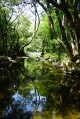
(1) Cross the departmental road to take the path opposite. Follow this path to a stream, cross it (be careful, you will have to wade across) and rejoin the path that runs alongside the tennis courts.

(2) When you reach the small roundabout, turn left onto Chemin de la Fontaine de l'Ormeau. Pass the wash house on your left and continue along the road, which turns into a path leading to a small tarmac road called Chemin des Parettes.

(3) Turn right and follow the road to the Chemin de la Rourée junction.

(4) Turn right again, keep to the right at the intersection and go down to the small roundabout you passed earlier.

(2) Continue straight ahead on Chemin des Picholines. Go up the departmental road, which bends to the right further on, then runs alongside the golf course. Continue to the intersection with the "Notre-Dame du Brusc" sign.

(5) Turn right and head for the chapel car park (S/E).

Waypoints

  1. S/E : mi 0 - alt. 876 ft - Notre-Dame du Brusc Chapel
  2. 1 : mi 0.35 - alt. 781 ft - Oratory. Towards - Brague (fleuve)
  3. 2 : mi 0.66 - alt. 781 ft - Roundabout, junction of the circular loop
  4. 3 : mi 1.09 - alt. 856 ft - Chemin des Parettes, on the right
  5. 4 : mi 1.55 - alt. 873 ft - Chemin de la Rourée, on the right
  6. 5 : mi 2.48 - alt. 794 ft - Sign for "Notre-Dame du Brusc"
  7. S/E : mi 2.75 - alt. 876 ft - Notre-Dame du Brusc Chapel

Reviews and comments

4 / 5
Based on 9 reviews

Reliability of the description
4.2 / 5
Ease of following the route
4.2 / 5
Route interest
3.4 / 5
User 14560725

Overall rating : 5 / 5

Date of your route : Jan 27, 2026
Reliability of the description : ★★★★★ Very good
Ease of following the route : ★★★★★ Very good
Route interest : ★★★★★ Very good
Very busy route : No

A very pleasant route through the countryside, with some sections on roads.
We found a very friendly olive and olive product producer.
Well worth the detour.

Machine-translated

User 17166512

Overall rating : 4.3 / 5

Date of your route : Nov 23, 2025
Reliability of the description : ★★★★☆ Good
Ease of following the route : ★★★★☆ Good
Route interest : ★★★★★ Very good
Very busy route : No

I found it very pleasant because of the beautiful scenery and the peace and quiet. What's more, it was an easy hike, which suited me perfectly. The only slight difficulty was after crossing the stream, where the path ahead was blocked and we had to veer slightly to the left to find a place where we could continue our walk.

Machine-translated

nano47
nano47

Overall rating : 4.3 / 5

Date of your route : Sep 07, 2025
Reliability of the description : ★★★★★ Very good
Ease of following the route : ★★★★★ Very good
Route interest : ★★★☆☆ Average
Very busy route : No

A long journey and a route to avoid when it rains

Machine-translated

GIAMMUGNANI
GIAMMUGNANI

Overall rating : 4 / 5

Date of your route : May 06, 2024
Reliability of the description : ★★★★☆ Good
Ease of following the route : ★★★☆☆ Average
Route interest : ★★★★★ Very good
Very busy route : No

A marked trail, closed to hikers because the landowners have fenced it off.
But a pleasant walk
Beautiful view
Beautiful scenery

Machine-translated

leopal
leopal

Overall rating : 3.7 / 5

Date of your route : Jun 30, 2023
Reliability of the description : ★★★★★ Very good
Ease of following the route : ★★★★★ Very good
Route interest : ★☆☆☆☆ Very disappointing
Very busy route : No

A hike that is mostly uninteresting, along very busy roads with no space for pedestrians.
A walk to be avoided!

Machine-translated

Bruno 06
Bruno 06

Overall rating : 3.7 / 5

Date of your route : Oct 10, 2022
Reliability of the description : ★★★☆☆ Average
Ease of following the route : ★★★★☆ Good
Route interest : ★★★★☆ Good
Very busy route : No

It's a shame that the departure point is only determined by latitude coordinates!
Thanks anyway.

Machine-translated

Clem and co
Clem and co

Overall rating : 4.3 / 5

Date of your route : Sep 03, 2022
Reliability of the description : ★★★★★ Very good
Ease of following the route : ★★★★★ Very good
Route interest : ★★★☆☆ Average
Very busy route : No

Very good description of the route. Half of it is fine, but the end is on a very busy road with no pedestrian space... Somewhat dangerous with children...

Machine-translated

Eric VANAERDE
Eric VANAERDE

Overall rating : 3.3 / 5

Date of your route : Mar 08, 2022
Reliability of the description : ★★★★☆ Good
Ease of following the route : ★★★★☆ Good
Route interest : ★★☆☆☆ Disappointing
Very busy route : No

Not particularly interesting except for walking along small roads, some of which are quite busy, especially the district road along the golf course. The ford is easy to cross given the narrow width (approx. 1 m) of the stream.

Machine-translated

chato9
chato9

Thanks for the information!

Machine-translated

Bob06
Bob06

Overall rating : 3 / 5

Date of your route : Jan 30, 2022
Reliability of the description : ★★★☆☆ Average
Ease of following the route : ★★★☆☆ Average
Route interest : ★★★☆☆ Average
Very busy route : No

Please note that the iron bridge no longer exists; you must cross the stream at the ford...risk of falling into the stream.

Machine-translated

Other walks in the area

For more walks, use our search engine .

The GPS track and description are the property of this route's author. Please do not copy them without permission.