The Biau Ri Route in Solre-le-Château

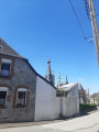
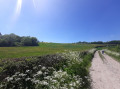
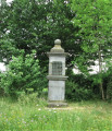
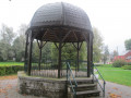
A family walk through woods and hedgerows on the outskirts of Solre-le-Château. Gravel paths and small country lanes lead you to discover a heritage full of character: chapels and oratories, traditional houses, and a bandstand.
Each season brings its own array of colours and light.

Details

n°1558940
Creation:
Last update:
Last review:
  • Walking
    Activity: Walking
  • ↔
    Distance: 6.52 mi
  • ◔
    Average duration: 3h 10 
  • ▲
    Difficulty: Easy

  • ⚐
    Back to start: Yes
  • ↗
    Ascent: + 230 ft
  • ↘
    Descent: - 200 ft

  • ▲
    Highest point: 758 ft
  • ▼
    Lowest point: 607 ft

Photos

Description of the walk

Starting point: The car park at Grand Place (Town Hall).

(S/E) With your back to the Tourist Office, cross the Place Verte behind the church and head left towards Rue de Beaumont, which you cross to follow Petite Rue opposite, then Rue de Marlière without changing direction.
After the Riamé stream, you’ll reach the junction known as Salmonbois.

(1) Carry on straight ahead along the Chemin de l’Écrevisse. Turn left towards the Bois de Nielles, then right onto Chemin Beaudart; cross the RD 962, then turn right onto the Route de Beaurieux for about 250 metres.

(2) Turn left onto the Chemin de la Follemprise, a country lane that crosses the pastures of La Follemprise farm. Carry on straight ahead until you reach the edge of the Bois de Beaurieux.

(3) Follow the Chemin du Gros Chêne to the right along the right-hand edge of the woodland until you reach the Belgian border.

(4) At the end of the woodland, turn right onto the Chemin rural du Chambris, which leads to Beaurieux through the bocage. Follow the signposts carefully.

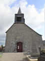
(5) You’ll arrive in the village of Beaurieux; turn left onto Rue du Truquet. After passing the Biau-Ri, in the square, take a look at the church (1542). After the church, take the second street on the left and, at
the next junction, turn right onto Rue du Calvaire.

(6) At the crossroads, continue towards Solre-le-Château along the Épinoy path, which you’ll take to the left here. It’s a one-way path that crosses the Dix Journels pastures. Cross the RD27 (take care) and you’ll reach the hamlet of Épinoy.

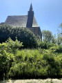
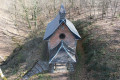
(7) Walk past the15th-century Épinoy Chapel, built in the Gothic style and perched on a rocky outcrop. Then continue along the Chemin du Moulin à Vent. As you pass, take note of the chapel dedicated to Notre-Dame de Foy.

(8) At the next crossroads, take Rue de Clairfayts straight ahead, then the third street on the right to return to the car park (S/E).

Waypoints

  1. S/E : mi 0 - alt. 620 ft - Grand Place car park (Town Hall)
  2. 1 : mi 0.65 - alt. 610 ft - The junction known as Salmonbois
  3. 2 : mi 1.83 - alt. 676 ft - La Follemprise country lane
  4. 3 : mi 2.75 - alt. 741 ft - Chemin du Gros Chêne on the right-hand edge of the woodland
  5. 4 : mi 3.25 - alt. 755 ft - Edge of the woodland near the border
  6. 5 : mi 4.2 - alt. 673 ft - Beaurieux
  7. 6 : mi 4.57 - alt. 659 ft - Épinoy Trail
  8. 7 : mi 5.46 - alt. 719 ft - Épinoy Chapel
  9. 8 : mi 6.17 - alt. 679 ft - Le Moulin à Vent crossroads
  10. S/E : mi 6.52 - alt. 620 ft - Grand Place car park (Town Hall)

Notes

__Take care when crossing the RD 27 and 962.
__
Route listed in the PDIPR (Departmental Plan for Walking and Hiking Routes)

Follow the yellow signposts. (Yellow Cross = wrong direction, arrow to the right = turn right, arrow to the left = turn left, horizontal line = go straight on)

Short alternative route: 7 km
Follow the start of the description for the main route
When you reach the point (2), continue straight on to the centre of the village of Beaurieux. Pass the church on your left, then turn right.
Head towards (6). Finish the walk by following the directions for the main route.

Worth a visit

Café rando Nord® Le Longchamp in Solre-le-Château
http://www.tourisme-avesnois.com/sejourn...

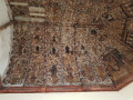
Beaurieux Church (1542): Inside, be sure to note the seigneurial chapel attached to the chancel, which houses the funerary monuments of the lords of Beaurieux; there you can see a statue of Saint Christopher, who is still venerated (pilgrimage in July).

Reviews and comments

4.2 / 5
Based on 2 reviews

Reliability of the description
4 / 5
Ease of following the route
4.5 / 5
Route interest
4 / 5
pierre gobin
pierre gobin

Overall rating : 4.7 / 5

Date of your route : May 30, 2021
Reliability of the description : ★★★★☆ Good
Ease of following the route : ★★★★★ Very good
Route interest : ★★★★★ Very good
Very busy route : No

A lovely walk. Stunning scenery, well-preserved hedgerows, and two particular favourites: the village of Baurieux and the hamlet of Epinoy. The roads we took were quiet and, during our walk, had very little traffic. The signposting along the route is helpful at times. Just two minor points that explain why I’ve given it a ‘good’ rating rather than ‘very good’.
(5) instead of “...After the church, take the second street on the left and, at the next junction, turn right onto Rue du Calvaire”. I would suggest: “After the church, walk to the War Memorial for both World Wars, turn left, join Rue des Plaines and follow it to the right until you reach a junction with a road, the Chemin d’Epinoy – not the Sentier d’Epinoy as indicated. It is not, or is no longer, a one-way street. In fact, the first street after the church is actually a footpath, the ‘Sentier de l’Église’.
In Epinoy, it might be worth specifying that you should walk past the Chapel on the right, following the path downhill.

I repeat, these are just minor details; the signposting helps you find your way if you’re in any doubt.
I recommend this walk without the slightest hesitation.

Pierre Gobin

Machine-translated

sarraut
sarraut

Overall rating : 3.7 / 5

Date of your route : Aug 08, 2020
Reliability of the description : ★★★★☆ Good
Ease of following the route : ★★★★☆ Good
Route interest : ★★★☆☆ Average
Very busy route : No

BEAUTIFUL VIEWS BUT LOTS OF TARMAC

Machine-translated

Other walks in the area

For more walks, use our search engine .

The GPS track and description are the property of this route's author. Please do not copy them without permission.