Route des terres d'Illiat

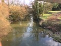
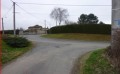
This route will take you past some lovely farmhouses all around the small village of Illiat. Don’t miss the short detour to Illiat Church and its 12th-century frescoes!

Details

n°21014664
Creation:
Last update:
Last review:
  • Walking
    Activity: Walking
  • ↔
    Distance: 9.50 mi
  • ◔
    Average duration: 4h 35 
  • ▲
    Difficulty: Moderate

  • ⚐
    Back to start: Yes
  • ↗
    Ascent: + 279 ft
  • ↘
    Descent: - 272 ft

  • ▲
    Highest point: 837 ft
  • ▼
    Lowest point: 673 ft
  • ⚐ Country: France
  • ⚐ City: Illiat (01140)
  • ⚑
    Start/End: N 46.18737° / E 4.88664°
  • ❏
    IGN map(s): Ref. 3029SB
  • Hour-by-hour weather

Description of the walk

Car park in front of the inn (next to the lake).

(S/E) Head towards the cemetery.

(1) At the junction just before the cemetery, turn left and start the climb to see the church of Illiat, most of which dates from the 12th century (wall frescoes).

(2) Then turn round to return to the cemetery entrance.

(1) Turn left and, after 50 metres, turn left again. Cross the D66 towards the stadium.
Once past the stadium, you can admire the magnificent view.

(3) Take the first road on the left towards Belhomme, and carry on until you reach the Y-junction; turn left, then take the first path on the left again; after two houses on the left, you’ll reach the D66.

(4) Turn right and, 100 m further on, take the first road on the left. At the junction, carry straight on, then let a track on the right pass you by. Join the tarmac road and turn right. Let the track on the right pass you by. Pass through the hamlet of Les Janeins and take the track on the left after the last houses; this joins a tarmac road.

(5) Turn right for 150 m and then turn left onto the grassy path. When you reach the house at Montézant, rejoin the tarmac road on the right and, after 150 m, take the path that goes straight on. After a short descent, the path leads onto a road; head right, and at the next junction, take the road on the left. Leave the road to take the grassy path after an S-bend. This joins the D66a.

(6) Follow the departmental road to the right for 100 metres and, after a hedge of thuja trees, turn left towards La Collonge.
You can see the Collonge farm and its dovecote; there used to be a fortified house here.
Walk for about 400 m before turning onto the path that runs alongside the woods until it reaches a road.

(7) Take the road on the left. When you reach a crossroads, turn left again and, 250 metres further on, take the first path on the right, which leads to Trève Levô after 2.5 km.
On the right you can see a farmhouse with a very beautiful porch and, on the left, a pond.

(8) Take the road on the right until you reach the D66.

(9) Head left for 100 metres, then, just past the house, take a path on the right. Stay on the main track for about 1.1 km, until you reach the houses in the hamlet of Les Joubert.
Carry on straight ahead for 50 m.

(10) Turn right. You’ll come to a four-way junction. Go straight on. At the crossroads after the houses, turn left onto the road leading back towards the stadium and the crossroads you passed on the way there.

(3) Carry on straight ahead to reach the car park via the reverse route of the outward journey (S/E).

Waypoints

  1. S/E : mi 0 - alt. 709 ft - Car park in front of the inn
  2. 1 : mi 0.08 - alt. 705 ft - Etang de rivériat
  3. 2 : mi 0.23 - alt. 725 ft - Église Saint-Symphorien (Illiat)
  4. 3 : mi 1.06 - alt. 791 ft - Belhomme. Junction of the circular loop
  5. 4 : mi 1.81 - alt. 699 ft - Les Violets
  6. 5 : mi 2.84 - alt. 722 ft - Manigand
  7. 6 : mi 3.97 - alt. 696 ft - La Collonge
  8. 7 : mi 4.76 - alt. 725 ft - Les Longets
  9. 8 : mi 6.15 - alt. 810 ft - Turn right
  10. 9 : mi 7.01 - alt. 820 ft - Combabonet
  11. 10 : mi 7.81 - alt. 830 ft - Les Jouberts
  12. S/E : mi 9.5 - alt. 709 ft - Car park in front of the inn

Notes

The public toilets and drinking water point are situated at the junction of Rue du Bourg and Allée de l’Etang Rivériat, where the motorhome service area is located.
Situated on the banks of the Etang Rivériat, the picnic areas allow you to enjoy a peaceful lunch during your walks or hikes.

This walk is organised by the Val de Saône Centre Tourist Office in collaboration with the FF Randonnée de l’Ain.

63% tarmac.

Worth a visit

Saint Symphorien Church:
Built in the 12th century, the church retains from that period its apse adorned with Romanesque frescoes depicting two of the three Holy Women at the tomb alongside Saint Mark and Saint Peter. These frescoes are amongst the oldest in the department of Ain and are listed as a Historic Monument. Major alterations took place in the 19th century, led by Pierre Bossan, the architect of Notre-Dame de Fourvière and the Basilica of Sainte Philomène in Ars-sur-Formans. The interior of the nave was rebuilt in the Neo-Romanesque style and the bell tower was completely rebuilt in the Neo-Byzantine style.

Reviews and comments

5 / 5
Based on 1 review

Reliability of the description
5 / 5
Ease of following the route
5 / 5
Route interest
5 / 5
Office de Tourisme VSC

Hello,

Thank you for your comment and for your interest in our area.
We will pass on your message to Illiat Town Hall.
We look forward to seeing you again soon on our walking trails.
The Tourist Office team

Machine-translated

henri974
henri974

Overall rating : 5 / 5

Date of your route : May 19, 2023
Reliability of the description : ★★★★★ Very good
Ease of following the route : ★★★★★ Very good
Route interest : ★★★★★ Very good
Very busy route : No

A brilliant walk; the village of Illiat is small but well-kept; we were able to admire the church both from the outside and inside –
There were numerous large farmhouses along the route, some tastefully restored, whilst others still exude the authenticity of a farmhouse of yesteryear.
In front of one property, we were able to admire a hedge of irises in every colour.
The only downside is that the so-called ‘grassy’ paths aren’t maintained; we walked through grass that came up to mid-calf for the taller walkers and to the knees for the shorter ones; it’s very unpleasant and tiring.
It’s not a walk I’d undertake in the height of summer for fear of stepping on a ‘creeping plant’, such is the height and density of the grass.
Could the person who suggested this walk on Vidorando perhaps raise the matter with Illiat Town Hall regarding the maintenance of these marked trails?

Machine-translated

Other walks in the area

For more walks, use our search engine .

The GPS track and description are the property of this route's author. Please do not copy them without permission.