Route from the Saint-Georges Chapel to Fontenoy-le-Château

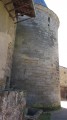
This route starts at the municipal campsite on Route de la Vierge. It will take you to the Chapel of Saint-Georges, built in the middle of the forest on the site of a deadly fratricidal battle. This route passes near the Arpero bar (a surprising log cabin between the canal and the Coney), the Carrières Volle quarries, the Tour des Lombards tower, the listed church, the castle ruins and the Embroidery Museum.

Details

26346
Creation:
Last update:
Last review:
  • Walking
    Activity: Walking
  • ↔
    Distance: 5.62 mi
  • ◔
    Average duration: 2h 50 
  • ▲
    Difficulty: Easy

  • ⚐
    Back to start: Yes
  • ↗
    Ascent: + 328 ft
  • ↘
    Descent: - 351 ft

  • ▲
    Highest point: 1,119 ft
  • ▼
    Lowest point: 830 ft

Description of the walk

Departure from the Municipal Campsite in Fontenoy-le-Château.
You can park your car on the grass between the path and the football pitch.
The route is marked (follow the blue crosses).

(S/E) Retrace your steps and continue right on the D40 departmental road towards Fontenoy (watch out for traffic). You will come to a crossroads at the motocross track on your left.

(1) Take the tarmac road on the left towards La Corée. Continue along this road until you reach the first sharp right-hand bend.
Continue along the path slightly to the left. Continue along this path until you reach the forest.
Continue along the path through the forest, following the markings (blue crosses) on the trees.
The path crosses the beautiful Saint-Georges forest, where you will see magnificent oak and beech trees.

(2). Turn right onto the carriage road and continue along this road until you reach the Chalet de Saint-Georges, where you can take a break.

(3) At the chalet, take the path into the forest on your left. Continue along this path to the left in front of the chalet until you reach the Chapelle Saint-Georges (a chapel built following a deadly fight between two brothers).

(4) Retrace your steps, then turn left to cross the stream at the ford (walk on the stones in the river) and continue along the forest path, following the blue cross markings. Continue to the D20 departmental road.

(5) Take it to the right until you reach the village centre. You will pass close to the Arpero bar (an imposing log cabin) on your left and the Volle quarries on your right.
At the end of this road, leave the bridge on your left and continue straight on the village's Grande Rue (cobbled street).

(6) In the centre of the village, turn left onto Ruelle des Moulins, which passes in front of the Lombards tower and the Coney reservoir before arriving at the village square.
Take the street opposite, passing between the museum (open in the afternoons) and the town hall, until you reach the entrance to the listed Saint-Mansuy church (the church is open and can be visited).
Retrace your steps slightly and take the lane on the right, then the path that goes around the cemetery to the castle ruins. Take the opportunity to visit these places steeped in history.

(7) Turn left and continue the hike along Chemin de la Loge (follow the tarmac road to the D40 departmental road. Follow it straight ahead to the crossroads near the cross-country course.

(1) Continue straight ahead along the same route to the car park (S/E)

Waypoints

  1. S/E : mi 0 - alt. 1,076 ft - Fontenoy-le-Château Municipal Campsite
  2. 1 : mi 0.53 - alt. 1,001 ft - Cross-country terrain, crossroads of the circular loop
  3. 2 : mi 1.54 - alt. 1,119 ft - Turn right onto the carriage road.
  4. 3 : mi 1.88 - alt. 1,030 ft - Chalet de Saint-Georges
  5. 4 : mi 2.23 - alt. 991 ft - Saint-Georges Chapel
  6. 5 : mi 3.2 - alt. 837 ft - D20 - Côney (rivière)
  7. 6 : mi 3.97 - alt. 843 ft - On the left, Ruelle des Moulins
  8. 7 : mi 4.31 - alt. 942 ft - On the left, Chemin de la Loge
  9. S/E : mi 5.62 - alt. 1,076 ft - Fontenoy-le-Château Municipal Campsite

Notes

Bring a water bottle in hot weather, good shoes (some difficult sections due to mud in places and a ford to cross), binoculars and a camera.
Please keep dogs on a leash (wildlife, etc.).
Part of the route is shared with a mountain bike trail.

Worth a visit

In the village centre:
Listed church, Museum of Embroidery, Heritage and Metallurgy, Castle Ruins, Lombard Tower, Marina, Charles Le Téméraire greenway, etc.
Accommodation available (Le Moulin Cotant hotel and restaurant, Fontenoy-le-Château campsite).
Restaurants: Moulin Cotant, La Scie Goguette farmhouse inn, Arpero, campsite.

Reviews and comments

4 / 5
Based on 9 reviews

Reliability of the description
4.1 / 5
Ease of following the route
3.9 / 5
Route interest
3.9 / 5
randonneur 70
randonneur 70
• Edited:

Overall rating : 4.3 / 5

Date of your route : Jan 22, 2024
Reliability of the description : ★★★★☆ Good
Ease of following the route : ★★★★☆ Good
Route interest : ★★★★★ Very good
Very busy route : No

A very pleasant and varied hike through these landscapes.
Suitable for all seasons.
Don't forget your map and GPS, just to be on the safe side.

Machine-translated

baudry eric
baudry eric

Overall rating : 4.7 / 5

Date of your route : Aug 09, 2021
Reliability of the description : ★★★★★ Very good
Ease of following the route : ★★★★☆ Good
Route interest : ★★★★★ Very good
Very busy route : Yes

The route is very well marked up to the sawmill and the chapel.
atNo. 5, I think the description at the beginning needs to be revised. When we crossed over, we came to a beautiful house with blue shutters and no path turning to the left, so we turned back and resumed the route as indicated, but we thought it would be more interesting to take the path through the woods from the start to return to the campsite car park (less dangerous than the tarmac road).
A lovely walk with wonderful smells.

Machine-translated

Kiki6570
Kiki6570

Overall rating : 4 / 5

Date of your route : Mar 07, 2020
Reliability of the description : ★★★★☆ Good
Ease of following the route : ★★★★☆ Good
Route interest : ★★★★☆ Good

It is difficult to reach the chapel after the recent forestry work.

Machine-translated

larpète
larpète
• Edited:

Hello, everyone
As the reviews for this hike were not very positive, we decided to go on another hike.
larpète

Machine-translated

grandin
grandin ★

guybosman

The signposting for this walk must not be sufficiently maintained. That is why we are asking the authors for a description of the route. Combined with the map, is this not clear enough to follow this walk without relying on the signposting?

Machine-translated

guybosman
guybosman

Overall rating : 3 / 5

Date of your route : Nov 05, 2018
Reliability of the description : ★★☆☆☆ Disappointing
Ease of following the route : ★★☆☆☆ Disappointing
Route interest : ★★★★★ Very good

The blue cross markings are insufficient. Above all, they can be confused with the blue markings on trees used for forestry work.

Machine-translated

christianhonore
christianhonore

Overall rating : 4 / 5

Date of your route : Jul 02, 2017
Reliability of the description : ★★★★☆ Good
Ease of following the route : ★★★★★ Very good
Route interest : ★★★☆☆ Average

A short, easy walk. The chapel isn't particularly attractive, as it's too new and doesn't stand out. The forest section is pleasant, with plenty of shade. However, there is a lot of tarmac...

Machine-translated

bibi
bibi ★

Thank you for your feedback. Visorando is not responsible for signposting... Did you get lost? If so, where? How should the description be completed for future users?
Is the route on the map not suitable?
Kind regards

Machine-translated

gpapy
gpapy

Overall rating : 3.3 / 5

Date of your route : Sep 22, 2016
Reliability of the description : ★★★★☆ Good
Ease of following the route : ★★☆☆☆ Disappointing
Route interest : ★★★★☆ Good

no markings or landmarks, otherwise a peaceful hike

Machine-translated

irma70
irma70

Overall rating : 3.7 / 5

Date of your route : May 29, 2014
Reliability of the description : ★★★★★ Very good
Ease of following the route : ★★★★★ Very good
Route interest : ★☆☆☆☆ Very disappointing

A very beautiful walk through the forest, but unfortunately far too much road to finish the hike.

Machine-translated

Biloo
Biloo
• Edited:

Overall rating : 3.7 / 5

Date of your route : Mar 09, 2014
Reliability of the description : ★★★★☆ Good
Ease of following the route : ★★★★☆ Good
Route interest : ★★★☆☆ Average

A pleasant hike to do with the family (no major difficulties).

Machine-translated

PONTASSE
PONTASSE

Overall rating : 5 / 5

Date of your route : Sep 15, 2013
Reliability of the description : ★★★★★ Very good
Ease of following the route : ★★★★★ Very good
Route interest : ★★★★★ Very good

VERY ENJOYABLE HIKE, BEAUTIFUL FOREST, CHURCH WORTH SEEING, VERY PICTURESQUE VILLAGE OF FONTENOY. THE EXPLANATIONS ARE VERY CLEAR...

Machine-translated

Other walks in the area

For more walks, use our search engine .

The GPS track and description are the property of this route's author. Please do not copy them without permission.