


 Country:
 City:


Cross a bridge (2)
Leave the GR®221 by turning left (3)
Turn right (4)
Turn left (5)
Then turn right (6)
Turn right (7)


A hike of moderate difficulty, alternating between shaded and sunny sections. The walk starts on the GR® 221, on a fairly flat, tarmac path. It then heads up a lovely climb through the woodland, followed by a series of hairpin bends up to a hilltop offering panoramic views of the bay and the sea on one side and Mount Fartàritx on the other. The return journey follows the same route.


Cross a bridge (2)
Leave the GR®221 by turning left (3)
Turn right (4)
Turn left (5)
Then turn right (6)
Turn right (7)
Car park near the Roma Bridge (1) in Pollença.
⚠️ Tips: there are no water sources along the route, so make sure you bring enough water. Avoid this walk in wet weather (slippery ground) and wear good walking boots.
Puig de Maria in Pollença  2.63 mi
+886 ft
-886 ft
2h 00
 Easy
 Departure from Pollença (Balearic Islands)
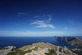
Route from Casa Vicenç to La Mola (Serra de Tramuntana)
 6.24 mi
+1,690 ft
-1,654 ft
4h 20
 Difficult
Departure from Pollença (Balearic Islands)
The path from Sant Vicenç to Port de Pollença
 2.62 mi
+240 ft
-253 ft
1h 25
Easy
Departure from Pollença (Balearic Islands)
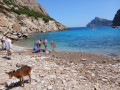
Cami de la Cala de Boquer
 3.24 mi
+515 ft
-512 ft
1h 55
Moderate
Departure from Pollença (Balearic Islands)
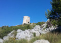
La talaia d'Albercutx
 3.23 mi
+696 ft
-705 ft
2h 05
Easy
Departure from Pollença (Balearic Islands)
Puig San Marti d’Alcudia
 4.69 mi
+778 ft
-778 ft
2h 50
Moderate
Departure from Alcúdia (Balearic Islands)
From Platja Formentor to Cala Burta and back
 6.23 mi
+951 ft
-955 ft
3h 40
Moderate
Departure from Pollença (Balearic Islands)
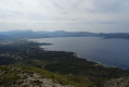
Talaia d'Alcudia
 2.16 mi
+915 ft
-915 ft
1h 45
Moderate
Departure from Alcúdia (Balearic Islands)
For more walks, use our search engine .
The GPS track and description are the property of this route's author. Please do not copy them without permission.
Scan this QR code with your smartphone's camera.
To open this route on your smartphone, you must have the Visorando app installed. If not, got to the Apple Store (iPhone) or Google Play Store (Android) to download the app.
 Visorando Member

