Country:

 City:



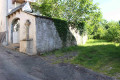
Park at Place Marius Lescure between the town hall and the church.
(S/E) With your back to the town hall, turn right and cross the Route d’Astaillac with care. Walk up the Route des Melons until you reach a stone cross against the front of a house.
(1) Take the path on the right and head downhill. You’ll come to a small tarmac road; follow it to the left. You’ll arrive at a place called Cantouny, featuring a turret restored in 2016; a beautiful 15th-century house, which is privately owned.
(2) Take the path on the left after the garage. Walk along the edge of the woods and climb steadily up to the Croix de Bonnet.
(3) Take the tarmac road on the left.
(4) Just before the D41E1, turn left onto a path that leads into the woods. At a crossroads (not shown on the map), carry on straight ahead. You’ll come to a small tarmac road; follow it to the right. At the next junction, turn left onto another road.
(5) When this road turns left at a large oak tree, carry on straight ahead along a track and head downhill. Further down, look out for the Croix de la Martelle, which was a destination for processions right up until the 1950s. Carry on along a path on the left. About fifty metres further on, you’ll pass the Font Grande fountain, which supplied the village with drinking water during the 19th century. Turn left, then further on you’ll come to a small road; carry on straight ahead until you reach Place Marius Lescure (S/E).

 Visorando Member


 Association / Club / Walk leader
 Moderate