Route de Fontaine Couverte via the aerodrome

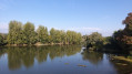
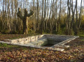
This circular route allows you to discover all that Cuisery has to offer: the village centre, the aerodrome, the countryside (pond, woods, fields), including wildlife: Bresse poultry farms, horses in the meadows or at the riding school, birds by the pond, and occasionally hares or roe deer in the fields.

Details

7895876
Creation:
Last update:
Last review:
  • Walking
    Activity: Walking
  • ↔
    Distance: 5.11 mi
  • ◔
    Average duration: 2h 25 
  • ▲
    Difficulty: Easy

  • ⚐
    Back to start: Yes
  • ↗
    Ascent: + 66 ft
  • ↘
    Descent: - 69 ft

  • ▲
    Highest point: 696 ft
  • ▼
    Lowest point: 640 ft
  • ⚐ Country: France
  • ⚐ City: Cuisery (71290)
  • ⚑
    Start/End: N 46.558558° / E 5.000163°
  • ❏
    IGN map(s): Ref. 3027SB
  • Hour-by-hour weather

Description of the walk

Park on the Place d’Armes in Cuisery.

(S/E) Head south via Rue du Champ de Foire. Cross a small car park, then turn right onto Rue Petite Vigne des Louis. Immediately turn left onto the gravel path running alongside the primary school. Continue along Chemin des Bergeronnettes.
When you reach Chemin de la Louère, first turn right then left and carry on to the entrance gate of Montrevost Castle.

(1) Turn right onto Chemin du Meix, keep to the left to cross the small square and continue to the left. Pass in front of the gate of Château de La Motte and continue for about fifty metres along Route de Montrevost.
Turn right onto Route des Platières and follow it until you reach the junction with Route de Pont-de-Vaux. Cross the road and carry on straight ahead onto Route de la Fontaine Couverte.

(2) At the corner of the Préty-Cuisery riding school, take the path on the right. At the junction, continue left onto Chemin de Ganay until you reach the pond of the same name and the T-junction.

(3) Turn right and proceed to the junction with the Route de Tournus (D975). Cross with care, follow the road to the left for a few dozen metres, then turn right to skirt the aerodrome, heading north. You will reach a Y-junction.

(4) Keep right at the three-way junction and follow the Chemin du Champ Boursier to complete the loop round the airfield. Further on, let the Chemin des Bruyères branch off to the right; continue straight on along the Chemin du Champ Boursier.

(5) Turn left onto Chemin de la Croix Bouilloud, then immediately right onto Chemin des Grands Sires. Pass the sports facilities on your right and the water tower, then continue on to the car park.

(6) At the corner of the car park, turn left, walk past the supermarket and continue straight on, opposite, along Chemin du Tacot. At the junction in the woods, take the path sharply to the right and emerge onto Route de Bourg-en-Bresse. Cross the road carefully.

(7) Walk past Le Palace theatre on the left to reach Rue Baraban. At the end of this street, turn right to return to Place d’Armes (A/D).

Waypoints

  1. S/E : mi 0 - alt. 689 ft - Place d’Armes – car park
  2. 1 : mi 0.42 - alt. 689 ft - Entrance to Montrevost Castle
  3. 2 : mi 1.64 - alt. 686 ft - Préty-Cuisery Riding School
  4. 3 : mi 2.32 - alt. 663 ft - Ganay Pond
  5. 4 : mi 3.19 - alt. 659 ft - Y-junction.
  6. 5 : mi 4.15 - alt. 666 ft - Chemin de la Croix Bouilloud
  7. 6 : mi 4.67 - alt. 692 ft - Supermarket car park, on the left
  8. 7 : mi 5.05 - alt. 679 ft - Le Palace Theatre
  9. S/E : mi 5.11 - alt. 689 ft - Place d’Armes – car park

Notes

No particular difficulties. Do take care, however, when crossing the Route des Platières, the road to Tournus or the road to Bourg-en-Bresse (road traffic).

Worth a visit

- The Village du Livre and its famous book market (held on the first Sunday of every month with external stallholders).
- The market on the Place d’Armes every Tuesday.
- The biodiversity museum ‘Le Centre Eden’, featuring permanent and temporary exhibitions, a cabinet of curiosities, a park, a planetarium and activities related to nature and the environment.
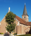
- The church in Cuisery
- The Saint-Pierre Chapel
- Montrevost Castle (private): Originally dating from the 14th century, it was renovated and rebuilt between the 16th and 19th centuries. This neo-Gothic castle is now known as “Les Kastéliades”, a group lodge offering high-end facilities.
- The Chemin du Tacot refers to the route taken by the ‘little train’ line that linked Tournus to Louhans from 1906 to 1939.
- The Tourist Complex on the banks of the Seille: a protected natural area offering, in season, catering (bar and snack bar), accommodation (campsite) and water sports (electric boat hire, canoes, pedalos, etc.).
- The Tournus-Cuisery aerodrome: watch small aeroplanes and microlights take off and land, or go on a maiden flight.
- Two equestrian centres offer horse riding and trail rides.

Reviews and comments

4.5 / 5
Based on 2 reviews

Reliability of the description
5 / 5
Ease of following the route
5 / 5
Route interest
3.5 / 5
User 6535208

Overall rating : 4.7 / 5

Date of your route : Mar 16, 2026
Reliability of the description : ★★★★★ Very good
Ease of following the route : ★★★★★ Very good
Route interest : ★★★★☆ Good
Very busy route : No

This is a very easy walk with virtually no elevation gain; the village of Cuisery is well worth a visit with its narrow streets and bookshop

Machine-translated

Alain de Bresse
Alain de Bresse

Overall rating : 4.3 / 5

Date of your route : Feb 07, 2022
Reliability of the description : ★★★★★ Very good
Ease of following the route : ★★★★★ Very good
Route interest : ★★★☆☆ Average
Very busy route : No

A very well-signposted route offering a pleasant walk, though it often runs close to heavily urbanised areas, factories, shopping centres, aerodrome hangars and a motocross track… There are walks in the Bresse region through better-preserved natural surroundings, such as woods and ponds…

Machine-translated

Other walks in the area

For more walks, use our search engine .

The GPS track and description are the property of this route's author. Please do not copy them without permission.