Bonnahont – Bonnefont route

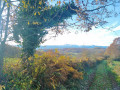
A lovely circular route alternating between countryside and woodland. Stunning panoramic views of the Pyrenees. Bonnefont, a charming little village where the Marquis de Montespan once lived.

Details

43080048
Creation:
Last update:
Last review:
  • Walking
    Activity: Walking
  • ↔
    Distance: 6.41 mi
  • ◔
    Average duration: 3h 30 
  • ▲
    Difficulty: Moderate

  • ⚐
    Back to start: Yes
  • ↗
    Ascent: + 663 ft
  • ↘
    Descent: - 653 ft

  • ▲
    Highest point: 1,526 ft
  • ▼
    Lowest point: 961 ft

Photos

Description of the walk

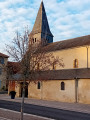
Park in the square by the town hall and church.

(S/E) Walk to the end of the square, near the River Baïse, then turn right onto Chemin de la Ribère. Next, take Chemin des Barricots on your right. Continue until you reach Route de Lannemezan (D17).

(1) Cross the road carefully (there is no pedestrian crossing), and take Chemin du Serroutet opposite. At the junction, near Clos du Saubat, turn right, then take the next path on your left. Continue to the junction with Chemin du Serrot.

(2) Turn right, keep left at the three-way junction and continue along this stony track.

(3) At the wide right-hand bend, ignore a path on your left and carry on to the next junction, located before the bridge over the Lizon.

(4) Turn right and take the path that climbs into the forest. Stay on this forest track, ignoring all the paths that branch off to the right. Cross the woodland and continue to the junction with the RD21.

(5) Turn left and follow the road uphill for about 50 metres. Before the bend, look for a forest track on your right and, after a few steps, ignore a path that branches off to the left. Continue to the next crossroads, at a place called Paloumère.

(6) Turn left (note: the path is somewhat hidden by the foliage). Begin the descent to another crossroads (elevation 389).

(7) Take the first path branching off to the right, which leads out of the forest. Continue to the RD17.

(8) Cross the road carefully, turn right to walk alongside the road and carry on to the next junction. Turn left onto Chemin Charlot and continue to the junction with the path called Clos du Couteret.

(9) Turn right onto this track. At the junction with the Route de Trie-sur-Baïse, turn right and carry on to the junction with the Rue du Château.

(10) Turn left, cross the street known as Bourg de Ville and, opposite, take Rue de l’Église to return to the starting car park (S/E).

Waypoints

  1. S/E : mi 0 - alt. 965 ft - Town hall and church square. Near the - Baïse (rivière)
  2. 1 : mi 0.57 - alt. 1,073 ft - Junction with Route de Lannemezan
  3. 2 : mi 1.01 - alt. 1,138 ft - Chemin du Serrot junction
  4. 3 : mi 1.74 - alt. 1,224 ft - Turn
  5. 4 : mi 2.51 - alt. 1,388 ft - Turn right at the junction before the bridge at - Lizon (rivière) - Affluent de la Baïse
  6. 5 : mi 4.12 - alt. 1,263 ft - D21
  7. 6 : mi 4.61 - alt. 1,385 ft - Paloumère junction
  8. 7 : mi 4.85 - alt. 1,273 ft - Junction at elevation 389
  9. 8 : mi 5.5 - alt. 1,063 ft - D17 junction
  10. 9 : mi 5.83 - alt. 1,030 ft - Chemin Charlot junction
  11. 10 : mi 6.25 - alt. 981 ft - Junction with Rue du Château
  12. S/E : mi 6.4 - alt. 965 ft - Town hall and church square

Notes

A map or GPS route is essential.

Worth a visit

The Marquis de Montespan lived in Bonnefont. Reference to Jean Teulé’s book *Le Montespan*.

Reviews and comments

3.8 / 5
Based on 3 reviews

Reliability of the description
3.7 / 5
Ease of following the route
3.7 / 5
Route interest
4 / 5
labradornoir
labradornoir

Overall rating : 4.7 / 5

Date of your route : Nov 02, 2024
Reliability of the description : ★★★★★ Very good
Ease of following the route : ★★★★★ Very good
Route interest : ★★★★☆ Good
Very busy route : No

It’s a lovely route. However, do make sure you follow the route description and map carefully, as you won’t always find the place names mentioned in the guidebook.
The signposting is rather haphazard...
With the app, it’s fine.

Machine-translated

lecbalcaz
lecbalcaz

Overall rating : 3.3 / 5

Date of your route : Dec 18, 2023
Reliability of the description : ★★★☆☆ Average
Ease of following the route : ★★★☆☆ Average
Route interest : ★★★★☆ Good
Very busy route : No

A pleasant route, but the signposting leaves something to be desired. Fortunately, the GPS proved very useful.

Machine-translated

bbrunelet
bbrunelet

Overall rating : 3.3 / 5

Date of your route : Dec 11, 2023
Reliability of the description : ★★★☆☆ Average
Ease of following the route : ★★★☆☆ Average
Route interest : ★★★★☆ Good
Very busy route : No

We had a bit of trouble finding some of the place names and paths mentioned in the guidebook whilst out and about.
We needed the help of the map on Visorando to check which paths we were taking (which is always more difficult in the countryside because of the number of paths and tracks you come across).
Otherwise, it was a very pleasant walk with lovely views, including of the Pyrenees mountain range.

Machine-translated

ritournelle
ritournelle

This route has not yet taken place; it will be offered in partnership with Acta32 as part of the 2024 programme.

Machine-translated

Other walks in the area

For more walks, use our search engine .

The GPS track and description are the property of this route's author. Please do not copy them without permission.