Ensisheim Route

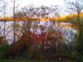
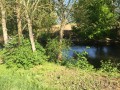
The beautiful village of Ensisheim, with its remarkable houses, opens out onto a plain bordered by the Ill and the Quatelbach, where it’s lovely to get some fresh air.

Details

n°33821021
Creation:
Last update:
Last review:
  • Walking
    Activity: Walking
  • ↔
    Distance: 4.62 mi
  • ◔
    Average duration: 2h 10 
  • ▲
    Difficulty: Easy

  • ⚐
    Back to start: Yes
  • ↗
    Ascent: + 13 ft
  • ↘
    Descent: - 13 ft

  • ▲
    Highest point: 728 ft
  • ▼
    Lowest point: 712 ft
  • ⚐ Country: France
  • ⚐ City: Ensisheim (68190)
  • ⚑
    Start/End: N 47.866078° / E 7.352588°
  • ❏
    IGN map(s): Ref. 3719OT, 3719OTR, 3720ET
  • Hour-by-hour weather

Photos

Description of the walk

The starting point of the walk is situated alongside Ensisheim Church, on its north side.

(S/E) Facing the side of the church, head to the right, towards the square between the church forecourt and Ensisheim Town Hall. At the T-junction, turn right towards the Stop sign, opposite the restaurant ‘Au Bœuf Rouge’. Carry on straight ahead along a one-way street, Rue Xavier Mossmann. Continue along this street as it bends to the left. Ignore a street on your left and carry on past a car park and then a playground. The street turns sharply left at number 23. Walk past a square and its war memorial. At the end of the street, at the T-junction where the Maison Centrale (the prison) is located, turn right. Cross the road carefully. Cross the Quatelbach, ignore Avenue Foch on your left and walk past the Domaine du Moulin. Take the bridge over the Ill.

(1) Just after the bridge, turn left into Rue de l’Ill. From here, follow the Blue Cross route towards the Sentier du Dollerbaechlein. Take the second street on the right after passing the Foyer Saint-Martin. Walk past a basketball court. At the end of the street, at the Stop sign, turn left into Rue de Wittenheim. Continue along this street for several hundred metres until you’ve passed house number 33.

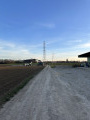
(2) Turn left. A few steps further on, at house no. 33A, turn right and walk alongside the high-voltage power lines.

(3) At the T-junction, turn left. The path then reaches the edge of the forest and curves slightly to the left. At the Y-junction, turn right. At the next Y-junction, turn left towards a large pipe crossing the plain.

(4) When you reach it, turn left and follow the Blue Diamond markings from here on. Take the footbridge over the Ill, still following the pipe. Just after the bridge, turn right onto the path running alongside the Ill. At a Y-junction where a small wooden wayside cross is hanging from a tree, turn left.

(5) Take the first path on the right, then follow a wooden footbridge that winds through the trees on the left. Continue along this path for just over a kilometre.

(6) When the path gives way to a tarmac road, turn left and ignore the dirt track that continues straight on towards the village. At the T-junction, opposite house no. 36, turn right. Ignore the two streets that turn left and walk alongside the cemetery car park.

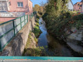
(7) At the Stop sign, turn left onto Avenue Foch, then take the first one-way street on the right, Rue Boellmann. When the street turns sharply left, take a small passageway closed to vehicles, which runs between two fences, towards the town centre. At the end of the path, cross a bridge, ignore the turnstile and leave the signposted route to turn right onto a path that runs alongside a boundary wall on the left and the Quatelbach Stream on the right.

(8) When the stream bends to the right, head back up onto the tarmac track on the left. Continue along the wall and go through a gate with a wire mesh leading into a courtyard and a porch with a skylight. Go through the porch and turn left onto the cobbled street. Cross the road carefully, then take the first street on the right. Walk past half-timbered houses, ignore a road that turns left and walk past a mural. At the four-way junction, turn left into Rue de l’Église. Cross the road carefully and take the first street on the right, running alongside the church, to return to your starting point (S/E).

Waypoints

  1. S/E : mi 0 - alt. 715 ft - Ensisheim Church
  2. 1 : mi 0.3 - alt. 722 ft - Rue de l’Ill
  3. 2 : mi 0.9 - alt. 715 ft - Junction at no. 33
  4. 3 : mi 1.28 - alt. 715 ft - T-junction
  5. 4 : mi 2.16 - alt. 728 ft - Junction
  6. 5 : mi 2.57 - alt. 725 ft - Small wooden wayside shrine
  7. 6 : mi 3.51 - alt. 719 ft - Junction on the road
  8. 7 : mi 3.97 - alt. 719 ft - Avenue Foch
  9. 8 : mi 4.34 - alt. 722 ft - The town’s ramparts
  10. S/E : mi 4.62 - alt. 715 ft - Ensisheim Church

Notes

At the starting point (S/E) and all around the church, there are plenty of parking spaces available.
Just after point number (5) on the route, there is a picnic table. To find it, ignore the jetty on the left and walk a few dozen metres.

Worth a visit

5The route can be extended slightly, but this involves crossing a ford, which may not always be easily passable, depending on the season and water levels. At point number (4) on the route, rather than following the pipe, continue straight on along the Blue Cross trail. Walk past the Ferme Saint-Jean and a chapel dedicated to Sainte-Marie. At the crossroads just after the chapel, head down to the left and cross the stream. Then, turn left and follow the stream. You’ll come across the small wooden wayside cross and rejoin the route at the fork at point number ( ).

The pipe you’ll be walking alongside from point number (4) on the route forms part of the Potash Mines Drainage Canal; it is almost 30 km long and runs from Staffelfelden to Fessenheim. The industry, now defunct, brought prosperity to the region for many years.

At point number (8), you are on the Promenade des Remparts, which showcases the town’s ancient 15th-century city walls. After the walk, back in the old town, you can admire a magnificent gate and some very pretty half-timbered houses. Both points of interest are accompanied by information boards so you can learn more.

Reviews and comments

4.7 / 5
Based on 1 review

Reliability of the description
4 / 5
Ease of following the route
5 / 5
Route interest
5 / 5
Yukulovicz
Yukulovicz

Hello. No, the walk starts outside the village of Ensisheim and therefore takes place partly on dirt tracks, which can be muddy in wet weather.

Machine-translated

jms68490
jms68490
• Edited:

Hello, is the walk ONLY on paved paths? In other words, is it advisable on wet ground?

Machine-translated

300360
300360

Overall rating : 4.7 / 5

Date of your route : Mar 03, 2025
Reliability of the description : ★★★★☆ Good
Ease of following the route : ★★★★★ Very good
Route interest : ★★★★★ Very good
Very busy route : No

A lovely way to explore Ensisheim on this walk.
Best done on a sunny day.
And it’s easy to do with children.
We’ll be going back for another walk around Ensisheim.
The village is lovely. Well worth a visit for those who haven’t been there before!

Machine-translated

Monette
Monette

Hello. Unfortunately, we didn’t go on that outing, as the weather wasn’t on our side last Thursday.
But it’s only a postponement. As a result, attendance figures are unknown. Monday 22 April 2024

Machine-translated

Other walks in the area

For more walks, use our search engine .

The GPS track and description are the property of this route's author. Please do not copy them without permission.