Country:

 City:
City:


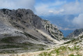
Parking is available along the road crossing Monte Baldo, 1.5 km after Novezza. There are around ten spaces near the signs marking the start of the walk.
(S/E) Head up to the left towards Rifugio Telegrafo. After a stretch through the forest, which can be slippery in places, you’ll soon reach the first junction. Carry on straight ahead and, a few metres further on, a signpost indicates Forcella Val Fontanella and Forcella Valdritta to the right.
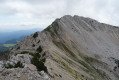
(1) Turn right amongst these small mountain pines. The winding path leads in a few minutes to a broad ridge, over which paragliders soar and where you can spot a few edelweiss.
(2) Follow this ridge upwards towards the pass (Forcella Val Fontanella).
(3) Once at the pass, take the level path on the right towards Forcella Valdritta. In a more rocky landscape, the path descends slightly before climbing again to reach the Col de la Forcella Val Fontanella.
(4) Continue to the right along the same path on the mountainside for about 150 metres.
(5) A metal post marks a path that climbs to the left. You will also see the sign ‘Cima Valdritta 2218 m’ written on a rock.
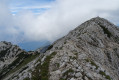
Take this path, which crosses over to the eastern slope of Monte Baldo. This section is quite narrow and vertiginous, but the path is very well marked.
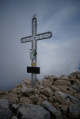
You’ll see a cross on your left. To reach it, follow the path which continues straight on and passes it before turning left to climb up to the cross without any difficulty. Once there (it doesn’t seem to be quite at the highest point), you can make your way to the cairn marking the summit of Monte Baldo.
(6) The return journey follows the same route (S/E).

 Visorando Member
 Average