Circular panoramic walk in Limone sul Garda

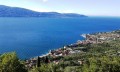
A short walk above Limone sul Garda which, whilst allowing you to escape the crowds of tourists for a while, offers a magnificent view of the town and the lake. The slopes are quite steep, but the path is very well equipped in difficult sections and well secured.

Details

n°49149856
Creation:
Last update:
Last review:
  • Walking
    Activity: Walking
  • ↔
    Distance: 2.67 mi
  • ◔
    Average duration: 1h 55 
  • ▲
    Difficulty: Moderate

  • ⚐
    Back to start: Yes
  • ↗
    Ascent: + 787 ft
  • ↘
    Descent: - 761 ft

  • ▲
    Highest point: 820 ft
  • ▼
    Lowest point: 217 ft

Description of the walk

The starting point is at one of the jetties from which you can reach Limone by boat. You’ll need to adapt your route depending on where you’re heading in town.

(S/E) From the small harbour known as “Porto Vechio”, turn left onto the high street and follow it for about 150 metres.

(1) Turn right onto “Via Rovina” (be careful, the slope is steep and the small pebble surface makes it tricky, especially in wet weather). You’ll soon reach the main road, the SS45bis, which runs through Limone.

(2) Cross the SS45bis and, opposite, take the uphill path onto “Via Milanese” (be careful not to take the path immediately on the right, which climbs straight up towards the cliff). You’ll soon find yourself overlooking a lemon grove. Follow “Via Milanese” to reach a small inn situated on the banks of the San Giovani stream.

(3) Cross the stream, then take the path furthest to the left (actually a set of steps) which leads to the cliff. Then follow the path along the cliff face (it is equipped with a metal handrail throughout). Set in the heart of nature, in the shade, it offers magnificent views of the town and the lake.

(4) At the junction, turn left onto the path and begin the descent towards the town. You’ll come to a series of hairpin bends which you should follow downwards.

(5) Continue along a tarmac road which quickly becomes a street and winds its way between villas and hotels. Walk gently downhill to a bridge over the San Giovanni torrent and cross it.

(6) Just after the bridge, turn right and follow the banks of the torrent along a well-maintained path to the lakeside (crossing to the other side twice via footbridges). At the lakeside, turn left, keeping the lake on your right, and stay as close to the lake as possible to easily find the junction you passed at the very start of the walk.

(1) Retrace your steps along the route you took on the way there to reach the jetty (S/E).

Waypoints

  1. S/E : mi 0 - alt. 236 ft - Jetty for the Malcesine–Limone ferry crossing
  2. 1 : mi 0.1 - alt. 256 ft - Junction of the circular loop
  3. 2 : mi 0.21 - alt. 348 ft - Main road SS45bis
  4. 3 : mi 0.62 - alt. 623 ft - “La Milanesa” guesthouse
  5. 4 : mi 1.03 - alt. 728 ft - Start of the descent back to Limone
  6. 5 : mi 1.29 - alt. 610 ft - Return via a tarmac road
  7. 6 : mi 1.71 - alt. 489 ft - Start of the path running alongside the stream
  8. S/E : mi 2.67 - alt. 236 ft - Jetty for the Malcesine–Limone ferry crossing

Notes

For the start of the walk, if you have trouble finding ‘Via Rovina’, the important thing is to reach the main road that runs through Limone (SS45bis) and locate the point (2), which is the starting point for several hiking trails (it is situated past several car parks to the north of Limone and the first tunnel – so you could use this as a starting point if you’re coming by car).

This walk could be classified as easy, as the path sections are very well maintained and safe; however, the gradients are sometimes steep, so be sure to wear shoes with good grip (especially in wet weather).

As most of the route is very close to Limone, it is very easy to find food and drink, and even shelter (except in the section situated directly on the cliff overlooking Limone – between (3) and (5)).

Public toilets (clean, as is often the case in Italy, and free of charge) are available by the lake on the way back towards the town centre.

Worth a visit

Near the inn ((3), there is a waterfall upstream of the bridge and the start of several hiking trails into the valleys overlooking Limone and the lake (takes at least 4 hours).

Of course, the main attraction of this walk is the view it offers of the town and the lake, with its beautiful villas and adjoining gardens. It also allows you to escape (a little) from the throngs of tourists at the lake.

There are picnic tables along the route, offering superb views, particularly just before the viewpoint (4).

The fact that you can reach Limone by crossing the lake from many other towns means you can combine a walk with a trip out on the lake in a single day (on average, there are crossings every hour from numerous towns situated along the lake’s shores).

And, of course, the charming historic town of Limone, with its lemon groves clearly visible from the lake.

Reviews and comments

5 / 5
Based on 1 review

Reliability of the description
5 / 5
Ease of following the route
5 / 5
Route interest
5 / 5
Bouconne VTT
Bouconne VTT

Overall rating : 5 / 5

Date of your route : Aug 28, 2024
Reliability of the description : ★★★★★ Very good
Ease of following the route : ★★★★★ Very good
Route interest : ★★★★★ Very good
Very busy route : No

A short, very pleasant walk in the sweltering heat. We were really glad to reach the top and get into the shade
There are magnificent views of Lake Garda, set amongst lemon and olive trees.
The route description is very well done.

If it’s hot, make the most of the chance to cool off at the many fountains along the climb, as there isn’t much shade on this stretch.

At point 6, just before the bridge on the left, there’s a little spot where you can cool your feet without having to go straight into the river.

If you’re arriving by car, park in the car park at the bottom, just before the end of the walk, as it’s the only one with enough space to accommodate visitors.

Machine-translated

Other walks in the area

For more walks, use our search engine .

The GPS track and description are the property of this route's author. Please do not copy them without permission.