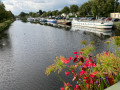
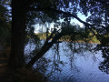
Towpath along the Nantes–Brest Canal from Saint-Omer-de-Blain

Route along the towpath and back via La Touche aux Thébauds, Peslan and the village of Saint-Omer-de-Blain.
Takes around 2 hours on foot or by mountain bike.

Details

7517543
Creation:
Last update:
Last review:
  • Walking
    Activity: Walking
  • ↔
    Distance: 5.44 mi
  • ◔
    Average duration: 2h 35 
  • ▲
    Difficulty: Easy

  • ⚐
    Back to start: Yes
  • ↗
    Ascent: + 59 ft
  • ↘
    Descent: - 59 ft

  • ▲
    Highest point: 92 ft
  • ▼
    Lowest point: 23 ft
  • ⚐ Country: France
  • ⚐ City: Blain (44130)
  • ⚑
    Start/End: N 47.467095° / W 1.863657°
  • ❏
    IGN map(s): Ref. 1122SB
  • Hour-by-hour weather

Photos

Description of the walk

Start from the picnic area at Saint-Omer-de-Blain.

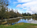
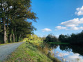
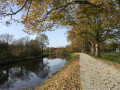
(S/E) With your back to the Isac, follow the Nantes–Brest Canal towpath to the left as far as the Barel Lock.

(1) Continue along the canal to La Touche aux Thébauds. Leave the towpath, turn right towards the village and join a road.

(2) Then head up to the right towards Peslan, walking for about 500 metres. You can continue straight on to visit the bread oven in the centre of the village. Alternatively, turn right at a 90° angle onto a track and, at the end of it, turn left towards Peslan.

(3) At the first houses, continue to the right, crossing the Ruisseau de Curin (please note: crossing this stream may be impassable depending on the season). Continue to the road. Follow it to the right. Approach the lock.

(4) Before the lock, turn left onto the first path. Cross a country lane and head towards Le Perrai. Cross it and follow the path which leads out onto Rue de l’Écluse. Head towards the crossroads at the entrance to Sant-Omer de Blain.

(5) Continue to the right along Rue du Fresne, then right again along Rue du Moulin, left along Rue de la Loge and right towards La Motte. Finally, join the towpath via a footpath.

(6) Then turn right to return to the starting point (A/D).

Waypoints

  1. S/E : mi 0 - alt. 33 ft - Picnic area
  2. 1 : mi 0.44 - alt. 33 ft - Barel lock
  3. 2 : mi 1.58 - alt. 36 ft - La Touche aux Thébauds
  4. 3 : mi 2.44 - alt. 89 ft - Peslan and the Curin stream
  5. 4 : mi 3.08 - alt. 43 ft - Rue de l’Écluse – Saint-Omer
  6. 5 : mi 3.93 - alt. 89 ft - Entrance to the village of Saint-Omer-de-Blain
  7. 6 : mi 4.72 - alt. 33 ft - La Motte wooden bridge – towpath
  8. S/E : mi 5.44 - alt. 33 ft - Picnic area

Notes

(S/E) Picnic area
(1) Water point in front of the lock-keeper’s house

Saint-Omer village: pub and grocery shop.

Worth a visit

(1) Barel lock
(2) Village of La Touche aux Thébauds (in the municipality of Guenrouet)
(3) Peslan, in the centre of the village Bread oven (off the route)
(5) The village of Saint Omer and its church, rebuilt after the war.
(6) The wooden bridge at La Motte

Reviews and comments

4.8 / 5
Based on 2 reviews

Reliability of the description
5 / 5
Ease of following the route
4.5 / 5
Route interest
5 / 5
CCFC
CCFC
• Edited:

6 km of uninteresting towpath, followed by a long stretch along the road, before finally returning to the slightly wooded towpath for the way back

Machine-translated

JEAN-MARC P
JEAN-MARC P

Overall rating : 5 / 5

Date of your route : Jul 21, 2023
Reliability of the description : ★★★★★ Very good
Ease of following the route : ★★★★★ Very good
Route interest : ★★★★★ Very good
Very busy route : No

The route was very pleasant; we even spotted some fallow deer and their fawns on a property bordering the path between points 4 and 5 (and some very large dogs, though they were behind a very secure fence).
A lovely mix of canal banks and countryside.

Machine-translated

kidom
kidom

Overall rating : 4.7 / 5

Date of your route : Oct 02, 2022
Reliability of the description : ★★★★★ Very good
Ease of following the route : ★★★★☆ Good
Route interest : ★★★★★ Very good
Very busy route : No

A really lovely walk that we’ll definitely do again

Machine-translated

Other walks in the area

For more walks, use our search engine .

The GPS track and description are the property of this route's author. Please do not copy them without permission.