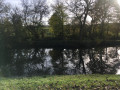
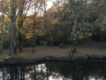
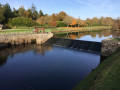
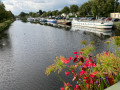
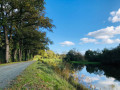
The Bougard lock, accessible from both banks of the canal, starting from Blain

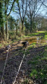
This walk takes you along both banks of the Nantes–Brest Canal between Blain and the Bougard lock. From Blain harbour, follow the wide towpath to the Bougard lock. You then cross the canal and continue along a short stretch of road until you rejoin the old towpath. This narrow, wonderfully bumpy and beautifully shaded path takes you back to the harbour. You’ll be delighted by the sight of numerous birds and a wide variety of plants.

Details

14858698
Creation:
Last update:
Last review:
  • Walking
    Activity: Walking
  • ↔
    Distance: 9.11 mi
  • ◔
    Average duration: 4h 15 
  • ▲
    Difficulty: Moderate

  • ⚐
    Back to start: Yes
  • ↗
    Ascent: + 69 ft
  • ↘
    Descent: - 69 ft

  • ▲
    Highest point: 118 ft
  • ▼
    Lowest point: 26 ft
  • ⚐ Country: France
  • ⚐ City: Blain (44130)
  • ⚑
    Start/End: N 47.46994° / W 1.765815°
  • ❏
    IGN map(s): Ref. 1122SB, 1222SB
  • Hour-by-hour weather

Photos

Description of the walk

Park in the car park at Blain harbour.

(S/E) Take theGRP® des Trois Rivières trail, marked in red and yellow, to reach the bridge over the canal.

(1) Cross the N171 road and continue along the right bank of the canal (towards Brest). Follow the towpath to the Paudais lock. Enjoy the beautiful flower-filled areas when in season.

(2) Carry on along the canal. After a gentle bend, you’ll find yourself opposite the old hospital, surrounded by a huge park.

(3) Carry on along the towpath until you reach the Bougard lock.

(4) Cross the canal by turning left onto the D81. Keep to the left-hand side and take care, as the verge isn’t suitable for walkers. You’ll reach the crossroads in the hamlet of Eudrais, near a large yellow house.

(5) Turn slightly left and, shortly afterwards, enter the hamlet of La Réauté.

(6) Turn left at the crossroads, then follow the road straight ahead. Pass a cross, then take a 90° right-hand bend with the road. Continue straight on until you reach the D33.

(7) Please note: this road is quite busy. Turn left and follow it on the left-hand side. A fairly wide grassy path allows you to walk safely. You’ll reach the “Pont Piétin” bus stop, situated in front of the entrance to what remains of the old hospital.

(8) Continue along the D33 until you reach the junction with the road leading to La Simnaudais.

(9) Turn left, then left again at the next junction, and then right. You will then enter a woodland; cross through it to emerge on the left bank of the canal.

(10) Turn right and continue along a relatively narrow, winding path that is somewhat bumpy. Further on, take the footbridge over the Ruisseau de la Madeleine. Continue along the path until you reach the spillway of the Paudais lock.

(11) Carry on until you reach the first bridge crossing the canal. Cross the bridge, then turn right at the end of the bridge to return to the right bank of the canal and the road bridge.

(1) Follow the same route as on the way there to return to the Blain harbour car park (S/E).

Waypoints

  1. S/E : mi 0 - alt. 49 ft - Blain Harbour car park - Château de la Groulais
  2. 1 : mi 0.08 - alt. 59 ft - Road bridge
  3. 2 : mi 0.83 - alt. 46 ft - La Paudais Lock
  4. 3 : mi 2.68 - alt. 36 ft - Opposite Pont Piétin
  5. 4 : mi 3.75 - alt. 39 ft - Bougard Lock - Canal de Nantes à Brest
  6. 5 : mi 4 - alt. 52 ft - Carrefour l’Eudrais
  7. 6 : mi 4.38 - alt. 39 ft - La Réauté - Ruisseau du Pont Serin
  8. 7 : mi 5.33 - alt. 85 ft - D33 junction
  9. 8 : mi 5.71 - alt. 98 ft - Pont Piétin bus stop
  10. 9 : mi 6.24 - alt. 105 ft - La Simnaudais crossroads
  11. 10 : mi 6.99 - alt. 36 ft - Left bank of the canal
  12. 11 : mi 8.27 - alt. 46 ft - La Paudais spillway
  13. S/E : mi 9.11 - alt. 49 ft - Blain Harbour car park - Château de la Groulais

Notes

(S/E) Parking available at Blain harbour.
(4) Bougard Lock, with its machinery and spillway. There are a few benches where you can take a break.
(10) Picnic facilities available.
Shortly before (1) on the return journey: the bridge once carried a railway line. A sign provides full details about this railway, and the view over the canal is rather lovely.
You’ll need to cross one or two roads, and part of the walk is on tarmac. Most of the route follows quiet country lanes. Only the road from the crossing point (7) is busy, but it’s flanked by a wide grassy verge. In any case, please take care.

Worth a visit

La Groulaie Castle is easily accessible on foot from Blain harbour.

Reviews and comments

4.2 / 5
Based on 3 reviews

Reliability of the description
4.3 / 5
Ease of following the route
4.7 / 5
Route interest
3.7 / 5
User 17655665

Overall rating : 4 / 5

Date of your route : Jun 02, 2025
Reliability of the description : ★★★★☆ Good
Ease of following the route : ★★★★☆ Good
Route interest : ★★★★☆ Good
Very busy route : No

Enjoy your walk

Machine-translated

indie
indie

Overall rating : 4.3 / 5

Date of your route : Sep 30, 2024
Reliability of the description : ★★★★☆ Good
Ease of following the route : ★★★★★ Very good
Route interest : ★★★★☆ Good
Very busy route : No

An easy route with no elevation gain along the canal; however, it does follow a section of busy road, which could be partly avoided

Machine-translated

CCFC
CCFC
• Edited:

After 6 km of hauling, a lot of road and, finally, along the other bank (about 3/4 km)
not particularly interesting for a group of walkers.

Machine-translated

Gilbertaron
Gilbertaron
• Edited:

Overall rating : 4.3 / 5

Date of your route : Mar 27, 2023
Reliability of the description : ★★★★★ Very good
Ease of following the route : ★★★★★ Very good
Route interest : ★★★☆☆ Average
Very busy route : No

From the Bougard lock (4) to the junction with the Simnaudais (9), the route covers nearly 4 km, including two sections that are difficult or even dangerous, either due to the lack of a reliable hard shoulder for nearly 400 m, or a narrow hard shoulder with heavy traffic of fast-moving vehicles for approximately 1.5 km. Consequently, the final part of the route around the psychiatric hospital is rather arduous.

The most interesting part is the return journey to Blain along the left bank of the canal. It may be impassable after heavy rain, due to the canal swelling – it is also a river, at least along this stretch.

I won’t be doing that route again.

Machine-translated

Other walks in the area

For more walks, use our search engine .

The GPS track and description are the property of this route's author. Please do not copy them without permission.