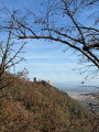
Ribeauvillé castles through the vineyards and the Schluesselstein

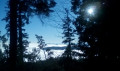
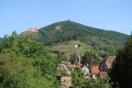
This is a pleasant walk that will take you through vineyards and woods to the remarkable Schlüsselstein Rock, then to the foot of the Taennchel and finally to two of Ribeauvillé’s three castles.
There are a few climbs, but on the whole it’s a fairly easy route.

Details

n°116144
Creation:
Last update:
Last review:
  • Walking
    Activity: Walking
  • ↔
    Distance: 6.40 mi
  • ◔
    Average duration: 4h 15 
  • ▲
    Difficulty: Moderate

  • ⚐
    Back to start: Yes
  • ↗
    Ascent: + 1,463 ft
  • ↘
    Descent: - 1,430 ft

  • ▲
    Highest point: 2,119 ft
  • ▼
    Lowest point: 925 ft

Photos

Description of the walk

The route starts from the sports ground at the top of Ribeauvillé (take Rue Klee then Rue de Lutzelbach uphill to its end, at the small car park where you can park).

(S/E) Take the narrow path that climbs eastwards between the vineyard and the house (24 Rue du Lutzelbach) and continue along the path through the vineyards. Ignore all paths branching off to the left until you reach a crossroads where you’ll meet the path marked with Yellow Triangles.

(1). Head straight ahead. From this point, follow the Altenholz nature trail, signposted with a gendarme’s cap. After a kilometre of flat path through woods and vineyards, you’ll reach a T-junction.

(2) Turn left.

(3) Walk past the former gamekeeper’s cottage and follow the sign for the ‘long route’. Walk alongside a fenced-off woodland.

(4) Turn right, following the fence. The single-track path climbs through the woods until it meets the path marked with Blue Crosses. Take this path to the left as far as the Schluesselstein Rock (indicated by an information board).
(Please note: the 1:25,000 map is inaccurate; it does not show the Schluesselstein in the correct location.)

(5) After the rock, ignore the two paths branching off to the left and continue along the path marked with Blue Crosses until you reach a track suitable for vehicles. Continue along this track to the right, ignoring the paths to the right and left, until you reach the Carrefour du Cerisier Noir.

(6) At the crossroads, turn left onto a steep path leading down to the Fontaine du Hêtre (marked with Blue Triangles). At the fountain, turn immediately left, and at the next crossroads, turn left towards the castles (marked with Yellow Crosses).

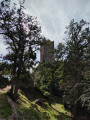
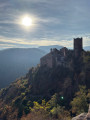
(7) Pass close to the Kahlfels Rock, then arrive at the ruined Saint-Ulrich Castle.

(8) Continue along the path marked with Yellow Crosses, passing close to Girsberg Castle.

(9) Stay on the same path, which descends gently towards Ribeauvillé, passing the Lutzelbach Fountain.

(10) At the track, turn right and follow the Yellow Cross markings back to the sports ground (S/E) through the pretty Lutzelbach valley, ignoring a path on your left.
Waypoints

  1. S/E : mi 0 - alt. 925 ft - Sports area
  2. 1 : mi 0.38 - alt. 1,184 ft - Crossroads: head straight ahead
  3. 2 : mi 0.97 - alt. 1,289 ft - At the crossroads, turn left
  4. 3 : mi 1.1 - alt. 1,329 ft - Ranger’s hut
  5. 4 : mi 1.2 - alt. 1,414 ft - Follow the wire fence
  6. 5 : mi 1.76 - alt. 1,808 ft - Schluesselstein Rock
  7. 6 : mi 3.2 - alt. 2,119 ft - Carrefour du Cerisier Noir
  8. 7 : mi 4.09 - alt. 1,749 ft - Kahlfels Rock
  9. 8 : mi 4.61 - alt. 1,719 ft - Château de Saint-Ulrich
  10. 9 : mi 4.71 - alt. 1,722 ft - Girsberg Castle
  11. 10 : mi 5.39 - alt. 1,371 ft - Lutzelbach Fountain
  12. S/E : mi 6.4 - alt. 932 ft - Sports area

Notes

Drinking water is available at the Lutzelbach and Hêtre fountains. Please note that these are not very visible and you will need to look for them at the edge of the path.

Picnic tables near the calvary located just before the Carrefour du Cerisier Noir and at the two castles.

Worth a visit

Beautiful views of the different valleys.

Reviews and comments

4.5 / 5
Based on 62 reviews

Reliability of the description
4.4 / 5
Ease of following the route
4.5 / 5
Route interest
4.6 / 5
virgule
virgule
• Edited:

Personally, I think what makes this route so charming are precisely the sections through the forest and the Schlüsselstein rocks. The castles, which are very busy, aren’t my favourite part. The appeal lies precisely in the fact that it’s a route with very few visitors, right in the heart of nature.

If you read the comments, you’ll see that there are other users who think the only attraction is visiting the castles. That’s not the point of this route. Perhaps I should mention this in the guide.

Everyone is free to have their own opinion.

Machine-translated

Chloww29
Chloww29

I’ve done loads of other walks before, but this one’s marked as ‘easy’ when it really isn’t… I still know what a walk’s like, but this one’s just all uphill and the forest isn’t that impressive, unlike the other walks I’ve done. I’ve done walks that were just through forest before, but they were simply more impressive and more visually stunning. I’ve simply given my opinion, so there’s no point in getting everything mixed up by talking to me about tourism when I’m actually from round here anyway 😅

Machine-translated

virgule
virgule

Hello,

The walk is described as easy, but I found it to be more of a moderate difficulty. In the comments, people say there’s a steep climb at the start and that it’s fine after that, but that’s not true at all!! This walk is nothing but uphill; there were very few flat sections, and the few descents were far too steep. In short, it wasn’t at all enjoyable. The walk is nothing special apart from the castles, which are incredible; the rest is just forest for the loggers…

To sum up, it’s a hike, which explains why there are climbs, descents and woodland. If you just want to see the castles, you’re better off following the route recommended by the tourist office.

Visorando’s focus is on hiking, not sightseeing. That’s my opinion, at least.

Machine-translated

Chloww29
Chloww29

Overall rating : 3.7 / 5

Date of your route : Oct 15, 2026
Reliability of the description : ★★★☆☆ Average
Ease of following the route : ★★★★★ Very good
Route interest : ★★★☆☆ Average
Very busy route : Yes

The walk is described as easy, but I found it to be more of a moderate difficulty. In the comments, people say there’s a steep climb at the start and that it’s fine after that, but that’s not true at all!! This walk is nothing but uphill; there were very few flat sections, and the few descents were far too steep. In short, it wasn’t at all enjoyable. The walk is nothing special apart from the castles, which are incredible; the rest is just forest for the loggers…

Machine-translated

epiluc91
epiluc91

Overall rating : 5 / 5

Date of your route : May 01, 2026
Reliability of the description : ★★★★★ Very good
Ease of following the route : ★★★★★ Very good
Route interest : ★★★★★ Very good
Very busy route : Yes

We did this hike in the opposite direction and, after point 8, climbed up to "Haut Ribeaupierre" before joining the trail between points 5 and 6 (elevation 626).
This hike takes you through magnificent forests and offers beautiful views over the plain and towards the Black Forest.
The only downside: on 1 May, the car park at the top of Lutzelbach was full, as were most of the car parks in the town. We had to set off from the bottom of Ribeauvillé....

Machine-translated

randoviso17
randoviso17

Overall rating : 4.7 / 5

Date of your route : Apr 06, 2026
Reliability of the description : ★★★★★ Very good
Ease of following the route : ★★★★☆ Good
Route interest : ★★★★★ Very good
Very busy route : Yes

A lovely route. It starts with a path through the vineyards, followed by a stunning view stretching from the villages all the way to the Black Forest, then a walk through the woods, passing by the foot of two castles, and finally a gentle descent.
The route was only very busy on the section leading to the castles.
As usual, we regret that the distance and elevation gain figures are underestimated: 20% and 15% (due to the limited number of checkpoints)

Machine-translated

a.emmrich
a.emmrich

Overall rating : 4.7 / 5

Date of your route : Nov 09, 2025
Reliability of the description : ★★★★★ Very good
Ease of following the route : ★★★★★ Very good
Route interest : ★★★★☆ Good
Very busy route : No

We did this hike yesterday, 9 November 2025.
It was a very pleasant hike, but you have to manage the initial climb and, above all, the steep descent towards the middle of the hike.
We didn't get a very good view of the plain (due to fog), but it must be magnificent and we will return.
It was wonderful to discover the two sumptuous castles and the views they offer of each other. Reaching them feels like a reward towards the end of the route.
We will definitely plan this hike again when the sun is shining more brightly.
Angèle Emmrich

Machine-translated

Nathalie et Francis
Nathalie et Francis

Overall rating : 5 / 5

Date of your route : Mar 09, 2025
Reliability of the description : ★★★★★ Very good
Ease of following the route : ★★★★★ Very good
Route interest : ★★★★★ Very good
Very busy route : No

No particular difficulties apart from a steep climb at the start. Lovely views and a pleasant approach to the castles.
A walk for all the family.

Machine-translated

bruno laumond
bruno laumond
• Edited:

Overall rating : 5 / 5

Date of your route : Jul 29, 2024
Reliability of the description : ★★★★★ Very good
Ease of following the route : ★★★★★ Very good
Route interest : ★★★★★ Very good
Very busy route : Yes

Lovely quiet walk, often shaded, with a variation to visit the Drusenbach chapel and the Haut Ribeaupierre castle, which is easy to follow using the app. A little busier around the castles (normal, holiday period).

Machine-translated

virgule
virgule

Hello,

I'd be very surprised to find cyanobacteria at Schlusselstein.

Machine-translated

choupette68
choupette68

Overall rating : 4.7 / 5

Date of your route : Jul 22, 2024
Reliability of the description : ★★★★★ Very good
Ease of following the route : ★★★★★ Very good
Route interest : ★★★★☆ Good
Very busy route : No

Pleasant walk in the forest, in very hot weather, I followed the river with my dog (leash required).
Be careful towards the more hilly part, some trees have fallen. You have to go over or around them.
The Lac de lauch and the waterfall are magnificent.
Concerning the dogs, no cynobacteria.

Machine-translated

virgule
virgule

Hello,

The time given by Visorando is based on an average of 3.5 km/h. Most hikers find this very long and take less time. But you're perfectly free to take longer, if you're having a picnic, taking photos or picking blueberries or mushrooms.

In this hyper-touristy area, there is often confusion between hiking and sightseeing. I see that you found the route from (7), i.e. the castles, interesting.

There's a circuit that's less of a hike than a tourist walk and is more in line with what you're looking for. It's only 7 km long, but it climbs as well.

https://www.visorando.com/randonnee-bala...

Machine-translated

bes25420
bes25420

Overall rating : 3.7 / 5

Date of your route : Jun 03, 2024
Reliability of the description : ★★★★★ Very good
Ease of following the route : ★★★★☆ Good
Route interest : ★★☆☆☆ Disappointing
Very busy route : Yes

The route was described as an "easy" hike, which I didn't think was the case. 70% of the route is just very hard climbing, and 30% just as complicated descending. The secondary interests were only visible from point 7 onwards.
The weather was miserable today, so I spent a long time in the fog. No such luck.
In my humble opinion, you need to be in good physical condition to complete the course in the time allowed.
As far as I'm concerned, the route should be put in the Difficult category.

Machine-translated

gigigigi
gigigigi

Overall rating : 5 / 5

Date of your route : May 03, 2024
Reliability of the description : ★★★★★ Very good
Ease of following the route : ★★★★★ Very good
Route interest : ★★★★★ Very good
Very busy route : Yes

What a wonderful discovery!

Machine-translated

MANN Jean-Paul
MANN Jean-Paul

Overall rating : 5 / 5

Date of your route : Mar 05, 2024
Reliability of the description : ★★★★★ Very good
Ease of following the route : ★★★★★ Very good
Route interest : ★★★★★ Very good
Very busy route : No

We've just completed the walk in good conditions. The route is beautiful, pleasant and very well explained. In fact, we fully understood the author-trekker's comments.
Perfect

Machine-translated

Other walks in the area

For more walks, use our search engine .

The GPS track and description are the property of this route's author. Please do not copy them without permission.