


Refine your search for walks in Château des Fées
Château des Fées walks


 From Bertrix to Cugnon and from Château des Fées to Point de Vue de La Mergire
 Visorando Member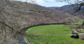
 9.78 mi
 +1,227 ft
 -1,220 ft
 5h 35
5h 35
 Moderate
 Departure from Bertrix (Province de Luxembourg)
Route on one of the slopes of the Semois, from Bertrix to Cugnon, from the Château des Fées to the Point de Vue de La Mergire, from the Moulin de Cugnon to the Old Cemetery of Mortehan, returning via the old Bertrix-Herbeumont railway line, now the RAVeL and Route des Pierres qui Parlent.
A walk towards the Arboretum and the Château des Fées
 10.80 mi
+1,762 ft
-1,752 ft
6h 30
10.80 mi
+1,762 ft
-1,752 ft
6h 30
 Difficult
Departure from Bertrix (Province de Luxembourg)
Difficult
Departure from Bertrix (Province de Luxembourg)
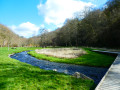
Set off to explore the Château des Fées, a rocky outcrop secured by a few low stone walls, as well as the Bertrix Arboretum, where you can discover numerous specimens of trees from all corners of the world.This beautiful, exclusively woodland walk, which is very quiet, should be considered difficult not only because of its cumulative elevation gain but also due to a few sections on steeply sloping paths or paths that are virtually non-existent on the ground. It’s not the Alps or the Vosges... just Wallonia on the Semois side!
Walks near Château des Fées
Bouillon – Florenville
 16.41 mi
+1,529 ft
-1,470 ft
8h 55
16.41 mi
+1,529 ft
-1,470 ft
8h 55
 Very difficult
Departure from Bouillon (Belgique) (Province de Luxembourg)
Very difficult
Departure from Bouillon (Belgique) (Province de Luxembourg)
Leaving Bouillon and its castle to reach Florenville means linking the two ends of the Semois by crossing the plateau and its forests rather than following the river’s course and meanders; it is therefore a long climb followed by a gradual descent; it also means leaving a town on tarmac, travelling along stony paths and dirt tracks, crossing two fords, and returning to tarmac to reach the town again. And it’s a long walk of over 26 kilometres. The accommodation I’ve chosen in Florenville is the campsite.
From Bouillon Castle to Sedan Castle
14.14 mi
+1,385 ft
-1,601 ft
7h 40
Difficult
Departure from Bouillon (Belgique) (Province de Luxembourg)
This fully signposted cross-border trail links Bouillon Castle in Belgium to Sedan Castle in France.
This is one of the possible return routes for the hike from one castle to another across the border, hike no. 36479520
After following the Semois river, you will climb up to Corbion, a small village perched high in the municipality of Bouillon. Then, after crossing the border stream near the "Maison Verlaine", you will join the old Bouillonnais road, which will take you gently to the Sedan region.
Bané Campsite – Villance
 15.10 mi
+1,358 ft
-1,716 ft
8h 10
Difficult
Departure from Libin (Province de Luxembourg)
15.10 mi
+1,358 ft
-1,716 ft
8h 10
Difficult
Departure from Libin (Province de Luxembourg)
This second section runs along the eastern boundary of the municipality of Libin. After a night at the Bané campsite, explore the Anciennes Troufferies Nature Reserve and the Noire Eau valley as it joins the Lomme, before finishing at the former kaolin quarry in Libin.
 Chassepierre – Arlon Official Campsite
47.67 mi
+1,962 ft
-1,634 ft
8 hrs
Difficult
Departure from Florenville (Province de Luxembourg)
Starting from Chassepierre, this route through the Gaume region allows time to visit remarkable cultural sites and another of the ‘most beautiful villages in Wallonia’. This involves a few detours, but fewer than those along the Semois, where the route cuts across several bends! The route description refers to the ‘nodes’ of the cycle network developed in Belgium. The route includes a loop through Arlon to the viewpoint at the top of Knippchen, which can be done in the evening or the following morning.
Chassepierre – Longuyon
36.76 mi
+2,024 ft
-2,254 ft
7 hrs
Difficult
Departure from Florenville (Province de Luxembourg)
For a return trip to Metz in a single day, this route takes you to Longuyon station. Provided you set off early enough, you’ll be able to visit Orval Abbey, then the citadel of Montmédy, stop for lunch by the Étang de Charency-Vezin and reach Longuyon by mid-afternoon.
From Chassepierre to Pétange (Luxembourg) along the Semois
46.66 mi
+1,430 ft
-1,398 ft
6 hrs
Difficult
Departure from Florenville (Province de Luxembourg)
For most of the route, this third stage follows roads suitable for cycling, smooth paths and cycle lanes. The Semois meanders so much that it is impossible to ‘follow’ it along its entire length, but this route crosses it numerous times and heads all the way up to its source in Arlon!The ride takes you through the Gaume and the Arlon region, away from the main roads with heavy motor traffic.
Circular of the great REX from Botassart
7.23 mi
+1,434 ft
-1,854 ft
4h 35
Moderate
Departure from Bouillon (Belgique) (Province de Luxembourg)
Circular passing by the resting place of the great L.D.
A route with elevation changes and beautiful scenery, but not too difficult. You can even avoid getting your feet wet. About 4½ hours of walking at a good pace.
From Carlsbourg to Paliseul (long version via Our)
 13.85 mi
+1,001 ft
-935 ft
7h 15
Difficult
Departure from Paliseul (Province de Luxembourg)
13.85 mi
+1,001 ft
-935 ft
7h 15
Difficult
Departure from Paliseul (Province de Luxembourg)
The walk starts at Carlsbourg station and winds its way between the provinces of Namur and Luxembourg, through pastures, farmland and forests. Passing through Our, Wallonia’s most beautiful village, it ends at Paliseul station.
Florenville – Meix-devant-Virton
12.75 mi
+719 ft
-896 ft
6h 30
Difficult
Departure from Florenville (Province de Luxembourg)
From Florenville to Meix-devant-Virton, our path will take us along a succession of forest tracks and paths and gravel roads. It also means leaving the gentle riverbank behind to venture deep into the steeply wooded massif on the southern slope of the Semois.
Villance – Bané Bivouac
 17.24 mi
+1,381 ft
-1,033 ft
9h 10
Difficult
Departure from Libin (Province de Luxembourg)
17.24 mi
+1,381 ft
-1,033 ft
9h 10
Difficult
Departure from Libin (Province de Luxembourg)
This first section runs along the western and southern boundaries of the municipality of Libin. Discover the Anloy military cemetery and the First World War memorial steles in Ochamps. Pass close to the Source de la Lesse and finish at the Bané campsite.