


Refine your search for walks in Chapelle Saint-Vincent (La Llagone)
Chapelle Saint-Vincent (La Llagone) walks


 Circular forest loop between the Col de Quillane and La Llagonne
 Visorando Member
 10.18 mi
 +886 ft
 -886 ft
 5h 25
 Moderate
 Departure from La Llagonne (Pyrénées-Orientales)
This hike, mostly through forest, will introduce you to a wild, mountainous landscape. You will enjoy this shaded hike in summer and winter on snowshoes, following part of the Voie Blanche (groomed and free).
The elevation gain is low and the trails are wide enough to enjoy the scenery in complete tranquillity.
You can take shortcuts to give your legs a rest at point (3) or point (10).
Walks near Chapelle Saint-Vincent (La Llagone)
Chemin Vauban from Mont-Louis to La Llagonne
2.00 mi
+344 ft
-72 ft
1h 15
 Easy
Departure from La Cabanasse (Pyrénées-Orientales)
This section of the Chemin Vauban links Mont-Louis to La Llagonne via an easy and pleasant route. After skirting the ramparts of the fortified town of Mont-Louis, the route crosses the River Têt before reaching the village of La Llagonne. One-way walk: leave a car at La Llagonne (car park near the post office) to return to Mont-Louis.
Chemin Vauban: From Sauto to Formiguères
14.63 mi
+1,112 ft
-1,401 ft
7h 40
 Difficult
Departure from Sauto (Pyrénées-Orientales)
This section of the Chemin Vauban links Sauto and Formiguères, passing through La Llagonne, the Col de la Quillane, Lake Matemale and the village of Matemale. The route, which is generally easy and accessible to all, alternates between balcony paths, woodland trails and sections along the shores of Lake Matemale, offering beautiful panoramic views of the surrounding peaks and providing an opportunity to explore the Tour de Creu.Please note that the route passes through the La Quillane ski resort, which means it is impassable whilst the resort is open for the winter season. The final section between Lake Matemale and Formiguères, which mainly follows a forest track, offers little shade and should therefore be avoided in very hot weather.
The Balcons de la Têt and the Yellow Train
 6.59 mi
+873 ft
-2,398 ft
3h 45
Moderate
Departure from La Cabanasse (Pyrénées-Orientales)
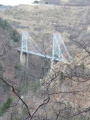
A climb on the Train Jaune from Fontpédrouse to La Cabanasse, followed by a beautiful, tree-lined descent along the River Têt.A lovely walk, partly through the forest; this is a different route from La Cabanasse to Planès suggested by PO Express, with the chance to find a few porcini mushrooms depending on the season, and to pass under the Gisclard Bridge, a true engineering marvel for its time.
From Planès to Coll del Torn
 11.53 mi
+2,608 ft
-1,467 ft
7h 35
Moderate
Departure from Pyrénées-Orientales
First stage of the Capcir route.
Village in the valley and at higher altitudes, high plateaus, a major centre for solar energy, finishing in a peaceful setting.
Superbolquère to Planès
 12.77 mi
+1,952 ft
-2,749 ft
7h 35
Difficult
Departure from Bolquère (Pyrénées-Orientales)
The final stage of the Capcir route.
This stage follows the Train Jaune route.
From Coll del Torn to Esposolla (Espousouille)
 13.99 mi
+1,706 ft
-2,848 ft
7h 55
Difficult
Departure from Matemale (Pyrénées-Orientales)
Second stage of the Capcir route.
A long day, with no real difficulties.
Views of the Matemale and Puyvalador lakes.
Crossing the Puyvalador dam.
Arrival at Espousouille, in the Galba Valley.
Crossing from Balcère to Les Angles
4.84 mi
+489 ft
-755 ft
2h 40
Easy
Departure from Les Angles (Pyrénées-Orientales) (Pyrénées-Orientales)
An easy, two-thirds shaded route suggested by a Year 3 class. Superb views to help children from the countryside discover the mountains: lake, forests.
Thués-Entre-Valls - Carança refuge
 5.40 mi
+3,832 ft
-653 ft
5h 50
Moderate
Departure from Thuès-Entre-Valls (Pyrénées-Orientales)
This is the first stage of the Thués - Fillols loop, which takes you up the Carença Gorge to the refuge of the same name.
Thués-Entre-Valls – Fillols Route
34.29 mi
+14,088 ft
-14,383 ft
5 days
Moderate
Departure from Thuès-Entre-Valls (Pyrénées-Orientales)
A 5-day route in the Catalan Pyrenees, offering the chance to explore the stunning Carença Gorges before finishing with an ascent of the Catalan giant: the Canigou.
Chemin Vauban From Formiguères to Rouze
13.74 mi
+1,286 ft
-3,018 ft
7h 25
Moderate
Departure from Formiguères (Pyrénées-Orientales)
This section of the Chemin Vauban links Formiguères to Rouze, crossing the Capcir and then the Donezan. The route, which is generally easy and pleasant, alternates between forest tracks, sections through the undergrowth, paths along ridges and more open stretches offering beautiful panoramic views. The route runs alongside the Galbe river, crosses the Col des Ares – which marks the border between the Pyrénées-Orientales and Ariège – and then continues through the Donezan region via Carcanières and Le Puch. It also takes you past the magnificent Château d’Usson before reaching the village of Rouze.