


Refine your search for walks in Chapelle de la Grande Fabrique (Renage)
Chapelle de la Grande Fabrique (Renage) walks


 Small bee and large bee at Renage
 Association / Club / Walk leader
 4.79 mi
 +702 ft
 -715 ft
 2h 50
2h 50
 Moderate
 Departure from Renage (Isère)
To the Trees, Citizens! A lovely walk through the woodland, heading towards the Criel plateau. Along the route, you’ll find all the common tree species and the Criel walnut groves. From the ridges, there’s a panoramic view of the peaks of the Vercors and the Chartreuse.On the way back, a permanent exhibition of photographs in the woodland illustrates the Chemin du Sophora. The return route then takes you through the Parc de l’Ancienne Soierie and its remarkable trees, then past the Lavoir des Amours, where weavers used to wash their linen and, perhaps, meet their soulmate.
The little bee around Renage
2.80 mi
+564 ft
-564 ft
1h 45
 Easy
Departure from Renage (Isère)
Easy
Departure from Renage (Isère)
To the trees of the town! A lovely walk through the woodland, towards the Criel plateau. Along the route, you’ll find all the common tree species and the Criel walnut groves. On the way back, a permanent exhibition of photographs in the woods illustrates the Chemin du Sophora. The return route then takes you through the Parc de l’Ancienne Soierie and its remarkable trees, then past the Lavoir des Amours, where weavers used to wash their linen and, perhaps, meet their soulmate.
Walks near Chapelle de la Grande Fabrique (Renage)
 The Molière Plateau
 Visorando Member
 8.44 mi
+1,604 ft
-1,621 ft
5 hrs
Moderate
Departure from Autrans (Isère)
8.44 mi
+1,604 ft
-1,621 ft
5 hrs
Moderate
Departure from Autrans (Isère)
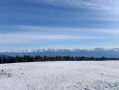
A winter snowshoe hike through magnificent landscapes, offering stunning views in unspoilt, peaceful natural surroundings.
Gillonnay - Pissieu
 15.64 mi
+784 ft
-1,017 ft
8 hrs
15.64 mi
+784 ft
-1,017 ft
8 hrs
 Very difficult
Departure from Gillonnay (Isère)
Very difficult
Departure from Gillonnay (Isère)
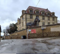
Eighth stage from east to west on the Way of St James. You are now on the Via Gebennensis – GR®65 or the ‘Route du Puy’ – which is undoubtedly the best-known route as it most closely follows the historical path to Santiago de Compostela.
For this8th stage, you will walk mainly through fields and forests, punctuated by a strong cultural identity at La Côte Saint-André and also in villages such as Ornacieux or Balbins, with the Saint-Michel Chapel offering a magnificent 360° panorama.
From Sassenage to Noyarey on the slopes of the Vercors
 3.77 mi
+1,125 ft
-1,119 ft
2h 45
Moderate
Departure from Sassenage (Isère)
3.77 mi
+1,125 ft
-1,119 ft
2h 45
Moderate
Departure from Sassenage (Isère)
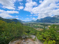
This exploratory hike along the paths on the northern flank of the Vercors should be treated as a training session if it is cold higher up. There are three viewpoints, two of which have been developed.
That said, the constant change in gradient along this route is sure to please any hiker or runner hoping to tackle the drovers' road leading to the Sornin plateau at a later date.
This walk is only enjoyable in dry weather, as the slopes become slippery after rain.
Crossing the Vercors from Engins to Saint-Gervais
21.71 mi
+5,394 ft
-7,323 ft
14h 40
 Extremely difficult
Departure from Engins (Isère)
Extremely difficult
Departure from Engins (Isère)
This traverse of the northern Vercors links Engins to Saint-Gervais from east to west, passing over three peaks and through particularly wild sections. The route offers a wonderful variety of landscapes, ranging from forests to mountain pastures and the ridges typical of the Vercors. The higher ground offers stunning views over the Isère valley, the Chartreuse and the surrounding Alpine massifs. The route alternates between open stretches and more wooded sections, some of which are very remote.
⚠️ This route is intended solely for experienced and well-trained walkers. A GPX track is essential. See practical information.