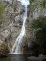
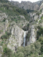
Piscia di l'Onda waterfall

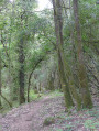
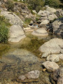
An easy walk to this beautiful waterfall with a shaded route. You can paddle at the foot of the waterfall

Details

n°26360691
Creation:
Last update:
–
Last review:
  • Walking
    Activity: Walking
  • ↔
    Distance: 3.17 mi
  • ◔
    Average duration: 2h 05 
  • ▲
    Difficulty: Moderate

  • ⚐
    Back to start: Yes
  • ↗
    Ascent: + 719 ft
  • ↘
    Descent: - 702 ft

  • ▲
    Highest point: 1,903 ft
  • ▼
    Lowest point: 1,614 ft
  • ⚐ Country: France
  • ⚐ City: Moca-Croce (20140)
  • ⚑
    Start/End: N 41.807033° / E 9.01544°
  • ❏
    IGN map(s): Ref. 4253OT
  • Hour-by-hour weather

Photos

Description of the walk

Access via the village of Moca, then climb towards Croce. Park in the small car park at the cemetery.

Yellow markings

(S/E) With your back to the cemetery, take the path opposite and walk along the hangars, then one or two ruined sheepfolds.

(1) Ford the Buiena stream over the rocks, then the Cervareccia and Pinzalone streams. Continue to a junction of three paths.

(2) Turn right and climb up to the old ruined castle (not visible). Continue straight ahead until you reach the Piscia de l'Onda waterfall.

(3) You can splash around at the foot of the waterfall. Take the same route back to the cemetery and the starting point (S/E).


Waypoints

  1. S/E : mi 0 - alt. 1,647 ft - Cemetery
  2. 1 : mi 0.64 - alt. 1,644 ft - Fording
  3. 2 : mi 1.21 - alt. 1,624 ft - Crossroads with three paths
  4. 3 : mi 1.6 - alt. 1,903 ft - Piscia di l'Onda waterfall
  5. S/E : mi 3.17 - alt. 1,644 ft - Cemetery

Notes

Bring a swimsuit for those who want to splash around or stand under the waterfall.

Variation at (2). Go down to the right. When you reach the mill (near the road), return to Moca and then go back up to the crossroads towards Croce.

Reviews and comments

4.6 / 5
Based on 31 reviews

Reliability of the description
4.7 / 5
Ease of following the route
4.6 / 5
Route interest
4.5 / 5
User 25619867

Overall rating : 3.7 / 5

Date of your route : Sep 05, 2026
Reliability of the description : ★★★☆☆ Average
Ease of following the route : ★★★☆☆ Average
Route interest : ★★★★★ Very good
Very busy route : No

An easy walk to start with. A few trickier sections towards the end (make sure you wear proper walking shoes – forget the flip-flops!). But once you reach the waterfall, you’ll forget all your efforts because the place is so beautiful.
The starting point is a bit tricky to find (the cemetery is below, so you can’t see it straight away. You’ll need to park in front of the bins, which are clearly visible from the road 👍)

Machine-translated

Gigi 2A
Gigi 2A

Hi, nothing too difficult, but just need to be a bit careful when getting past these rocks. Almost the whole walk is on flat ground, so this section is a bit different from the rest of the route. Good walking shoes (low-cut or high-top) are still recommended, though.
Enjoy the walk 🥾😉

Machine-translated

User 23574372

Hello, do you need to be technically proficient for the final stretch of the walk, or is it enough just to have good walking boots and take care? In other words, is the final stretch of the walk manageable for casual walkers?
Thank you

Machine-translated

Gigi 2A
Gigi 2A

A lovely walk, partly in the shade (which is a real bonus given the current heatwave). The end of the walk is a bit technical, with two rocky sections to negotiate before reaching the waterfall. What a treat to be able to have a dip under the waterfall before setting off back. Do bear in mind the water quality, though. This summer, many rivers have been contaminated by bacteria.

Machine-translated

auebersax
auebersax

Overall rating : 5 / 5

Date of your route : Aug 24, 2026
Reliability of the description : ★★★★★ Very good
Ease of following the route : ★★★★★ Very good
Route interest : ★★★★★ Very good
Very busy route : No

A superb, refreshing walk through the shade and along the feed channel. We carried on past the waterfalls, taking the wooden footbridge. At the top, we found some lovely natural pools. It’s easier to take a dip up there than at the waterfall.

Machine-translated

Gigi 2A
Gigi 2A
• Edited:

Overall rating : 5 / 5

Date of your route : Jul 15, 2026
Reliability of the description : ★★★★★ Very good
Ease of following the route : ★★★★★ Very good
Route interest : ★★★★★ Very good
Very busy route : No

A lovely walk, partly in the shade (which was very welcome given the recent heatwave). The end of the walk is a bit technical, with two rocky sections to negotiate before reaching the waterfall. What a treat to be able to have a dip at the foot of the waterfall before heading back.

Machine-translated

Frederico
Frederico

Overall rating : 5 / 5

Date of your route : Jun 04, 2026
Reliability of the description : ★★★★★ Very good
Ease of following the route : ★★★★★ Very good
Route interest : ★★★★★ Very good
Very busy route : No

A lovely walk with no particular difficulties, near the waterfalls; at the last information sign, be sure to keep to the right to reach the large waterfall; to the left, a very steep descent leads to the small waterfall; in both cases, the water is cool, but like all waterfalls

Machine-translated

Martine B4.
Martine B4.

Overall rating : 4.7 / 5

Date of your route : Sep 03, 2025
Reliability of the description : ★★★★★ Very good
Ease of following the route : ★★★★★ Very good
Route interest : ★★★★☆ Good
Very busy route : Yes

a lovely walk in the forest with the sound of rushing streams
No difficulty
beautiful cool waterfall at the end

Machine-translated

User 25942007
• Edited:

Overall rating : 4.3 / 5

Date of your route : Jul 30, 2025
Reliability of the description : ★★★★☆ Good
Ease of following the route : ★★★★☆ Good
Route interest : ★★★★★ Very good
Very busy route : Yes

Very beautiful hike: about 45 minutes there and 45 minutes back on a well-marked trail, mostly in the shade and through a forest. At the end, there is a beautiful waterfall with a pool. You can swim, but it was cold at around 17°C. There are rocks in the shade for picnics.

Machine-translated

User 27227198

Overall rating : 4.7 / 5

Date of your route : Aug 15, 2025
Reliability of the description : ★★★★★ Very good
Ease of following the route : ★★★★★ Very good
Route interest : ★★★★☆ Good
Very busy route : No

A pleasant trail through the woods, fairly easy, ending at a beautiful waterfall.
You can cool off in the pool under the waterfall, but be careful of slippery rocks!

Machine-translated

User 1002300

Overall rating : 4.7 / 5

Date of your route : Jul 25, 2025
Reliability of the description : ★★★★★ Very good
Ease of following the route : ★★★★★ Very good
Route interest : ★★★★☆ Good
Very busy route : No

A pleasant hike in the shade throughout, which meant we could do it in the afternoon. Be careful at the end to keep to the right to head towards the waterfall, otherwise you'll end up on a fairly steep descent into the earth towards the tiny waterfall. The water was cool but fine for swimming, although it was more like paddling as the water was only up to mid-thigh.

Machine-translated

User 12814779
• Edited:

Overall rating : 4.7 / 5

Date of your route : Jul 21, 2025
Reliability of the description : ★★★★★ Very good
Ease of following the route : ★★★★★ Very good
Route interest : ★★★★☆ Good
Very busy route : Yes

It took us six hours to complete the hike without encountering a single other hiker.
Stop for a drink at José's place at the Col de Saint Eustache, he's a real character.

Machine-translated

User 12810828

Overall rating : 4 / 5

Date of your route : Jun 16, 2025
Reliability of the description : ★★★★☆ Good
Ease of following the route : ★★★★☆ Good
Route interest : ★★★★☆ Good
Very busy route : No

The foot of the waterfall is easily accessible, unlike the Pisse du Coq, where access is very difficult. Swimming is possible, and the water is very cool. There are a few drops, but nothing too difficult. The waterfall is magnificent, and there was no one else there. Visited in June.

Machine-translated

User 26233298

Overall rating : 4.3 / 5

Date of your route : Jun 22, 2025
Reliability of the description : ★★★★☆ Good
Ease of following the route : ★★★★☆ Good
Route interest : ★★★★★ Very good
Very busy route : No

A fairly accessible hike, the outward journey feels more difficult than the return. The entire route is shaded, which is pleasant. The path is generally very easy to follow and there is a lovely spot for swimming at the end.

Machine-translated

User 25983233

Overall rating : 1 / 5

Date of your route : May 30, 2025
Reliability of the description : Not used / Not applicable
Ease of following the route : Not used / Not applicable
Route interest : ★☆☆☆☆ Very disappointing
Very busy route : No

The trail is not maintained and is covered with tall grass, brambles, and nettles. It is dangerous in its current state and impassable due to the risk of falling.

Machine-translated

Other walks in the area

For more walks, use our search engine .

The GPS track and description are the property of this route's author. Please do not copy them without permission.