Cap Gros

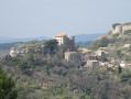
Starting from the charming village of Évenos, this challenging walk leads to Cap Gros, a magnificent viewpoint overlooking the Var coast near Toulon. The first part of the route joins the Vallon du Destel and follows it upstream along a very rugged path requiring care and caution. Next comes the steep climb to the Croupatier, a long wooded ridge leading to the Rouvière Plane, then on to Cap Gros. The return journey takes you via the Col du Corps de Garde and the valley of the same name to join the D62, which leads gently back to the starting point, reached via a short, easy climb. A varied experience, then, on a route requiring excellent physical fitness as well as a good sense of direction.

Details

n°48596407
Creation:
Last update:
Last review:
  • Walking
    Activity: Walking
  • ↔
    Distance: 8.74 mi
  • ◔
    Average duration: 5h 40 
  • ▲
    Difficulty: Very difficult

  • ⚐
    Back to start: Yes
  • ↗
    Ascent: + 1,923 ft
  • ↘
    Descent: - 1,923 ft

  • ▲
    Highest point: 1,886 ft
  • ▼
    Lowest point: 279 ft
  • ⚐ Country: France
  • ⚐ City: Évenos (83330)
  • ⚑
    Start/End: N 43.165507° / E 5.845163°
  • ❏
    IGN map(s): Ref. 3346OT
  • Hour-by-hour weather

Photos

Description of the walk

Évenos has two small car parks which fill up very quickly whatever the season. If there are no spaces available, you can park at the side of the road before reaching the village (depending on the route chosen): there are three or four spaces available without encroaching on the carriageway.

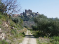
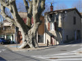
(S/E) Head towards the village, pass the small car park on the left and arrive at Place Marie Mauron, where there are further parking spaces. Take the small paved slanting street leading to a viewpoint with an orientation board, then walk past a restaurant. You’ll come to a junction where you should turn right onto Rue du Château, which winds its way past the foot of the impressive ruins.

Yellow markings

Walk past Saint-Martin’s Church and continue along the lovely tree-lined path leading to the viewpoint at the end of the medieval city walls.

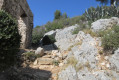
(1) At the foot of the walls, look out for the barely visible start of the path leading to the Vallon du Destel. The trail is sometimes difficult to follow on the stony ground, so keep a close eye on the markings. In the final third of the descent, the slope becomes particularly steep and the unstable ground requires caution to avoid falls. You’ll reach a fork in the path.

(2) Turn left, cross a final steep section before emerging at the bottom of the valley a few metres from the bed of the Destel, which is usually dry.

No signposting

Turn left to head back up the stream. The vegetation is quite dense at the start and negotiating the shrubs lying across the path proves rather difficult (as of April 2024). Afterwards, the walk is quite enjoyable but remains laborious. You’ll need to alternate between the left and right banks to best navigate certain ‘pools’ or ‘potholes’, some of which may still contain water at the end of winter and whose smooth stones offer little grip.

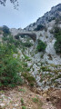
(3) Cross a series of sloping slabs. Three tricky sections are secured by chains, but the route remains challenging and requires care and balance. After crossing a final chained section, walk about thirty metres to reach the start of a path marked by a small signpost with a yellow background.

Old and faded Yellow Circle markings

(4) Turn right and begin an extremely steep and gruelling climb, taking care to follow the trail, which is sometimes faint, and where the virtually non-existent markings are of little help. Reach the Fontaine des Joncs, which is fenced off and therefore inaccessible. Continue along the path, which is now well marked and has levelled out. You’ll reach a junction that’s not very obvious on the ground.

(5) Turn right and you’ll soon reach a good cross-country path.

Yellow markings

Turn right and carry on until you reach a flat stretch.

(6) Turn left onto a stony path (Blue Cross) and continue uphill to reach an unnamed pass where, on the left, there is a small sign marking the boundary between the municipalities of Ollioules and Évenos and, on the right, a signpost.

GR® markings: white and red + blue

(7) Head straight ahead, veering slightly to the left. Climb the broad Croupatier ridge via a stony path, crossing a few sharp limestone pavements, passing a dilapidated concrete building covered in graffiti, then reach a junction with a signpost.

(8) Turn left, following the sign for “La Rouvière Plane – Le Revest-les-Eaux”. Stay on the wide, almost flat path until you reach a three-way junction.

(9) Keep to the right and continue until you reach a signpost indicating the start of a path on the left.

No signposting

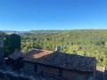
(10) Go straight on and continue along the wide path, winding round several bends before reaching Cap Gros. Take a moment to admire the exceptional 360° panorama: to the north, Sainte-Baume and, in the distance, the Chaîne de l’Étoile; to the south, Toulon harbour and the Saint-Mandrier peninsula; to the east, the Giens peninsula and the Corniche des Maures.

(11) Then head towards a small, dilapidated concrete structure and follow a very faint trail on the ground that is difficult to spot. Make sure you keep heading in the same direction, keeping the Cap Gros ascent track at a distance on your left, before rejoining it about a hundred metres before the signpost where the markings end. Turn right to rejoin it.

GR® markings: white and red + blue

(10) Follow the narrow path on the right; keep left at the junction a little further on, which is not shown on the map. You’ll reach an open area with, on the left, a yellow concrete post indicating an underground gas pipe. Head down to the right and, shortly afterwards, turn left following the double markings; simply follow these until you reach the D62 at the Col du Corps de Garde. As you approach the pass, the tracks become numerous, but the markings leave little room for doubt.

Blue markings

(12) Turn left and walk alongside the road for about thirty metres, then take a path on the left which initially runs parallel to the road but soon veers away from it. A few metres further on, leave this path for a less obvious track starting on the right and marked by clearly positioned blue signposts. This path follows the Vallon du Corps de Garde, running parallel to the departmental road and below it. As you approach Le Broussan, ignore the turn-off to the D62 on the right and continue along the path, which becomes tarmac and eventually joins the road.

(13) Turn left, keep left at the nearby road junction and walk through the village of Le Broussan. Cross the bridge over the dry riverbed of the Destel.

No signposting

Ignore the signposted path on the left (signpost) and stay on the road, keeping to the left-hand side. Take particular care as there is no accessible verge and traffic can be quite heavy depending on the season. Carry on, passing the beautiful Roux house, and continue along a long straight stretch until you reach the narrow, tarmac road on the left – a hairpin bend – which leads to the pumping station.

(14) Turn left and go round the pumping station on the left to find the grassy path – which is sometimes cluttered at the start – leading back to Place Marie Mauron in Évenos. Turn right, pass the small car park and go straight on to reach the car park (S/E).

Waypoints

  1. S/E : mi 0 - alt. 1,083 ft - Parking
  2. 1 : mi 0.29 - alt. 1,138 ft - Start of the signposted path
  3. 2 : mi 0.78 - alt. 436 ft - Junction, turn left. Near the - Reppe (fleuve)
  4. 3 : mi 1.4 - alt. 410 ft - Sloping slabs
  5. 4 : mi 1.64 - alt. 561 ft - Signpost, turn right
  6. 5 : mi 1.95 - alt. 958 ft - Junction, turn right
  7. 6 : mi 2.32 - alt. 1,220 ft - Path on the left, Blue Cross
  8. 7 : mi 2.46 - alt. 1,381 ft - Crossroads, GR junction®°°
  9. 8 : mi 3.24 - alt. 1,617 ft - Signpost, turn left
  10. 9 : mi 3.56 - alt. 1,621 ft - Three-way junction, on the right
  11. 10 : mi 3.9 - alt. 1,657 ft - Signpost: A/ straight on – R/ turn right
  12. 11 : mi 4.51 - alt. 1,886 ft - Cap Gros/Baou de Quatre Ouro
  13. 12 : mi 5.44 - alt. 1,286 ft - Col du Corps de Garde (391m)
  14. 13 : mi 6.2 - alt. 1,010 ft - D62
  15. 14 : mi 8.35 - alt. 1,004 ft - Pumping station junction
  16. S/E : mi 8.74 - alt. 1,079 ft - Parking

Notes

Warning

Do not undertake this walk after a spell of rain. The wet rocks in the Destel stream bed become extremely dangerous at such times, and the risk of falling is very high.

Hike difficulty rating

Despite its distance and moderate elevation gain, this hike deserves a ‘Very Difficult’ rating for the following reasons:

  • there are several extremely steep sections, both on the ascent and descent, with stony and very unstable ground. This is particularly the case between (1) and the Destel valley, as well as between (4) and (6) when ascending towards the Croupatier.
  • The ascent up the Destel is very ‘physically demanding’: the route follows the stream bed, crossing the slabs, ‘pools’ or ‘potholes’ that make up the stream. You must carefully judge your path as you frequently cross from one bank to the other. Three particularly tricky sections are secured by chains, but the rock is very smooth and offers little grip: great caution is required. Furthermore, depending on the season – and this was the case in April 2024 – some pools of water may still remain, making progress difficult.
  • The route is not always easy to follow. Between (1) and (2), the markings on the ground are a valuable aid, and it is important to use them to identify the continuation of the path. The markings between (4) and (5) are very patchy: the GPX track and the mobile app will be very useful, if not essential.

Hiking boots with good lugged soles are essential due to the rocky terrain.
Walking poles will be very useful on the descents, but you’ll need to stow them away in your rucksack to walk back up the Destel to (4).

(4) It is important not to miss the small signpost indicating the start of the path leading away from the Destel riverbed. Otherwise, you will soon reach Les Cuves, which are impassable and must be bypassed via a very rugged section equipped with chains, before reaching the yellow-marked path which you must take to the right to rejoin the route described before (6). This adds to the difficulty and distance, as the route then stretches to 17 km.

Alternatives

Those who dislike tarmac may find the return journey via the D62 monotonous and unappealing. However, this gently sloping and consistently shaded stretch can also be enjoyed as a chance to recover from the strenuous effort expended during the first part of the walk. In any case, caution is advised, particularly if travelling in a group.

You can avoid this return journey by road by using two vehicles: the first at the start in Évenos and the second at the Broussan car park. In this case, the walk will be shorter, at 10.7 km.

Another option is to head back via the Vallon du Destel by following the signposted path just after the bridge on the way out of Le Broussan. I personally advise against this as the stream bed is more difficult to descend than to climb, especially when you’re already tired.

Worth a visit

Always be cautious and plan ahead when you're outdoors. Visorando and the author of this route cannot be held responsible for any accidents occurring on this route.

The GR® and PR® markings are the intellectual property of the Fédération Française de Randonnée Pédestre.

Reviews and comments

5 / 5
Based on 1 review

Reliability of the description
5 / 5
Ease of following the route
5 / 5
Route interest
5 / 5
Jean-Claude Clémens
Jean-Claude Clémens

Overall rating : 5 / 5

Date of your route : May 24, 2024
Reliability of the description : ★★★★★ Very good
Ease of following the route : ★★★★★ Very good
Route interest : ★★★★★ Very good
Very busy route : No

There’s a stark contrast between a challenging climb between the start and point 6, followed by a leisurely stroll between point 6 and the finish. The Destel riverbed, with its water-filled potholes, is very pleasant, and the panoramic views in the second half of the route are superb.
The stretch on tarmac between Le Broussan and Evenos is admittedly a bit long.
Duration of the hike: 4 hours 40 minutes without any long breaks. Personally, I would have classified this route as merely ‘difficult’.

Machine-translated

Other walks in the area

For more walks, use our search engine .

The GPS track and description are the property of this route's author. Please do not copy them without permission.