


 Country:
 City:


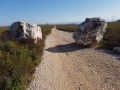
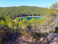
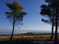
Park your car at the Saint-Julien Chapel car park (the chapel is on the left as you leave the village of Saint-Julien coming from Martigues; 200 m after the traffic lights, a sign points to the chapel).
(S/E) The walk begins by walking 50 m down the road from the car park, then turning left up the hill. At the junction with the Provençal reeds, carry on straight ahead, then go round the farm on the left to reach the woodland at the end of the field. At the edge of the woodland, take the path leading off to the right. Carry on straight ahead twice, then turn right once. A good path leads to the dirt track known as the “Chemin de L’Escalette”. After crossing the vineyard, head left until you reach the crossroads where, on the left, you’ll find the start of the Sentier de Fumadis.
(1) At the fork, begin the climb up to the plateau via the footpath. Then continue straight on until the end of the footpath to reach a wide track.
(2) Turn right (east) onto the wide track overlooking the Vallon de Valtrede. This follows the power line before veering southwards and leading to a telecoms mast. Go past the mast to reach a crossroads.
(3) Carry on to the right, crossing the Chemin de Valprete and heading south down towards the small path leading into the Vallon de Romaron. Continue through the valley, passing the first three junctions, until you reach the fourth.
(4) Ignore the path leading down to Carry and turn left to head back up the Romaron valley.
(5) At the three-way junction, go left; at the next junction, turn right, then join a wide track and walk a few metres to the right.
(6) At the junction of tracks, head left, ignore the track on the right and carry on to the next track with its viewpoint.
(7) Turn left towards the Plaine de Romaron. Continue along the track, then take the track on the right. Follow this track until the next junction at the bend in a wide track.
(8) Turn left onto this track, then turn right onto the first path leading uphill. Turn left immediately at the first junction, then keep going straight on until you reach the next track on this parallel path. Continue heading west on a path running parallel to the track leading to the Plaine de Romaron. You’ll reach a junction at the end of the path.
(9) Leave the plain to go round the quarry on the right and head northwards. Make the first turn right then left, then carry on straight ahead at the second to reach a third.
(10) Turn left to stay on the ridge above the Étang de Berre. Cross two tracks and reach a third junction.
(11) After crossing the Vallon du Sault (the track coming from Château Neuf), continue to the descent into the Vallon de Maximin, which you should leave on your right to continue along the ridge path. Carry on until you reach a very steep section towards the end (you’ll inevitably have to dismount in wet weather).
(12) Continue down the slope until you reach the junction with the Vallon de Maximin.
(13) Turn left and, 200 metres further on, take the start of the “Single des Gouguètes”.
(14) There are two steep sections in the first 500 metres of the Single des Gouguètes; after that, the path is superb right to the end of the descent.
(15) Depending on the season, the small path opposite, heading west, takes you round the main track. Join it further on and turn right towards Les Tourels.
(16) Leave the Chemin de Valtrede and turn left onto the Chemin de Beaumanière. After 500 metres on the road, under the power line, turn right onto the ‘Beaumanière single track’ (bear in mind that walkers may be coming the wrong way along this single track, where visibility is poor!).
Next, a good track runs alongside the village of Saint-Julien. Carry straight on at the first junction, then turn left at the second to reach a wider track. Follow it to the right until you reach a 90° bend. At this point, take a path on the left. Carry straight on, then make a left-right turn. Then head straight ahead again, then turn left towards the cemetery. Cross the road and head for Saint-Julien Church (S/E).

 Visorando Member
 Easy


 Difficult

