


Refine your search for walks in Cabrières (Hérault)
Cabrières (Hérault) walks


 Pioch Farrus mine, Church of Saint-Gély-d'Arques from Cabrières
 Visorando Member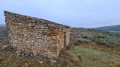
 9.51 mi
 +1,368 ft
 -1,381 ft
 5h 35
5h 35
 Moderate
 Departure from Cabrières (Hérault) (Hérault)
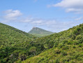
Hike with varied terrain and a beautiful view of the Pic de Vissou. The ruins of the Church of Saint-Gély d'Arques are a lovely spot for a picnic.Some sections are not marked and require the use of a GPS.
The Vissou ridges and the Estabel terrace
 7.04 mi
+1,529 ft
-1,519 ft
4h 35
Moderate
Departure from Cabrières (Hérault) (Hérault)
7.04 mi
+1,529 ft
-1,519 ft
4h 35
Moderate
Departure from Cabrières (Hérault) (Hérault)
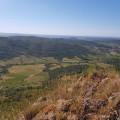
This trail winds through the heart of a listed site, rich in natural, geological and scenic discoveries. Leaving the village, the trail winds through the vineyards, climbs through the fragrant heath and reaches the impressive cliffs of the Pic de Vissou. This pleasant route offers many geological curiosities and, in particular, an amazing view of the Estabel terrace. In the background, the silhouette of Vissou serves as a landmark during this walk full of surprises.
This hike may be closed depending on the fire risk level. Be sure to check the map.
The Crozes drovers' roads
 9.55 mi
+1,909 ft
-1,880 ft
6h 05
Moderate
Departure from Cabrières (Hérault) (Hérault)
9.55 mi
+1,909 ft
-1,880 ft
6h 05
Moderate
Departure from Cabrières (Hérault) (Hérault)
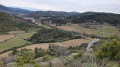
During this hike, you can discover the remains of the old village of Cabrières at the foot of the castle, the hamlet of Les Crozes, the Tiberet mills and the old paths, known as "drovers' roads" in Occitan.
Cabrières Castle and Les Pitrous
3.93 mi
+2,680 ft
-2,507 ft
4h 10
Moderate
Departure from Cabrières (Hérault) (Hérault)
A short but interesting walk to Cabrières Castle (3rd to 1st century BC), with fine views of the Pic de Vissou, the village, Mount Tibéret and the Pitrous valley. The route passes through the beautiful and renowned vineyards of the Cabrières Estabel AOC.
La Soureille d'Izarne
 8.06 mi
+1,348 ft
-1,319 ft
4h 55
Moderate
Departure from Cabrières (Hérault) (Hérault)
8.06 mi
+1,348 ft
-1,319 ft
4h 55
Moderate
Departure from Cabrières (Hérault) (Hérault)
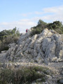
The path to the top of La Soureille d'Izarne is quite steep, but the effort is rewarded with a superb view of the Pyrenees on a clear day. Walking along the ridges requires a little care, but there are no vertiginous passages. The rest of the route is easy.
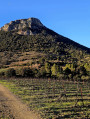
Cabrières Castle and Pic de Vissou
 9.18 mi
+2,300 ft
-2,277 ft
6h 15
Moderate
Departure from Cabrières (Hérault) (Hérault)
9.18 mi
+2,300 ft
-2,277 ft
6h 15
Moderate
Departure from Cabrières (Hérault) (Hérault)
During this hike in the heart of a listed site, rich in natural, geological and scenic discoveries, you can explore the ruins of the old village of Cabrières at the foot of the castle, then climb the ridges of Vissou before ascending the peak to discover a breathtaking viewpoint.This hike follows twoPR®® trails, the “Drovers' Roads of Crozes” and then the “Pic de Vissou”. Not difficult, but still a bit of a workout.
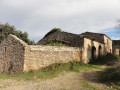
Les Crozes - Vailhan loop via the ruins of Tibéret
 7.83 mi
+1,280 ft
-1,263 ft
4h 45
Moderate
Departure from Cabrières (Hérault) (Hérault)
7.83 mi
+1,280 ft
-1,263 ft
4h 45
Moderate
Departure from Cabrières (Hérault) (Hérault)
A pleasant hike with remarkable views and beautiful 360° panoramas of Mont Saint-Clair and the Mediterranean, Caroux, Pic de Vissous and Mont Baudille Séranne. We were lucky enough to catch a glimpse of the Canigou massif.
On the Falgairas plateau
 7.63 mi
+817 ft
-833 ft
4h 15
Moderate
Departure from Neffiès (Hérault)
7.63 mi
+817 ft
-833 ft
4h 15
Moderate
Departure from Neffiès (Hérault)
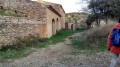
Hike in the hills between Neffies, Vailhan and Les Crozes (hamlet of Cabrières). Beautiful views at the start and end of the route over the plains of Languedoc Roussillon. We were lucky that day to have a wonderful view of the Mediterranean, Canigou and the Pyrenees.
The Map of Ceressou in Fontès
3.83 mi
+551 ft
-535 ft
2h 15
 Easy
Departure from Fontès (Hérault)
Easy
Departure from Fontès (Hérault)
A modified version of aPR® of the same name with an easier start for parking and a crossing of the River Boyne via the bridge on the D174. ThePR® ford before Ceressou is very often impassable. Otherwise, the rest of the route is identical.
Le Plan du Ceressou is an ancient volcano. Curiously, its name has changed in recent years from Ceressou to Celessou on IGN maps.
Vineyards and volcanoes of Fontès
 6.79 mi
+1,109 ft
-1,109 ft
4h 05
Moderate
Departure from Fontès (Hérault)
6.79 mi
+1,109 ft
-1,109 ft
4h 05
Moderate
Departure from Fontès (Hérault)
Part of the route takes you through vineyards and over the Céressou and Baumes volcanoes surrounding Fontès, offering views of the sea.
Extreme route of the Cirque de Mourèze – caves – monuments – Lake Salagou
13.04 mi
+3,825 ft
-3,802 ft
10 hrs
 Very difficult
Departure from Mourèze (Hérault)
Very difficult
Departure from Mourèze (Hérault)
An extreme challenge: this route takes you from the Cirque de Mourèze to the shores of Lake Salagou, followed by a climb up some of the most beautiful peaks and past several landmarks along the way. As many kilometres as there are places to visit!
Prehistoric site and UNESCO Global Geopark, Natura 2000
The Mourèze Circus
 4.24 mi
+1,145 ft
-1,145 ft
2h 55
Moderate
Departure from Mourèze (Hérault)
4.24 mi
+1,145 ft
-1,145 ft
2h 55
Moderate
Departure from Mourèze (Hérault)
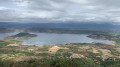
Discover the dolomitic cirque of Mourèze, shaped by erosion, with exceptional views of the Lac du Salagou and the Mediterranean coast.
This hike may be prohibited depending on the level of fire risk. Please consult the map.
Remains of Villeneuvette's past
 1.97 mi
+167 ft
-161 ft
1h 05
Easy
Departure from Villeneuvette (Hérault)
1.97 mi
+167 ft
-161 ft
1h 05
Easy
Departure from Villeneuvette (Hérault)
Walk around Villeneuvette and its hydraulic remains, which were used to supply the now disused royal factory.
Circular Crozes in Neffiès
9.08 mi
+1,247 ft
-1,266 ft
5h 15
Moderate
Departure from Neffiès (Hérault)
An easy hike combining open areas with views of the Pyrenees and wooded areas.
Along the route, you will see a coal mine shaft and the ruins of Tibéret, behind which is a multi-level mill powered by gravity from a water basin (now abandoned).
The Béals trail
 2.85 mi
+653 ft
-669 ft
1h 55
Moderate
Departure from Salasc (Hérault)
2.85 mi
+653 ft
-669 ft
1h 55
Moderate
Departure from Salasc (Hérault)
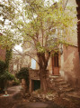
Set off to explore the village of Salasc, for a refreshing break, and its partly shaded hills, which offer views of the surrounding area and the Salagou valley. The Béals are irrigation channels that have long watered the gardens and are still used today in Salasc.
This hike may be closed depending on the fire risk level. Remember to check the map.
More walks in Cabrières (Hérault)
Select a point of interest below: