La Fagne des Deux Séries

A very beautiful walk through a nature reserve, suitable for all seasons.

Details

2719055
Creation:
Last update:
Last review:
  • Walking
    Activity: Walking
  • ↔
    Distance: 5.10 mi
  • ◔
    Average duration: 2h 40 
  • ▲
    Difficulty: Easy

  • ⚐
    Back to start: No
  • ↗
    Ascent: + 325 ft
  • ↘
    Descent: - 361 ft

  • ▲
    Highest point: 1,982 ft
  • ▼
    Lowest point: 1,696 ft
  • ⚐ Country: Belgium
  • ⚐ City: Baelen 
  • ⚑
    Start: N 50.544785° / E 6.058944°
  • ⚑
    End: N 50.548732° / E 6.056934°
  • Hour-by-hour weather

Photos

Description of the walk

The starting point is situated between Eupen and Baraque Michel, on the N68.
It is exactly at the Drossart roundabout, where there is a large car park. The starting point is indicated on the second information sign.

(S/E) At the Drossart roundabout, the walk begins by following the Yellow Rectangle signposts.

(1) At the junction, carry on along the road (2nd on the left), heading east-north-east. Continue straight on for about 1.8 km until you reach a crossroads.

(2) Turn right onto a slightly uphill stony track and follow it for 1 km.

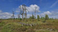
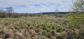
(3) At the next junction, turn right onto a long, straight stretch of road for 2 km. On the right, you’ll see a picnic area; take a moment to admire the moorland and a pond.

(4) When you reach an information sign, turn right. Head slightly downhill to reach the crossroads you passed on the way out.

(1) Then take thefirst left to return to the starting point (S/E).

Waypoints

  1. S : mi 0 - alt. 1,755 ft - Information sign
  2. 1 : mi 0.32 - alt. 1,811 ft - Crossroads on the circular loop
  3. 2 : mi 1.41 - alt. 1,791 ft - Stony path to the right
  4. 3 : mi 2.05 - alt. 1,982 ft - Crossroads
  5. 4 : mi 3.34 - alt. 1,962 ft - Information sign
  6. E : mi 5.1 - alt. 1,696 ft - information sign

Notes

Wear suitable walking shoes.

Worth a visit

The Fagne des Deux Séries is a collection of heathland and peat bogs on a plateau: Wikipedia link.

Reviews and comments

4.8 / 5
Based on 2 reviews

Reliability of the description
5 / 5
Ease of following the route
5 / 5
Route interest
4.5 / 5
Olivier TGV
Olivier TGV

Overall rating : 4.7 / 5

Date of your route : Oct 25, 2024
Reliability of the description : ★★★★★ Very good
Ease of following the route : ★★★★★ Very good
Route interest : ★★★★☆ Good
Very busy route : No

A lovely hike with no particular difficulties.
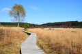
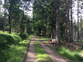
The trail starts in the woods, and halfway through, the landscape opens up onto the moor, completely changing the environment.
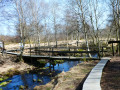
There is a picnic table and a raised viewing point on the edge of a small pond between points 3 and 4.

Machine-translated

Clément Triboulet
Clément Triboulet

Overall rating : 5 / 5

Date of your route : Jan 13, 2022
Reliability of the description : ★★★★★ Very good
Ease of following the route : ★★★★★ Very good
Route interest : ★★★★★ Very good
Very busy route : No

A must-do.
The local signage (yellow rectangles) is very well done, making it impossible to get lost.
PLEASE NOTE
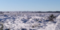
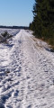
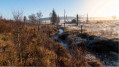
If you do this hike in winter, the sun is very low and completely hidden by the tall spruce trees for two-thirds of the route. It is therefore very cold. We chose a sunny day and only saw and felt the sun (vitamin D) on the upper third of the route (between points 3 and 4 on the map).
We walked on icy snow, which requires good balance and sure footing. Unfortunately, when you look where you're putting your feet, you can't enjoy the scenery!
That said, the open landscape (between points 3 and 4 on the map) overlooking the Duret is ABSOLUTELY SPLENDID, lunar, surreal and worth the trip and the cold alone.

Machine-translated

jiefdehuy
jiefdehuy
• Edited:

Only visible on map, not yet executed

Machine-translated

Other walks in the area

For more walks, use our search engine .

The GPS track and description are the property of this route's author. Please do not copy them without permission.