Buchhuebel and Pferchfeld

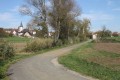
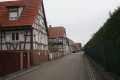
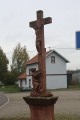
A pleasant walk through the hills above Morsbronn-les-Bains towards the Niederwald. Beautiful Alsatian landscapes. Memorials. Traditional Alsatian architecture.

Details

818415
Creation:
Last update:
Last review:
  • Walking
    Activity: Walking
  • ↔
    Distance: 3.25 mi
  • ◔
    Average duration: 1h 40 
  • ▲
    Difficulty: Easy

  • ⚐
    Back to start: Yes
  • ↗
    Ascent: + 177 ft
  • ↘
    Descent: - 171 ft

  • ▲
    Highest point: 758 ft
  • ▼
    Lowest point: 538 ft

Photos

Description of the walk

The starting point is the car park next to the spa and rehabilitation centre. Alternatively, there is another car park at the Maison des Associations, next to the roundabout where the D27 and D250 roads meet (the route passes this point shortly after setting off: in this case, adjust the route description to return to the starting point).

(S/E) Leave the car park heading towards the far end via the road leading to the staff accommodation. Turn right onto the path before the building bordering this road to enter the grounds of the spa centre.

Continue straight on until you reach the spa centre’s internal road and go round the spa building on the left. When you reach the rear of the building, take the path on the left which leads towards the small stream and follow it towards the D27 (Route de Haguenau).

Leave the spa centre’s grounds via an opening in the hedge with a few steps to reach the pavement running alongside the D27 road opposite the Hôtel Beau Séjour.
Cross the D27 with great care due to heavy traffic (there is a pedestrian crossing).

Turn left. Shortly afterwards, cross the D86 and take the cycle path leading to the Maison des Associations car park.

Go under the archway between the Maison des Associations and the Syndicat des Eaux de la Sauer to reach a wide cycle path running from Haguenau to Woerth. Here, there is a designated area with a drinking fountain provided free of charge by the Syndicat des Eaux and two picnic tables.

(1) Turn left onto the cycle path. Cross the Route de Gunstett with care (at the pedestrian crossing) and continue straight on along the cycle path alongside the Route de Haguenau.

After four to five hundred metres, the cycle path runs behind a small roadside car park where vehicles can stop to visit the monument dedicated to those who died in the 1870 war on the other side of the road.

Cross the D27 with great care after the car park and take the farm track heading north-west next to the monument.
Continue along the farm track (heading north-west), which almost immediately passes under a medium-voltage power line. Carry on straight ahead towards the woodland.

(2) Enter the woodland to the left of a hunting hide and continue along the track heading north-west.
The forest track soon runs along the edge of a field on your right, heading west.

At the end of the field, the forest track climbs slightly into the woodland and joins a lovely forest lane, which you follow to its end.

At the western edge of the woodland (at a corner of a field), climb over the electric fence that protects the crops from wild animals in the forest. Turn left onto a forest track.

(3) Almost immediately, turn right onto the farm track running alongside the woodland and continue straight on until it joins a wide farm track (a ‘T’ junction).

(4) Turn left onto the slightly uphill farm track. The track passes under a medium-voltage power line before descending gently to the D250 road.

Cross this road with great care due to the traffic. Opposite, take the Route de Froeshwiller downhill, which leads to Morsbronn-les-Bains. Continue straight on until you pass the first houses in the village.

(5) Turn left onto the footpath which runs alongside a housing estate of modern houses on your right.
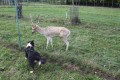
This footpath runs alongside a park with fallow deer on the left before leading to the car park near the spa centre, which marks the end of this walk (S/E).


Waypoints

  1. S/E : mi 0 - alt. 587 ft - Car park at the spa centre
  2. 1 : mi 0.51 - alt. 541 ft - Junction with cycle paths, on the left
  3. 2 : mi 1.16 - alt. 594 ft - Entrance to the Niederwald woodland
  4. 3 : mi 1.62 - alt. 745 ft - T-junction, turn right
  5. 4 : mi 1.9 - alt. 738 ft - T-junction: turn left
  6. 5 : mi 2.96 - alt. 594 ft - Junction of road and footpath, turn left
  7. S/E : mi 3.25 - alt. 587 ft - Car park at the spa centre

Notes

This walk across varied terrain requires suitable footwear.

Worth a visit

The Battle of 1870
6 August 1870: the Battle of Frœschwiller-Wœrth, with an episode in Morsbronn-les-Bains involving the French.

Morsbronn-les-Bains
All Saints’ Church: Morsbronn is one of around 50 towns in Alsace with a ‘simultaneous’ church.
Several monuments commemorating those who died in the Franco-Prussian War of 1870, including the impressive ‘Adler’ (‘Eagle’), not far from the Bouygues telephone relay station on the hills above the village.

In the spring of 1904, a borehole drilled by the Gewerkschaft Gute Hoffnung in search of oil discovered a hot spring at a depth of 450 metres, to the north-west, on the edge of the Route de Frœschwiller leading towards the village of Eberbach-Wœrth and the hamlet of Lausberg. Georges Urban, a restaurant owner from Morsbronn, bought the spring and, following analyses, this hot water source at 41.9°C was found to have beneficial properties for rheumatism as it is rich in sodium chloride and calcium.

Reviews and comments

4.1 / 5
Based on 3 reviews

Reliability of the description
4.3 / 5
Ease of following the route
4.5 / 5
Route interest
3.3 / 5
dsim14
dsim14

Overall rating : 4 / 5

Date of your route : Oct 05, 2020
Reliability of the description : ★★★★☆ Good
Ease of following the route : Not used / Not applicable
Route interest : ★★★★☆ Good
Very busy route : No

We had no trouble following the planned route up to the edge of the woodland, past the electric fence (point 3). We turned left, then right, along the edge of the woodland, as recommended, but after that the route description no longer matched up (points 3 and 4). We had to improvise. A few more details would no doubt be needed to confirm the route to take (tarmacked track, isolated houses, etc. – or not). We ended up on the D 250, but not opposite the Froeschwiller road.

Machine-translated

Gene.phi
Gene.phi

Overall rating : 4.7 / 5

Date of your route : Sep 21, 2020
Reliability of the description : ★★★★★ Very good
Ease of following the route : ★★★★★ Very good
Route interest : ★★★★☆ Good
Very busy route : No

:

Machine-translated

pgetrochon
pgetrochon

Thank you for your message.
At the start of the route, you’ll need to follow the road along the cycle path (which is well separated from the road by a small grassy verge) for about five hundred metres – depending on the traffic. However, there are no other options, given the private land that cannot be crossed.
At the point (4), I can confirm that you need to turn left and head slightly uphill along the edge of the woodland before continuing along a wide path between cultivated and grazed fields. Perhaps you carried on straight ahead at the point (3) along the path that leads just west of the hamlet of Lausberg? In that case, you do indeed need to turn right, but that does not correspond to the suggested route.
Enjoy your walks.

Machine-translated

KIENTZ
KIENTZ

Overall rating : 3.3 / 5

Date of your route : Sep 20, 2020
Reliability of the description : ★★★★☆ Good
Ease of following the route : ★★★★☆ Good
Route interest : ★★☆☆☆ Disappointing
Very busy route : No

The walk is quite noisy at the start because of the nearby road.
I think there’s a mistake at “4” – you shouldn’t turn left but head up to the right.
See you soon
Simone

Machine-translated

Other walks in the area

For more walks, use our search engine .

The GPS track and description are the property of this route's author. Please do not copy them without permission.