Country:

 City:


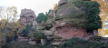
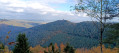
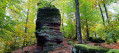
From Reinhardsmunster, drive up the Stambach forest road to Reinhardsmunster. Park in the car park at the Billebaum junction.
(S/E) Take the path marked with a Red Rectangle on the right, heading towards Schaefferplatz, until you reach the Lothringer Baechel junction.
(1) Turn left onto the path marked with a Red Rectangle crossed out in white, towards Rocher du Hibou. Take the path branching off to the right.
(2) Cross a path and reach the Hirschberg viewpoint, situated off the trail to the left.
(3) Retrace your steps and continue along the path. Admire the striking Rocher du Hibou. Turn right.
(4) Cross a track, head down a path on the left and continue to the Schaefferplatz picnic area.
(5) Continue along the road for about 100 m, then turn left onto the path marked with a Red Rectangle, heading towards the Grotte du Brotsch. Turn right shortly afterwards. Turn left at the hairpin bend and climb up to the Cuve de Pierre. Turn right at the Cuve de Pierre. Turn right onto the path and turn right shortly afterwards, then left. Walk past the Grotte du Brotsch and carry on. Climb the winding path up to the Rocher du Brotsch. Beautiful view.
(6) Take the Red Ring marked trail right at the far end, towards Krappenfels. A succession of viewpoints on rocky outcrops all the way to the Grand Krappenfels.
(7) Turn right onto the path and, immediately, left onto an unmarked path. Turn left, continue straight on and turn left onto the path marked with a Red Rectangle crossed by a white bar to reach the Rocher J.L. Huck with a view of the Geroldseck. Continue along the path towards Zimmereck.
(8) Turn right onto the path at the Petit Krappenfels rock and, shortly afterwards, take the hairpin bend to the left onto the path leading down towards Zimmereck.
(9) Turn slightly to the right and, immediately afterwards, turn left onto the path marked with a Blue Rectangle crossed by a White Rectangle. Stay on this path until you reach the Maisonnette de Pierres.
(10) Continue along the path marked with a Blue Rectangle crossed by a white line, following the Langenthalbach towards Schaefferplatz.
(11) Head down to the right onto the path marked with a Blue Rectangle towards Ochsenstein. Cross the footbridge and follow the path up to the left. Pass by the Jean-Louis Hemmerlin Fountain (named after a distinguished member of the Club Vosgien). Take the path on the left. Take a sharp right-hand bend and cross the Schlossberg Forest Track.
(12) Head up the path on the left. Take a sharp right-hand bend. Continue along the path to the right and, immediately, turn off onto the path on the left. Turn left beneath the rocky outcrop and climb up to the Wuestenberg (Wotan’s Mountain). See the Druids’ Stone.
(13) Continue along the GR®531 towards Krappenfels. Viewpoint overlooking the Rocher du Dabo in the distance. Descend the path to the right of a rock. Cross the Klappenfelsen Forest Track at the Col du Krappenfels.
(14) Continue along the Blue Rectangle trail towards Ochsenstein. Turn right at the fork. Cross the Schlossberg plateau to Ochenstein Castle. Walk around the Grand Ochsenstein.
(15) Head down the path to the left in front of the castle. Turn right after a rock. Turn left at the junction. Turn left onto the Loeffelthal Forest Road. Walk past the Haberacker Forest House and head to the Haberacker crossroads.
(16) Turn right onto the path that runs alongside the road and head to the car park at the Billebaum junction (S/E).
 Visorando Member


 Easy