


 Country:
 City:


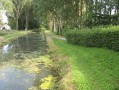

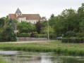

(S) Starting point: Val d’Auron lake.
Esplanade Mendès France. Point 0 marker on the ground (Pelles).
Set off along the ‘Rocade Verte’ on the Pont des Pelles. Follow the left bank, passing close to the old Mazières lock – a remnant of the canal – as far as the observatory for the Val d’Auron lower alkaline marsh biotope. Cross the footbridge over the Rampenne, then turn right at Le Porche, at the site of the Berry Canal (info 45). Cross the D106 and follow the route of the old Berry Canal, which has been filled in, as far as the Étourneau lock.
Km 6.0 Étourneau lock.
Turn right, pass the Étourneau, cross the D106 (elevation 141), then head up the Chemin des Cruzettes opposite. At the top, turn right for 50 metres, then left along the hedge; continue to the D31 at the Bois des Moines, where you turn left for 425 metres.
Take the first track on the right (Chemin de Bourges à Vorly) until you reach Chemin du Champ Perdu on the left (behind the sports ground), which continues as Rue du Champ Perdu, until you reach the D31.
Km 13.22: Junction of Rue du Champ Perdu and the D31. Plaimpied.
Turn right onto the D31 for 75m, then left onto the D46 for 125m. Pass in front of Saint-Martin Abbey Church (info 43), then head down Rue de la Garenne to the right until you reach the roundabout and the Berry Canal bridge.
Km 13.85 Plaimpied-Givaudins (Les Ponts) D46/Berry Canal (elevation 140).
(1) “Le Tour de Bourges” link.
Turn right and follow the left bank of the canal for 775 metres, then turn right over the small footbridge at the “Sente à Mimile”. Turn right onto the Chemin du Creusot; turn left into a cul-de-sac, then take Rue des Marais to the D106 roundabout. Turn left, then right onto the Beaulieu VC No. 5. Take the first path on the right, which runs behind the houses for 600 metres, then turn left onto the Chemin de la Vallée Caillon au Bourg (Les Bouloises). Turn right onto the Chemin des Chênes, which runs along the edge of the woods at La Grande Ruesse. At the end, turn right, cross the D46 (elevation 171), and continue along the Allée des Érables until you reach the D217.
Km 19.09 Junction of Allée des Érables and the D217.
Turn left, cross the bridge over the A71, pass the D34, and turn left onto Rue Louis Gallicher in Lissay-Lochy until you reach the silo. Follow the path to the right, cross the D2144, pass the cemetery and the water tower, and continue along Rue du Château d’Eau in Lochy.
Km 23.96 Lochy, junction of Rue du Château d’Eau and Chemin de la Rampenne.
(2) “Le Tour de Bourges” link.
Turn right onto Chemin de la Rampenne for 700m, then right again until you reach the tarmac road. Turn left, cross the Rampenne bridge, go round the Verrières estate on the left, follow the path ahead as it curves in a semicircle, pass under the EdF power line, then take the path on the right at Les Vallées for 1km (elevation 153). Turn left, pass under the EdF power line, cross the D31 at Les Noyers, until you reach the Route de la Grange Saint Jean.
Km 31.92 Route de la Grange Saint Jean.
Turn left onto this road and follow it for 825 metres. Take the first right into Allée Saint Jean, continuing to Chemin des Coudres at the hamlet of Carré d’As in Trouy Bourg. Follow Chemin des Coudres, turning left at Bois des Dames, then right onto the D73.
__(Between Trouy Bourg aux Coudres and the Porte de Trouy roundabout, all paths have
been destroyed or closed. The D73, which is very dangerous for non-motorised users, is the only
route. Please be very careful and ensure you are visible, avoiding backlighting)__.
The last track linking the airport to the A71 junction in the commercial area was destroyed in 2009. There is no longer any access, except by car.
Cross the bridge over the A71 and the Porte de Trouy roundabout.
Km 35.17: Porte de Trouy roundabout.
Continue along the D73, keeping to the right-hand verge, until you reach the tarmac track for Grand Buisson on the right. Turn left onto the Chemin de la Vallée des Noms towards Sainte Marie, then right onto the Chemin des Mondors. Go round Les Mondors on the left and follow the track running parallel to the D2144, through the former Talleries quarries, until you reach Rue Jean Gabin in Trouy Nord. Take the first right onto Rue Y. Montand; opposite, take the track after the zigzag barrier, which runs behind the houses and leads to Rue de la Saunière. Continue to the recycling centre on Rue de l’Espingole. (Trouy Nord).
Km 39.39 Recycling centre on Rue de l’Espingole (Trouy Nord).
Go down the steps and cross the D2144 opposite the gendarmerie (Bourges). Follow the Chemin du Grand Mazières down via the cycle path, continue along the green ring road on the left bank of the lake, keeping to the left, and cross the bridge over the dredgers.
Km 40.68 Finish: Val d’Auron lake, Esplanade Mendès France. Point 0 marker on the ground
(Pelles).

 Visorando Member

 Difficult

 Tourist office
 Easy

