


 Country:
 City:
City:




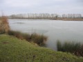
(S/E) Pelles du Plan d’Eau du Val d’Auron, Place Martin Luther King: ground marker at point 0. Cross the Pelles bridge and follow the green ring road to the right until it meets Rue Marcel Paul, near the flower-filled roundabout named after Jacques Duclos.
(1) Cross Rue Marcel Paul, follow the green ring road lined with tall plane trees, and pass on the right-hand side under the metal-plated bridge beneath Boulevard de l’Industrie.
(2) Pass the disused lock on Rue Edmond Jongleux and the stream known as ‘Le Goulu’. Continue along the cycle path on Quai Messire Jacques. Cross Place Agénor Bardoux and follow the Auron river until you reach the crossing on the right at the Louis XI lock (blue railing).
(3) Take the path on the left, between the Canal de Berry and Rue du Pré Doulet. At the traffic lights, cross Boulevard de l’Avenir and continue along the green ring road, which runs alongside the right bank of the Canal de Berry, until you reach the top of the hill.
(4) Turn right onto the green ring road, cross the bridges over the Yèvre and its tributaries, until you reach the very busy D60. Cross it to take the Allée de l’Ancienne Gare opposite, then turn left to reach pedestrian level crossing no. 169.
(5) Cross the tracks. Pass under the road bridge on the Route d’Orléans. Follow Rue du Moulon to the left. Pass Place Saint-Christophe with its church, which has been converted into a motorbike shop
(6) Cross Rue des Deux Ponts at the traffic lights and join Rue du Paradis.
(7) Turn right onto Rue André et Edouard Michelin, then left after 640 metres onto Rue André Charles Boulle. Continue to the traffic lights at Rue de Malitorne. Turn right (onto the pavement) for 340 metres, then left onto Route des Coulangis.
(8) Turn left onto Chemin de la Ruelle aux Anes, and continue to the Jacques Rimbault sports centre.
Turn right onto Chemin des Grosses Plantes, then left at the roundabout onto Route des Coulangis. Carry on straight along Route de Méry-es-Bois, then along Rue Gauchère until you reach the junction with Chemin des Champs Forts.
(9) Turn right onto Chemin des Champs Forts.
(10) Before the end of the track, turn left onto the path – initially a dirt track, then grassy – until you reach a metal-clad garden shed. After 75 metres, follow the path to the right until you reach the junction of trails 15 and 18 (info 1).
(11) Follow the signposting for trail 18 until it emerges onto Rue du Pasteur John Bost. Cross the road and take the signposted trail no. 10 opposite.
(12) Follow it to the right to join Trail No. 11, which you should follow to the left until it emerges onto Rue Raspail.
(13) Turn right onto Rue Raspail for 50 metres, then left onto Rue Ferrée. Take the path opposite the school for 50 metres to join Trail No. 3.
(14) Turn left onto Trail No. 3 until it comes out onto Rue Danton. Turn left, then immediately right to reach the Post Office, Trail No. 1 and the Cour des Chênes, which you should follow until you reach Rue du Grand Chemin.
(15) Turn right until you reach Rue François Coillard. Turn right at the ‘Stop’ sign by the temple and continue straight on along Rue du Puits Neuf, then take Rue Gaudine on the left.
(16) Turn right onto Cour des Varvarins, then straight on to Chemin des Lacs.
(17) Turn left onto this track, which is tarmac at first and then becomes a dirt track, for a distance of 750 metres.
(18) Turn left after the high-voltage power line onto the uphill track, then right after 250 metres. Continue straight on until you reach the fence of the Bois de Contremoret.
(19) Take the path leading down to the right, as far as the old Orléans railway line (rails removed).
(20) Turn left, follow the old Orléans railway line to the Chemin de Détry, then turn left onto it for 150 metres.
(21) Turn slightly right onto the grassy path leading uphill. Turn left at the next Fork in the road.
(22) Walk past one of the heritage sites, the ‘vine huts’ (info 2), and its information board. Continue to the signpost for Route de la Gorgeonne.
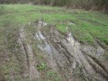
(23) Turn left, then carry on straight for 3,750 metres, crossing the Route de Fussy à La Greloue, to reach a rutted track, with all manner of fill and ruts – sometimes filled with water – running alongside the Contremoret woods. Cross the Route de Jou and continue along the Chemin de la Forêt until you reach Rue François Coillard.
(24) Turn left for 120 metres, then right onto Chemin de Chauchery, running alongside the sports ground. Then turn left onto Rue des Alouettes.
(25) Turn right onto the Chemin de l’Epinière and follow it to the D151 (Route des Racines).
(26) Turn left onto the D151 and continue for 140 metres, then turn left onto a path which becomes increasingly difficult (grass, ruts, water, branches, mud, ditches…), leading to the Route de Malitorne.
(27) Turn right and continue for 270 metres, staying on the wide pavement in the industrial estate, then turn right again at the traffic lights onto Rue des Pieds Blancs. Pass under the high-voltage power line.
(28) Follow Chemin de la Lune to the right until you reach the D151 at Les Racines.
(29) Cross the D151 at a place called Les Racines. Carry on straight ahead, then turn right onto Chemin des Rogerets. After 380 metres, turn left onto Chemin du ‘Briou aux Rogerets’, passing close to the Etang de l’Epinière, until you reach the D944 at the Auberge du Détour.
(30). Cross the D944 and cycle along the left-hand verge until you reach the roundabout. Continue left onto the pavement, passing the bowling alley on your right, and follow the grassy path alongside the Briou equestrian centre.
(31) Take the first path on the left (Chemin de la Perlotte), cross the D2076 and follow Rue de Chenevière. Cross Rue de Varye, then make the first turn right then left onto Chemin de Villeneuve.
(32) Continue along the grassy path furthest to the left, which runs behind the retail park, then along Chemin de Sinay, past the Sinay farm, and along Rue de Sinay.
(33) Turn left onto Rue des Bondoires and follow it for 210 metres. Take the second path on the right (Chemin du Clos des Reculets), which is tarmac at first and then becomes a dirt track. Pass between the boulders.
(34) At the traffic lights, turn right onto Rue des Coupances for 80 metres. Turn left and head down the track until you reach Rue Alfred de Vigny (tube chicanes).
(35) Turn right for 20m, then left onto the track at the end of the cul-de-sac to rejoin Rue A. de Vigny. Turn left onto this street for 60m. Turn right onto the first track before the roundabout.
(36) Go round the high-voltage pylon on the right, cross Rue des Prés Berthelot (a metal chicane that’s tricky to navigate), until you reach the high-voltage pylon on Rue des Vignes. Follow it to the right and cross Rue de la République.
(37) Pass the green space and its boules court. Continue to the right along Rue du Chemin Creux until you reach Avenue du Général de Gaulle. Turn right for 175 metres, then left onto Avenue Henri Debord to cross level crossing no. 168 (stay safe on the left-hand pavement). Take the D60 to the left, on the hard shoulder, until you reach the pedestrian crossing.
(38) Cross the D60 (Route de Berry-Bouy) and take the pavement on the right. After the tubular chicanes, follow the green bypass to the right, passing over the bridges spanning the branches of the Yèvre, the Yèvre itself and the Canal de Berry. Cross Rue de Vauvert, Rue Louis Mallet, Route de la Chapelle and Chemin de Villeneuve to reach the fountain at the Lautier roundabout.
(39) Cross Avenue Marcel Haegelen with great care. Turn right, still following the green ring road, onto Rue Nungesser et Coli; pass the Guynemer roundabout, Avenue Roland Garros, the traffic lights on Route de Châteauneuf and the traffic lights on Avenue de Saint-Amand, then turn left onto Rue Sainte-Ursule until you reach the transformer.
(40) Follow the sign for “Jardin Edouard André” to the left (info 3). The only exit is via the Sentier des Carrières. Pass the barrier on the right at Chemin des Carrières (a short, steep descent). At the traffic lights, turn left onto Rue de Mazières for 6 metres (info 4), then right onto Rue Marcel Paul, until you reach the green bypass before the J. Duclos roundabout. Turn right towards the excavators by the lake.
Finish: Point 0, Val d’Auron lake, Place Martin Luther King (S/E).


 Visorando Member

 Moderate
  Tourist office
 Easy
Easy 
