


 Country:
 City:


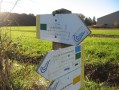


Starting point: Plan d’Eau du Val d’Auron
Esplanade Mendès France. Point 0 marker on the ground. (Pelles)
Start via the ‘Rocade Verte’, over the Pont des Pelles bridge to Rue Marcel Paul/Jacques Duclos roundabout.
(1) After following the Rampenne on the left, you’ll reach the junction of Rue M. Paul and the J. Duclos roundabout.
Cross Rue M. Paul, near the J. Duclos roundabout, follow the ‘Rocade Verte’, passing under the straight metal-clad bridge on Boulevard de l’Industrie.
(2) Cross Rue E. Jongleux and the Messire Jacques lock via the bridge over the Goulu. Follow Quai Messire Jacques. Cross Place Agénor Bardoux, following the Auron. Turn right then left onto the footbridge over the Louis XI lock. Junction with Rue Béranger. Take Rue du Pré Doulet opposite. At the traffic lights (2.680 km), cross Boulevard de l’Avenir, continue along the ring road that runs alongside the canal (Info 45), (Restaurants – CGR Cinema – ice rink…) and pass under the Green Ring Road bridge (3.340 km). Continue along the right bank of the Canal de Berry (Info 45), past Moulin Batard, under the D400 ring road bridge, and past the Pierrelay lock.
km 6.01 Pierrelay lock.
Turn left onto Rue de l’Écluse, take the D23 on the left for 150 metres, then turn right into Ruelle des Gats. Turn left at Les Morvées (after the Malus driving school), until you reach the four-way junction (8.220 km) (elevation 152). Carry on straight ahead, crossing the D107 and the railway lines via the gate at pedestrian crossing no. 167 at Les Grenades (9.420 km). Turn left onto Chemin des 4 Saisons, then onto Chemin de la Grenouille. Continue straight on (passing under the high-voltage power lines) until you reach the Veuilly Bridge over the A71 (La Chapelle-Saint-Ursin).
km 11.86 Veuilly Bridge over the A71 (La Chapelle-Saint-Ursin)
(3) “Le Tour de Bourges” link
Cross the bridge, then turn left onto the path which cuts through the woods, runs alongside the A71 motorway and the railway line, passes gas installation no. 42405, and joins the D16 near level crossing no. 169. Turn right onto the D16.
Between La Chapelle and Morthomiers, the road is unfortunately the only route.
Turn left onto the D135 at the crossroads (Route de la Chapelle, Chemin de Saint Jacques de Compostelle) towards Morthomiers, then take Rue du Bourg and continue along the Chemin de Saint Jacques de Compostelle (Info 35) from Le Bourg to Morthomiers, until you reach elevation 132, Bois de la Coudre/Bois Goujon (signposted).
km 18.03 Bois de la Coudre/Bois Goujon (Morthomiers) (signposted, elevation 132)
(4) “Le Tour de Bourges” link.
Turn left for 1.9 km, then right until you reach Chemin du Soubeau (900 m). Turn left, then right onto the Roman road in the Bois de Saint-Florent-sur-Cher. Turn right onto Allée de la Barrière Rouge for 530 m, then left until you reach Allée Pierre de la Roche (elevation 149).
km 23.75 Allée Pierre de la Roche (elevation 149), (Saint-Florent-sur-Cher)
(5) “Le Tour de Bourges” link.
Turn left and continue straight on until you reach Chemin de la Faisanderie; turn left onto the D35 (Rue Vaillant Couturier) for 60 metres. Turn right onto Rue Félix Piat, then continue straight on to enter the Town Hall grounds via the pedestrian crossing. Follow the path to the Town Hall (Info 39), Place de la République and Avenue Jean Jaurès (N151).
(6) Cross the River Cher via the bridge (25.660 km), then turn left onto the footbridge to reach the A. Soubiran Stadium. Follow the branch of the River Cher, pass under the submersible bridge, cross the D27 (Rue Roger Salengro) and take the Chemin Montant des Grands Buissons opposite. Turn left onto the viaduct (Info 41) of the former Bourges–Issoudun strategic railway line. Cross the viaduct, pass the water tower on Rue Joliot-Curie on the left, level crossing no. 173 (28.350 km) on Avenue Massicot (D28), which you should follow for 1.6 km (elevation 155). Turn left onto Rue de l’Espérance
km 31.57 Rue de l’Espérance/Allée Carolines (elevation 162). (Champfrost).
(7) “Le Tour de Bourges” link.
Turn left, pass Le Châtelier, then turn right after 1 km. After Le Grand Breuil, take the first right onto Chemin des Fouailles and continue to the church at Le Subdray. Turn left onto Rue de la Brosse, then right onto Rue du Belague; take the path on the right at the barrier and cross Allée des Charmes. A small path opposite, after the zigzag barrier, following the fences to the cycle path at the Subdray agricultural college.
km 37.63 Go round the college on the right, take the tarmac path, pass through the Bois de la
Couture to the tarmac path, a distance of 2.350 km. Turn left for 425 m, then right after the Couture farm. Follow the path which passes twice under the high-voltage power lines before joining the D107 at Pisse Vieille.
Between the D107 at Pisse Vieille and the Roman road at La Chapelle, there are no dedicated or safe crossing points. Stay on the pavements and verges, taking great care when crossing the entry and exit slip roads of the N151.
Turn left onto the D107, staying on the pavements or verges for safety; take the first roundabout on the right, pass under the N151; take the second roundabout on the right, then the third roundabout on the right; pass under the A71 motorway; go straight on at the fourth roundabout until you reach the Roman road (marker 155).
km 45.85 Turn right onto the Roman road until you reach the bridge over the D400 (45.110 km). Cross the bridge, and
carry on straight along the Chemin de Villeneuve until you reach the ‘Rocade Verte’ (follow this until the finish), the Lautier roundabout, Rue Nungesser et Coli, the Guynemer roundabout and Avenue Roland Garros. At the traffic lights at the D23/D2144 junction, turn left onto Rue Sainte-Ursule, then right onto Rue de Mazières, and left onto Chemin du Grand Mazières. Join the left bank of the lake on the left. Continue along the green bypass, crossing the bridge over the excavators.
km 51.06 Finish: Val d’Auron lake
Esplanade Mendès-France. Point 0 marker on the ground. (Pelles)

 Visorando Member
 Moderate

 Tourist office
 Easy

