


Circular route on the Via Brabantica


A walk of around 20 kilometres following a section of the GR®12 and joining the Via Brabantica for the return journey. The route takes you through the Bois de Mariemont, past the Seneffe marina and along the Brussels–Charleroi Canal.
Details
Creation:
Last update:
Last review:
–
–
-
 Activity: Walking
-
 Distance: 12.04 mi
-
 Average duration: 6h 00
-
 Difficulty: Moderate
-
-
 Back to start: Yes
-
 Ascent: + 525 ft
-
 Descent: - 535 ft
-
-
 Highest point: 594 ft
-
 Lowest point: 374 ft
-
 Country:
Belgium
-
 City:
Morlanwelz
-
 Start/End: N 50.46343° / E 4.233147°
-


 Hour-by-hour weather


Waypoints
- S/E : mi 0 - alt. 397 ft - Mariemont Wood
- 1 : mi 0.3 - alt. 377 ft - Junction with the GR12
- 2 : mi 1 - alt. 459 ft - Junction
- 3 : mi 1.83 - alt. 584 ft - Drève de Mariemont
- 4 : mi 3.39 - alt. 413 ft - Scailmont Wood
- 5 : mi 4.3 - alt. 413 ft - Longsart
- 6 : mi 5.27 - alt. 394 ft - Seneffe marina
- 7 : mi 6.66 - alt. 453 ft - Brussels–Charleroi Canal - Canal Charleroi-Bruxelle
- 8 : mi 6.87 - alt. 443 ft - Junction with the Via Brabantica - Canal Charleroi-Bruxelle
- 9 : mi 7.42 - alt. 453 ft - Godarville
- 10 : mi 8.61 - alt. 505 ft - Claire Fontaine
- 11 : mi 9.3 - alt. 548 ft - Chapelle-Lez-Herlaimont
- 12 : mi 9.77 - alt. 554 ft - N59
- S/E : mi 12.04 - alt. 397 ft - Mariemont Wood
Other walks in the area
Le Canal historique et l'héritage minier de Houdeng-Aimeries
 Visorando Member
 8.26 mi
+312 ft
-344 ft
4h 05
Moderate
 Departure from La Louvière (Hainaut)
The appeal of this walk lies in the way it combines the region’s mining history with the tranquil beauty of the historic Canal du Centre, a UNESCO World Heritage Site, featuring its boat lifts—now operational again—and other infrastructure dating back over 100 years, bearing witness to the ingenuity of their designers.
Three slag heaps near La Louvière
 7.61 mi
+692 ft
-801 ft
4h 05
Moderate
Departure from La Louvière (Hainaut)
During this walk, discover three slag heaps situated relatively close to one another: the AlbertI, Quesnoy and Saint-Emmanuel slag heaps. Slag heaps are man-made hills formed by the gradual accumulation of mining waste produced by mining operations. These hills stand as a testament to an iconic industrial activity that provided a livelihood for several generations of locals, and which has now ceased.
Leval-Trahegnies Circular Loop
 Tourist office
 3.57 mi
+167 ft
-167 ft
1h 45
 Easy
Departure from Binche (Hainaut)
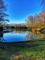
The route forms a circular route that takes you on a journey of discovery along the small paths of Leval-Trahegnies.
Houdeng-Goegnies lift circular
10.59 mi
+325 ft
-322 ft
5h 10
Moderate
Departure from La Louvière (Hainaut)
This route first follows the Canal du Centre Historique and its four hydraulic lifts, then returns via the new Canal du Centre and the impressive Strépy-Thieu boat lift. We will also cross the Sart canal bridge. On the old canal, we will also see the Houdeng swing bridge and the Bracquegnies drawbridge.
Hike without detailed description to be followed with the Visorando app.
From Binche to Vodgoriacum
 4.01 mi
+256 ft
-279 ft
2h 05
Easy
Departure from Binche (Hainaut)
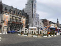
A walk starting from the centre of Binche to discover the town’s and the region’s medieval and ancient past.
From the old canals to the new canal between Seneffe and Godarville
 6.71 mi
+184 ft
-174 ft
3h 15
Moderate
Departure from Seneffe (Hainaut)
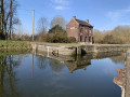
Here is a pleasant circular route mainly along the water’s edge with an unusual point of interest. To explore it properly, bring a torch. You’ll be able to see inside the Godarville boat tunnel, though without actually entering it. Those with a keen eye will spot here and there remnants of times gone by, such as landing stages, bollards or mooring posts, and a variety of birds, including cormorants.
Diabéto 2026 in Waudrez
2.15 mi
+46 ft
-46 ft
1h 00
Easy
Departure from Binche (Hainaut)
The walk starts and ends in Waudrez. It is an easy, rural route with historical information and anecdotes available throughout the walk. Although Waudrez may appear to be a village “without a history”, it has a rich past, and its proximity to Binche meant it was often occupied or even destroyed by enemy troops.
Diabéto 2026 via Bourleau
5.02 mi
+203 ft
-174 ft
2h 30
Easy
Departure from Binche (Hainaut)
An easy, scenic route with historical and anecdotal information available throughout the walk. Although Waudrez may appear to be a village with ‘no history’, it has a rich past, and its proximity to Binche meant it was often occupied or even destroyed by enemy troops.
For more walks, use our search engine .
The GPS track and description are the property of this route's author. Please do not copy them without permission.

