


Diabéto 2026 in Waudrez


The walk starts and ends in Waudrez. It is an easy, rural route with historical information and anecdotes available throughout the walk.
Although Waudrez may appear to be a village “without a history”, it has a rich past, and its proximity to Binche meant it was often occupied or even destroyed by enemy troops.
Details
Creation:
Last update:
Last review:
–
–
-
 Activity: Walking
-
 Distance: 2.15 mi
-
 Average duration: 1h 00
-
 Difficulty: Easy
-
-
 Back to start: Yes
-
 Ascent: + 46 ft
-
 Descent: - 46 ft
-
-
 Highest point: 299 ft
-
 Lowest point: 226 ft
 Country:
 City:


Waypoints
- S/E : mi 0 - alt. 272 ft - Place de l'Europe
- 1 : mi 0.2 - alt. 262 ft - Monument
- 2 : mi 0.61 - alt. 266 ft - Fork in the road
- 3 : mi 1.28 - alt. 289 ft - Crossroads
- 4 : mi 1.96 - alt. 289 ft - Chapel of Our Lady of Hal
- S/E : mi 2.15 - alt. 272 ft - Place de l'Europe
Other walks in the area
Diabéto 2026 via Bourleau
 Visorando Member5.02 mi
+203 ft
-174 ft
2h 30
Easy
 Departure from Binche (Hainaut)
An easy, scenic route with historical and anecdotal information available throughout the walk. Although Waudrez may appear to be a village with ‘no history’, it has a rich past, and its proximity to Binche meant it was often occupied or even destroyed by enemy troops.
Diabéto 2026 via the Lime Kiln
3.16 mi
+72 ft
-69 ft
1h 30
Easy
Departure from Binche (Hainaut)
The start and finish are in Waudrez. An easy, rural route with historical information and anecdotes available throughout the walk. Although Waudrez may appear to be a village ‘without a history’, it has a rich past, and its proximity to Binche meant it was often occupied or even destroyed by enemy troops.
From Binche to Vodgoriacum
 Tourist office
 4.01 mi
+256 ft
-279 ft
2h 05
Easy
Departure from Binche (Hainaut)
A walk starting from the centre of Binche to discover the town’s and the region’s medieval and ancient past.
Circular of Bonne Espérance Abbey
 5.66 mi
+230 ft
-217 ft
2h 50
 Moderate
Departure from Estinnes (Hainaut)
For this circular, park in the small car park in front of Bonne Espérance Abbey. On your return, you can enjoy a beer or a slice of sugar tart...
Walk between Buvrinnes and Mont-Sainte-Geneviève
 12.31 mi
+443 ft
-446 ft
6h 05
 Difficult
Departure from Binche (Hainaut)
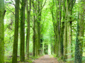
Set off to explore the countryside and woods around the Planty hill, on the border between Binche, Anderlues and Lobbes. The route runs alongside the Marais de Buvrinnes and passes successively through the Bois des Vieilles, the Bois du Baron (magnificent avenues lined with beech and Douglas fir trees) and the Bois d’Howis. A short round trip to the square on the other side of the church at Mont-Sainte-Geneviève allows you to discover a lovely century-old bandstand.
Leval-Trahegnies Circular Loop
 3.57 mi
+167 ft
-167 ft
1h 45
Easy
Departure from Binche (Hainaut)
The route forms a circular route that takes you on a journey of discovery along the small paths of Leval-Trahegnies.
Le Canal historique et l'héritage minier de Houdeng-Aimeries
 8.26 mi
+312 ft
-344 ft
4h 05
Moderate
Departure from La Louvière (Hainaut)
The appeal of this walk lies in the way it combines the region’s mining history with the tranquil beauty of the historic Canal du Centre, a UNESCO World Heritage Site, featuring its boat lifts—now operational again—and other infrastructure dating back over 100 years, bearing witness to the ingenuity of their designers.
Three slag heaps near La Louvière
 7.61 mi
+692 ft
-801 ft
4h 05
Moderate
Departure from La Louvière (Hainaut)
During this walk, discover three slag heaps situated relatively close to one another: the AlbertI, Quesnoy and Saint-Emmanuel slag heaps. Slag heaps are man-made hills formed by the gradual accumulation of mining waste produced by mining operations. These hills stand as a testament to an iconic industrial activity that provided a livelihood for several generations of locals, and which has now ceased.
For more walks, use our search engine .
The GPS track and description are the property of this route's author. Please do not copy them without permission.

