Circular loop in the Val d’Enfers

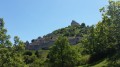
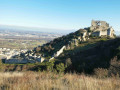
A challenging walk offering beautiful views of the Rhône and the Valence conurbation.

Details

48386374
Creation:
Last update:
Last review:
  • Walking
    Activity: Walking
  • ↔
    Distance: 4.49 mi
  • ◔
    Average duration: 2h 55 
  • ▲
    Difficulty: Moderate

  • ⚐
    Back to start: Yes
  • ↗
    Ascent: + 965 ft
  • ↘
    Descent: - 958 ft

  • ▲
    Highest point: 1,286 ft
  • ▼
    Lowest point: 354 ft
  • ⚐ Country: France
  • ⚐ City: Soyons (07130)
  • ⚑
    Start/End: N 44.918679° / E 4.861617°
  • ❏
    IGN map(s): Ref. 3036OT
  • Hour-by-hour weather

Description of the walk

Park in the car park at the Intermarché in Soyons.

(S/E) Head south to join the Chemin du Ruisseau, then turn right onto it to reach the junction with Rue Gustave Eiffel.

(1) Turn right onto this road and follow it to the Grand Page roundabout.

(2) Turn right onto the footpath and cycle path on Chemin des Mulets, which runs parallel to Boulevard Henri Jean Arnaud. Continue to the northern end of Guilherand-Granges Cemetery.

(3) Cross the boulevard with great care, then pass under the railway bridge to enter Guilherand Village via Rue de la Boissonnat. After the church, turn right onto Rue des Lavandières. At the next junction, turn left onto Chemin des Gardes. Pass under the reservoir; the path ends here.

(4) Continue along the path that follows on from it, skirting the western edge of the woodland. After a steep climb, you will almost reach a road at a place called Les Enfers.

(5) Without joining it, turn right and complete the climb to the junction with theGR®42.

(6) Turn left onto it, heading downhill, and rejoin the road you approached earlier, at the place known here as Val d’Enfers.

(7) Leave theGR® here. Cross the road and continue along a path opposite, which leads into the woods. Cross the small stream, which dries up in dry weather. Climb up and take the path on the right, which descends back towards the plain. Join the Chemin de la Côte (road).

(8) Turn left onto it and continue to the roundabout.

(9) Go through the roundabout and take the Impasse de l’Île, which passes under the railway line. At the next junction, turn left onto Rue Gustave Eiffel, where you’ll come back to the junction you passed on the way out.

(1) Turn right and follow the route back in the opposite direction to return to the car park (S/E).

Waypoints

  1. S/E : mi 0 - alt. 361 ft - Intermarché Soyons car park
  2. 1 : mi 0.21 - alt. 361 ft - Crossroads at the end of the circular loop
  3. 2 : mi 0.71 - alt. 364 ft - Gated track
  4. 3 : mi 1.2 - alt. 374 ft - Guilherand-Granges Cemetery
  5. 4 : mi 1.64 - alt. 505 ft - End point: Chemin des Gardes
  6. 5 : mi 2.53 - alt. 843 ft - Les Enfers
  7. 6 : mi 2.74 - alt. 1,280 ft - GR42
  8. 7 : mi 3.26 - alt. 902 ft - Val d’Enfers
  9. 8 : mi 3.87 - alt. 400 ft - Chemin de la Côte
  10. 9 : mi 4.02 - alt. 367 ft - Roundabout
  11. S/E : mi 4.49 - alt. 361 ft - Intermarché car park

Notes

Between (5) and (6), a good level of fitness is required as the climb is steep.
Furthermore, it is not advisable to undertake this route after heavy rain. The ground can be very slippery in places.

Worth a visit

Always be cautious and plan ahead when you're outdoors. Visorando and the author of this route cannot be held responsible for any accidents occurring on this route.

The GR® and PR® markings are the intellectual property of the Fédération Française de Randonnée Pédestre.

Reviews and comments

3.9 / 5
Based on 3 reviews

Reliability of the description
4.3 / 5
Ease of following the route
3.5 / 5
Route interest
4 / 5
User 18836343

Overall rating : 3.7 / 5

Date of your route : Jan 19, 2026
Reliability of the description : ★★★★☆ Good
Ease of following the route : ★★★☆☆ Average
Route interest : ★★★★☆ Good
Very busy route : No

No marking until point 6.

Machine-translated

User 18836343
• Edited:

Overall rating : 4 / 5

Date of your route : Dec 29, 2025
Reliability of the description : ★★★★☆ Good
Ease of following the route : Not used / Not applicable
Route interest : ★★★★☆ Good
Very busy route : No

A beautiful hike with views of the Rhône.
However, there are no markings untilNo. 6, where we finally find the GR 42.
No markings on the descent.
GPS strongly recommended.
Between points 5 and 6, there is a steep wall that is difficult to access. Very good physical condition is required for this tricky section.
Slippery terrain on the descent from No. 7 onwards.

Machine-translated

serge.entresangle
serge.entresangle

Overall rating : 4.3 / 5

Date of your route : Feb 18, 2025
Reliability of the description : ★★★★★ Very good
Ease of following the route : ★★★★☆ Good
Route interest : ★★★★☆ Good
Very busy route : No

A lovely route, though at times difficult to follow due to the side tracks created by mountain bikers on the towpath

Machine-translated

Other walks in the area

For more walks, use our search engine .

The GPS track and description are the property of this route's author. Please do not copy them without permission.