Grand tour of the Grande Chartreuse valley

A beautiful hike through forests and valleys, ideal for warm weather but also in mixed or stormy conditions, as there are several options to shorten the route in case of bad weather.
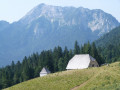
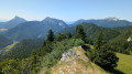
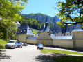
Haberts (shepherds’ and herdsmen’s huts), stunning scenery, a pass and several viewpoints overlooking the Grande Chartreuse Monastery.
There is a short stretch of tarmac at the end, which is unavoidable but very quiet with few cars.

Details

12921475
Creation:
Last update:
Last review:
  • Walking
    Activity: Walking
  • ↔
    Distance: 8.54 mi
  • ◔
    Average duration: 6h 35 
  • ▲
    Difficulty: Moderate

  • ⚐
    Back to start: Yes
  • ↗
    Ascent: + 3,045 ft
  • ↘
    Descent: - 3,038 ft

  • ▲
    Highest point: 4,649 ft
  • ▼
    Lowest point: 2,644 ft

Photos

Description of the walk

Park at the Pont des Allemands car park, located on the D103 towards the Grande Chartreuse, just before the start of the quiet zone of the Désert de la Grande Chartreuse.

(S/E)Cross the road and take the forest track visible opposite the car park (heading south-west), which is relatively steep at the start and then narrows into a path. After a circular bend to the right, at the Y-junction, a clear path branches off to the right, but this is not the right one! Take the slightly less visible path on the left, then, about 200 m further on, a path on the right.

(1) This path runs alongside an enclosure and leads to the peaceful Habert de Chartroussette.

(2) At Habert de Chartroussette, take a moment to watch the newts in the fountain, taking care not to disturb them (information board). Then cross the electric fence to the left of the fountain (there is a gap to step through). There isn’t really a marked path, but it’s hard to get lost. Walk up the grassy valley for its entire length, pass the few trees at the end of the valley to reach a mountain pasture crossed by a track. There is a gap in the fence provided for walkers.

Once on the track, cross it and pass through another fence (remember to close it properly!), then take the fairly steep path climbing up the valley to the right of the copse. Follow the right-hand side of the valley, which continues as a path through the forest.

(3) Follow this uphill path, which is eroded in places by rain (it seems to turn into a stream bed when it rains!). At the Y-junction, turn right, continuing uphill. You will soon reach the lower end of a new valley, which you will follow on the right until you reach the Habert de Billon.

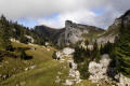
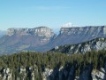
(4) At the Habert de Billon, head towards the Prairie de la Folie, which you will cross in its entirety; then, after a short stretch through the forest, you will reach the Prairie du Col de la Ruchère. Follow the path on the left towards the pass, with a magnificent view of the cliffs of the Grand Som.

(5) At the Col de la Ruchère, turn onto the path leading down (on the opposite slope to the one taken on the ascent). After about 300 m, take the path on the right and, 200 m further on, the one on the left which descends to the bottom of the valley.

As you descend, admire the magnificent view of La Chamechaude, before passing a few ruined buildings. Continue down the path to the Chapel of Saint Bruno, perched on its rock (closed).

(6) At the chapel, retrace your steps for a few dozen metres and pass in front of the Chapel of Notre-Dame de Casalibus (closed, but you can see inside through a small opening in the door). These two chapels are the remains of the original monastery, destroyed in 1132 by an avalanche.

(7) Then head down the path to a junction with a path branching off to the left, slightly further back.

(8) Take a sharp left onto this path which climbs to the left, slightly uphill, until you reach a sign just before Bourdoire, indicating the junction with theGR® Tour de Chartreuse.

(9) Follow this connecting path as it climbs up to theGR® Grand Tour de Chartreuse.

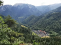
(10) Once at the junction, take theGR® Tour de Chartreuse on the right. Don’t miss the superb view of the Grande Chartreuse Monastery (on the right), which offers a view of the layout of the buildings, cloisters, gardens, orchards, etc. Continue along theGR®, cross two streams and don’t miss thesecond fork to the right.

(11) Take this path on the right and continue downhill.

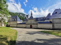
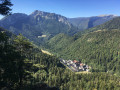
(12) The path becomes a track that skirts the Grande Chartreuse Monastery to the north. Enjoy the close-up view of the Grande Chartreuse Monastery, then continue along the track until you reach a small tarmac road, which you’ll take to the left.

(13) Walk past the monastery’s entrance gate, then continue along the tarmac road as it descends, following the walls surrounding the site.

(14) When you reach the entrance gate to the stables, turn onto the tarmac road leading down to the right and follow it for about 1 km (it is quiet as unauthorised vehicles are prohibited). You will arrive at the Pont des Allemands car park (S/E).

Waypoints

  1. S/E : mi 0 - alt. 2,644 ft - Car park at the - Pont des Allemands
  2. 1 : mi 0.75 - alt. 3,130 ft - Intersection
  3. 2 : mi 1.03 - alt. 3,310 ft - Habert de Chartroussette
  4. 3 : mi 1.69 - alt. 3,783 ft - Bottom of the Chartroussette valley
  5. 4 : mi 2.27 - alt. 4,196 ft - Habert de Billon
  6. 5 : mi 3.39 - alt. 4,649 ft - Col de la Ruchère
  7. 6 : mi 4.34 - alt. 3,862 ft - Chapelle Saint-Bruno (Saint-Pierre-de-Chartreuse)
  8. 7 : mi 4.43 - alt. 3,809 ft - Église Notre-Dame de Casalibus (Saint-Pierre-de-Chartreuse)
  9. 8 : mi 4.57 - alt. 3,740 ft - Hairpin bend
  10. 9 : mi 4.96 - alt. 4,137 ft - Junction with the GR Grand Tour de Chartreuse
  11. 10 : mi 5.47 - alt. 4,531 ft - Junction with the GR Grand Tour de Chartreuse
  12. 11 : mi 6.87 - alt. 3,573 ft - Intersection
  13. 12 : mi 7.25 - alt. 3,402 ft - Intersection
  14. 13 : mi 7.77 - alt. 3,156 ft - Entrance gate to the - Couvent de la Grande Chartreuse
  15. 14 : mi 7.97 - alt. 3,009 ft - Stables of the Grande Chartreuse
  16. S/E : mi 8.54 - alt. 2,644 ft - Car park at the - Pont des Allemands

Notes

A technically easy hike but quite long and with some elevation gain.
Hiking boots recommended.

The elevation gain and distance on Visorando are not accurate: our two other GPS devices were roughly in agreement and indicated approximately 18km and 950m of elevation gain.

We completed this circular route in 7½ hours, including a picnic, breaks and photos.

There are no drinking water points along the route, nor any shelters, as both huts are privately owned.

Please note: This walk is within the “silence zone of the Grande Chartreuse Desert”… Please ensure you do not make any noise near the Monastery, out of respect for the monks who live there in complete silence.
That said, even though the monks have taken a vow of silence, you are allowed to speak around the monastery, provided you remain discreet and speak in a low voice.
Take the opportunity to enjoy the calm, serenity and majesty of this place, and to listen to the sounds of nature!

Worth a visit

The Grande Chartreuse Monastery is closed to the public.
The Carthusian monks have taken a vow of silence and live in seclusion within the monastery, leaving only once a week for a walk in the mountains.

If you’d like to find out what a Chartreuse is and learn about the Carthusian monks’ way of life, you can visit the nearby Musée de la Correrie (you’ll drive past it on the way back, before joining the D520B).

Always be cautious and plan ahead when you're outdoors. Visorando and the author of this route cannot be held responsible for any accidents occurring on this route.

The GR® and PR® markings are the intellectual property of the Fédération Française de Randonnée Pédestre.

Reviews and comments

4.2 / 5
Based on 6 reviews

Reliability of the description
4 / 5
Ease of following the route
3.7 / 5
Route interest
4.8 / 5
User 3006295

Hello,
Can the route be downloaded without a Visorando subscription?
If so, can this route be used without the map backgrounds?
Thank you for your response.
Carinne L.

Machine-translated

Isa1
Isa1

Overall rating : 4.7 / 5

Date of your route : Aug 20, 2024
Reliability of the description : ★★★★★ Very good
Ease of following the route : ★★★★☆ Good
Route interest : ★★★★★ Very good
Very busy route : No

A lovely walk with open stretches offering beautiful views and shaded areas. Ideal for hot weather.

Machine-translated

lemarcheur65
lemarcheur65 ★

Hello Andy69
As I’ve said many times before: you don’t need an internet connection to use the app.
So don’t blame Visorando.
Before you set off, you need to:
- download the route for the hike
- download the map background(s)
- put your phone in flight mode (data off)
- check that everything is OK.
Quick setup using Wi-Fi or 4G before setting off
As a reminder, the GPS on your phone tracks your location without a network or data connection.
Please try again next time.

Machine-translated

Andy69
Andy69

Overall rating : 3 / 5

Date of your route : Jun 29, 2024
Reliability of the description : ★★☆☆☆ Disappointing
Ease of following the route : ★★☆☆☆ Disappointing
Route interest : ★★★★★ Very good
Very busy route : No

This hike cannot be undertaken without the app and a reliable mobile signal, as it takes place off the marked trails. Given the spring weather, the grass is very tall and we had to keep a constant eye on the app to make sure we didn’t stray from the route (which happened twice during the hike). After the Col de la Ruchère, at the entrance to the forest, we lost all signal and therefore the GPS and the app (a constant error message on the phone). We therefore walked by feel until we reached the St Bruno chapel, where we decided to finish the hike using the paths marked by the local authority. As a result, we didn’t complete the entire hike. Despite this, the scenery was magnificent, set amongst meadows and cows (watch out for the bull in the valley below the Habert de Billon!!). Although the hike is classified as ‘moderate’, it’s worth noting that the start is quite strenuous as it’s all uphill to Habert de Billon (good cardio workout) and, given the current wet weather, proper kit (suitable footwear and clothing) is essential.

Machine-translated

B-ron
B-ron

Overall rating : 4.7 / 5

Date of your route : Sep 11, 2023
Reliability of the description : ★★★★★ Very good
Ease of following the route : ★★★★☆ Good
Route interest : ★★★★★ Very good
Very busy route : Yes

A magnificent hike with a superb panoramic view of the monastery on the way back. The area gets very busy in summer.
I extended this hike by climbing to the summit of Petit Som (at the Col de Ruchère, point no. 5; simply follow the signs for ‘Petit Som’). Please note that the climb isn’t very long but is quite tough; the slope is quite steep towards the end. From the summit, the view is well worth the effort. Then head towards the Col de Léchaud and on to Habert du Bovinant (or Col de Bovinant). From there, I took the path that descends directly to point no. 10 (halfway down, turn left following a sign for La Correrie), but you can also continue straight on and you’ll reach point no. 9.

Machine-translated

Deuxpattes
Deuxpattes

Overall rating : 3.7 / 5

Date of your route : May 27, 2023
Reliability of the description : ★★★☆☆ Average
Ease of following the route : ★★★☆☆ Average
Route interest : ★★★★★ Very good
Very busy route : Yes

A very beautiful route, but a GPS is essential. (It must be said that the landmarks aren’t easy to pinpoint or describe).
Remember to look up regularly to admire the majesty of the Chartreuse mountains, which tower above you throughout.
Lots of mud today, especially in the last quarter. You don’t really feel the cumulative elevation gain.
Thanks for this post.

Machine-translated

Aurelie321
Aurelie321

Overall rating : 5 / 5

Date of your route : Nov 13, 2022
Reliability of the description : ★★★★★ Very good
Ease of following the route : ★★★★★ Very good
Route interest : ★★★★★ Very good
Very busy route : No

A lovely walk through the forest, with beautiful autumn colours at this time of year.
Magnificent views at the Col de la Ruchère and lovely views of the Grande Chartreuse Monastery on the way back.
The route was very easy to follow and we even had time to make a short detour between points 3 and 4 to the Belvédère d’Arpison, which was well worth a look.

Machine-translated

PARRASSIN
PARRASSIN

Overall rating : 4 / 5

Date of your route : Oct 05, 2021
Reliability of the description : ★★★★☆ Good
Ease of following the route : ★★★★☆ Good
Route interest : ★★★★☆ Good
Very busy route : No

A lovely walk – be sure to use the app

Machine-translated

Other walks in the area

For more walks, use our search engine .

The GPS track and description are the property of this route's author. Please do not copy them without permission.