Lachanau Northern Circular Route

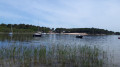
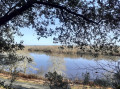
On the shores of Lake Hourtin, the hamlet of Lachanau, situated 2 km from the village of Hourtin, consists of small plots of land on which makeshift structures have been built. People from Bordeaux used to rent properties here to be close to the lake. Now, permanent buildings and beautiful wooden houses have been added on the shores of a lovely beach by France’s largest natural lake, set amidst the primeval forest.

Details

4730964
Creation:
Last update:
Last review:
  • Walking
    Activity: Walking
  • ↔
    Distance: 4.28 mi
  • ◔
    Average duration: 2h 00 
  • ▲
    Difficulty: Easy

  • ⚐
    Back to start: Yes
  • ↗
    Ascent: + 7 ft
  • ↘
    Descent: - 7 ft

  • ▲
    Highest point: 59 ft
  • ▼
    Lowest point: 49 ft

Photos

Description of the walk

To reach the starting point: walk to the end of Rue du Centre. Park in the car park at the picnic area near La Caravelle restaurant.

(S/E) Head back along Rue du Centre and turn right onto Rue de la Pigneraie, then right again onto Rue de l’Orée du Bois and continue until you reach Rue Julien Bataille.

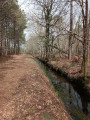
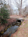
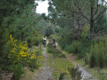
(1) Turn right onto this road for a few metres , taking great care to watch out for traffic. Cross the road and, after the last houses, turn left onto the diagonal path that runs alongside the small stream. Follow the stream until you reach a small bridge in the forest at the confluence of two streams.

(2) Cross the bridge to the left, then continue along the right bank of the stream until you reach the cycle path. Turn left and follow the cycle path for about a hundred metres until you reach the next path on the left.

(3) Take the path on the left and walk alongside the Craste Saint-Pierre de Fesset or Cabiron. Continue straight on until you reach Rue de Lachanau. Cross it carefully and continue along the path opposite to reach Rue des Colombes, which is a wide track. Turn left, walking along the verge for a few metres.

(4) Turn slightly left and carry on straight ahead along the path, which, in places, becomes a narrow track. When you reach the vicinity of Rue de Lachanau, turn right onto the path that runs along the edge of the woodland and, a few metres further on, you’ll come to the junction with the Craste Bonnette.

(5) Turn right and follow this craste to reach Rue des Colombes. There, turn left to easily reach the entrance to the hamlet of Lachanau.

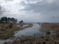
(6) Opposite, take the grassy path that runs between a fence and a stream to reach the next street. Take thesecond on the right, Rue de la Palombière, then turn right onto Rue du Fort and continue straight on. This road turns into a path that forms a large circular loop with a beautiful view of the lake.

(7) Continue to the left to reach Rue de la Plage. Take thefirst right onto Rue des Fauvettes and follow this road to reach the car park at the picnic area (S/E).

Waypoints

  1. S/E : mi 0 - alt. 56 ft - Car park at the picnic area
  2. 1 : mi 0.35 - alt. 49 ft - Stream junction
  3. 2 : mi 0.6 - alt. 56 ft - Small bridge
  4. 3 : mi 1.28 - alt. 56 ft - Craste Saint-Pierre crossroads
  5. 4 : mi 2.14 - alt. 52 ft - Crossroads on the Piste des Colombes
  6. 5 : mi 2.68 - alt. 56 ft - Craste Bonnette crossroads
  7. 6 : mi 3.5 - alt. 52 ft - Entrance to Lachanau
  8. 7 : mi 3.92 - alt. 49 ft - Beach
  9. S/E : mi 4.28 - alt. 56 ft - Car park at the picnic area

Notes

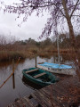
(S/E) Nearby, the La Caravelle restaurant, a large playground with picnic tables, a lakeside beach, and a jetty for small boats and fishing.

Worth a visit

(S/E) The hamlet of Lachanau, where small huts, cottages and houses are interspersed with the Crastes, the primeval forest, the lakeshore, the beach, the jetty and the marshes.

Reviews and comments

4.2 / 5
Based on 4 reviews

Reliability of the description
4 / 5
Ease of following the route
4.5 / 5
Route interest
4 / 5
EricQuinton
EricQuinton

Overall rating : 4.3 / 5

Date of your route : Jun 03, 2024
Reliability of the description : ★★★★☆ Good
Ease of following the route : ★★★★★ Very good
Route interest : ★★★★☆ Good
Very busy route : No

The final circular route runs alongside the lake. During periods of high water, the final section is flooded and inaccessible.
Make sure you wear trousers for the walk, as part of the route goes through gorse – and it’s prickly!

Machine-translated

christian.ken
christian.ken

Overall rating : 4.3 / 5

Date of your route : Aug 14, 2023
Reliability of the description : ★★★★☆ Good
Ease of following the route : ★★★★★ Very good
Route interest : ★★★★☆ Good
Very busy route : No

Easy and fun

Machine-translated

caline33
caline33

Overall rating : 4 / 5

Date of your route : Mar 29, 2023
Reliability of the description : ★★★★☆ Good
Ease of following the route : ★★★★☆ Good
Route interest : ★★★★☆ Good
Very busy route : No

A short, easy walk, with no difficulties at all, suitable for children, though a bit monotonous if you’re familiar with the area.

Machine-translated

randoparet
randoparet

Overall rating : 4 / 5

Date of your route : Nov 28, 2022
Reliability of the description : ★★★★☆ Good
Ease of following the route : ★★★★☆ Good
Route interest : ★★★★☆ Good
Very busy route : Yes

A lovely, easy route
I’d avoid going in the summer, I think, because of the crowds at the site and in the surrounding area!

Machine-translated

Other walks in the area

For more walks, use our search engine .

The GPS track and description are the property of this route's author. Please do not copy them without permission.