From Piqueyrot to Bombannes via the Gracieuse car park

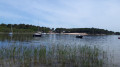
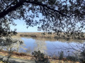
A walking route along the lake. Woodland, dunes and very varied landscapes, with the lake as the main feature… Very pleasant in all seasons. There are no particular difficulties, but don’t forget to protect yourself from the sun and flying insects (especially biting ones) depending on the season.

Please note: this round-trip walk requires two vehicles (there is no return journey available by public transport).

Details

n°75919040
Creation:
Last update:
Last review:
  • Walking
    Activity: Walking
  • ↔
    Distance: 7.67 mi
  • ◔
    Average duration: 3h 35 
  • ▲
    Difficulty: Moderate

  • ⚐
    Back to start: No
  • ↗
    Ascent: + 102 ft
  • ↘
    Descent: - 98 ft

  • ▲
    Highest point: 154 ft
  • ▼
    Lowest point: 49 ft
  • ⚐ Country: France
  • ⚐
    Area: Médoc
  • ⚐ City: Hourtin (33990)
  • ⚑
    Start: N 45.198897° / W 1.122211°
  • ⚑
    End: N 45.105438° / W 1.142087°
  • ❏
    IGN map(s): Ref. 1434OT
  • Hour-by-hour weather

Description of the walk

Set off from the car park in front of the restaurant “Le Piqueyrot”.

(S) From the car park, follow the cycle path to Anse de Gaouléou.

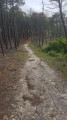
(1) Leave the cycle path, take the path on the left and follow it into the forest.

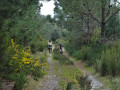
(2) Facing the lake, turn right. You can’t go wrong; the path is signposted with the Way of St James markings all the way to the finish. You’ll arrive at the “Piste des Allemands”.

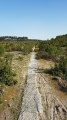
(3) Follow this very narrow concrete path to the left. Be careful, as there may be cyclists. You’ll arrive at the Gracieuse car park (E).

Waypoints

  1. S : mi 0 - alt. 52 ft - Car park in front of the restaurant “Le Piqueyrot”
  2. 1 : mi 0.31 - alt. 52 ft - Anse de Gaouléou
  3. 2 : mi 0.63 - alt. 49 ft - Facing the lake
  4. 3 : mi 5.87 - alt. 52 ft - The ‘des Allemands’ trail
  5. E : mi 7.67 - alt. 56 ft - La Gracieuse car park (Bombannes)

Notes

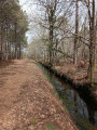
The path alternates between cycle path, sandy track and concrete path. There is no water along the route. Depending on the season, don’t forget your sun cream and mosquito repellent.

There is no public transport to Piqueyrot.

Reviews and comments

4.2 / 5
Based on 2 reviews

Reliability of the description
4.5 / 5
Ease of following the route
4 / 5
Route interest
4 / 5
User 771119

Overall rating : 4.7 / 5

Date of your route : Oct 02, 2025
Reliability of the description : ★★★★★ Very good
Ease of following the route : ★★★★☆ Good
Route interest : ★★★★★ Very good
Very busy route : No

Stop at the Gracieuse forest house and return to Piqueyrot. No easy transport between Bombannes and Piqueyrot. Hike between Bombannes and La Gracieuse already completed. A little less enjoyable: a large part of the route is on a German track (straight)

Machine-translated

Fred33121
Fred33121

Good evening
I’ve just done the walk again this morning with some colleagues. Walking along the lake in the shade is a real pleasure given the current (and upcoming) temperatures.
If you want to follow the lakeshore, you’ll have to wait until the end of summer when the water level has dropped.
Have a lovely evening

Machine-translated

joedelavenne
joedelavenne

Overall rating : 3.7 / 5

Date of your route : Jun 16, 2025
Reliability of the description : ★★★★☆ Good
Ease of following the route : ★★★★☆ Good
Route interest : ★★★☆☆ Average
Very busy route : No

It is a pity that you cannot follow the lake all the way to the edge and that most of the route is through trees. The hike therefore seems very long...

Machine-translated

Other walks in the area

For more walks, use our search engine .

The GPS track and description are the property of this route's author. Please do not copy them without permission.