Circular route starting from Naujac-sur-Mer beach at Le Pin Sec

Circular route through the Flamand pine forest to the Vendays blockhouse, returning via the beach along the coast.

Details

n°2868763
Creation:
Last update:
Last review:
  • Walking
    Activity: Walking
  • ↔
    Distance: 8.25 mi
  • ◔
    Average duration: 3h 50 
  • ▲
    Difficulty: Moderate

  • ⚐
    Back to start: Yes
  • ↗
    Ascent: + 43 ft
  • ↘
    Descent: - 43 ft

  • ▲
    Highest point: 66 ft
  • ▼
    Lowest point: 3 ft

Description of the walk

Park in the car park at Plage du Pin Sev in Naujac-sur-Mer.

(S/E) Head back towards the car park. Take the track on the left, after the campsite entrance, which runs alongside the campsite fence.

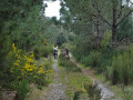
(1) Take the main path on the left, pass the aviators’ memorial and then join the path on the right which enters the Bois du Flamand. Follow this path due north and, after a right-angle bend, you’ll come to a four-way junction.

(2) Turn left, then keep left again at the next junction. Continue left, then right, until you reach the junction with the Barrière firebreak track.
Follow the path through the dunes to reach the beach; please respect the dunes by staying on the path. You will reach the blockhouse.

(3) Turn left towards the south and continue along the beach with the sea on your right. Continue along the beach until you reach the decorated blockhouses (painted) near Plage du Pin Sec.

(4) Carry on, heading up towards the beach access point, the lifeguard station and the restaurant ‘Le Pin Sec et à l’Eau’.
Take the Chemin des Pins de Galais to return to the car park where you started (S/E)

Waypoints

  1. S/E : mi 0 - alt. 46 ft - Pin Sec Beach car park, Naujac-sur-Mer
  2. 1 : mi 0.35 - alt. 46 ft - Campsite boundary
  3. 2 : mi 2.32 - alt. 46 ft - Four-way junction
  4. 3 : mi 4.45 - alt. 3 ft - Blockhouse on Vendays-Sud beach
  5. 4 : mi 7.83 - alt. 7 ft - Blockhouse at Le Pin Sec Beach
  6. S/E : mi 8.25 - alt. 46 ft - Pin Sec Beach car park, Naujac-sur-Mer

Notes

(S/E) Nearby are small shops and the restaurants Le Paradou, Le Pin Sec and À l’Eau, which are open only during the summer season.
Toilets and waste bins at the far end of the car park.
Campsite open during the summer season from early June to late September. Tel: 05.56.73.00.66
Cycle path starting from the campsite car park.

Worth a visit

Pin Sec beach, one of the most beautiful beaches in France.
There are surf spots and surf schools here.
The campsite
The cycle paths
These pine forests
The village of Naujac-sur-Mer
Saint-Isidore
To the north: Vendays-Montalivet, a village by the sea
To the south: Hourtin-Plage, a village by the sea
Lake Hourtin, the largest natural lake in France.
The naturist camps in Vendays.

Reviews and comments

4.2 / 5
Based on 2 reviews

Reliability of the description
4.5 / 5
Ease of following the route
3.5 / 5
Route interest
4.5 / 5
delangeb
delangeb

Overall rating : 4 / 5

Date of your route : May 05, 2025
Reliability of the description : ★★★★☆ Good
Ease of following the route : ★★★☆☆ Average
Route interest : ★★★★★ Very good
Very busy route : No

Set between the forest and the seaside, very pleasant

Machine-translated

Jurf
Jurf

For us, there was no GPS signal from about a hundred metres past the memorial stone right up to the beach.
I was simply giving a tip to future walkers on how to find their way without a GPS connection: “and after a right-angle bend, you’ll come to a four-way junction. (2) Turn left, then keep left at the next junction.”
Just before point 2, there’s a right-hand bend marked by wooden posts (beach access) to help you find your way.
And then it really is a straight sandy path between point 2 and the next fork. These are just pointers to help you find your way without GPS and without knowing the route. Otherwise, you shouldn’t turn right but carry on straight ahead past the wooden posts; however, the description isn’t clear without GPS and without knowing the area in this case.
In any case, thanks for this route – we weren’t familiar with the area.

Machine-translated

loran78
loran78

Hello, I mapped out this route and did it on Friday 2 February with some friends, without any problems. You must have got it wrong at the start – there was no soft sand or tree trunks. Did you pass the aviators’ memorial before heading down a lovely forest lane? Of course, for the return journey from the beach, you need to take the tides and tidal coefficients into account. There’s no mobile signal at the start – you pass under the mast – but the GPS works fine. I look forward to bumping into you on the trails.

Machine-translated

Jurf
Jurf

Overall rating : 4.3 / 5

Date of your route : Feb 03, 2024
Reliability of the description : ★★★★★ Very good
Ease of following the route : ★★★★☆ Good
Route interest : ★★★★☆ Good
Very busy route : No

There is no path, either on the way there through the pine trees or on the way back from the beach.
Look out for the bend before point 2. As you turn, there are wooden barrels on your left and in front of you.
Between point 2 and the next fork (to the left), the path is a ‘fresh’ sandy firebreak-style track.
A lovely circular loop.
Always remember to go via the beach at low tide, otherwise it’ll be trickier.
Outside the summer season, watch out for hunting at the start of the route (wild boar drives, lone hunters – we’ve seen it all).
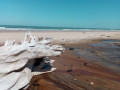
It’s not the most beautiful beach on the coast, but along the route you can see the rocky seabed beginning to emerge from the sand and (fresh?) water seeping out at the foot of the dunes, which creates sections of gravelly beach.
So make the most of it before the shoreline recedes even further!

Machine-translated

Other walks in the area

For more walks, use our search engine .

The GPS track and description are the property of this route's author. Please do not copy them without permission.