Country:

 City:
City:


Paid parking spaces (April–October) at the start. Free spaces further up, along the lake from the hamlet of Le Montaut. You can set off on foot from Le Montaut by walking along the lake; allow an extra 1 km each way.
(S/E) From the Allée du Mail car park, walk along the lake to the steps, to the right of the shop ‘Au bord de l’eau’.
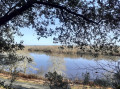
Continue along this path, the Voie de Soulac, which is one of the Médoc routes to Santiago de Compostela. This dune offers wonderful views from above over Lake Carcans-Hourtin. You’ll arrive at the Domaine de Bombannes.
(1) Continue along the tarmac road opposite, passing by the pelota court, and head towards the roundabout at the CVB junction.
(2) Option: You can take a detour to the right to visit the Pointe de Corben and return the same way.
Carry on straight ahead to the entrance to the ONF Discovery Trail, marked by a wooden gate on the right.
(3) Follow the path to the right as far as the lake, then take the boardwalk along the lake’s edge on the left.
Leave the Discovery Trail at the sign pointing to the viewpoint. Take in the view from the orientation table and the viewpoint a few metres further on.
(3) Head back down towards the beach where the jetty is located.
(5) Walk along the lake and join the road to walk alongside Pagode Beach as far as the Pagode Crossroads.
(6) Option: You can shorten the route by taking the road on the left, which bypasses Pointe de Bombannes.
Alternatively, take the road on your right towards the UCPA village.
(7) Enter the UCPA village and continue along the lake to Pointe de Bombannes, which offers a new view of the lake. If the weather is clear, a few buildings in Hourtin-Port can be seen in the distance. Continue along the lake, passing behind the accommodation.
(8) Walk alongside the rope barrier and join the tarmac path.
(9) (Do not cut through the woodland – it is not possible). Back at the UCPA village car park, turn right and follow the Way of St James.
(10) Carry on straight ahead until you reach the three-way junction.
(11) Turn right towards the Gracieuse car park and the cycle path (signposted).
(12) Follow the sign for Hourtin. Then leave the tarmac road and take the old cycle path on the left (there’s a map at the entrance). Follow it for several kilometres until you reach the Malignac crossroads.
(13) Continue along the path on the right.
(14) (Pass an area which could serve as a picnic spot by the lake on the way back). Continue to the junction with the firebreak.
(15) The Pointe de Malignac is not accessible in the same way as the previous headlands. There is a stretch of water on the right.
Option: There is another path 500 m further on which allows you to complete a circular route around Pointe de Malignac. This will add approximately 3 km.
Start the return journey from the junction with the firebreak. You can take the sandy path rather than the old cycle path for a change of terrain. The two run more or less parallel to each other.
(12) Back in Bombannes, you can make a detour via the Parking de la Gracieuse car park for another view of the lake.
(16) Continue towards the Carrefour de la Pagode.
(6) Cross right through Bombannes, following the road and passing the start of the Sentier Découverte again.
(3) Return via the same route you took on the way out.
(1) Take the path over the dune towards Maubuisson, enjoying the superb view of the lake, until you reach the Allée du Mail car park (S/E).
Alternative route. It is also possible to return to Maubuisson via the cycle path on the right for a change of scenery, but there are no particular views and cyclists also use this route. The path goes round the dune. The distance is the same.


 Visorando Member
 Moderate
 Difficult