Blanchemer Lake, Rainkopf, Steinwasen and Rothenbachkopf circular loop

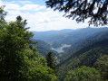
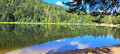
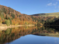
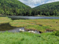
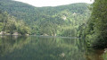
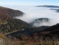
A circular route starting from Lac de Blanchemer, reaching the ridges featuring the peaks of Rainkopf, Rothenbachkopf and Batteriekopf, passing two farmhouse inns. The route follows mainly footpaths through forests and stubble fields, with several viewpoints. 

Details

71730203
Creation:
Last update:
Last review:
  • Walking
    Activity: Walking
  • ↔
    Distance: 7.62 mi
  • ◔
    Average duration: 5h 20 
  • ▲
    Difficulty: Moderate

  • ⚐
    Back to start: Yes
  • ↗
    Ascent: + 2,119 ft
  • ↘
    Descent: - 2,110 ft

  • ▲
    Highest point: 4,301 ft
  • ▼
    Lowest point: 3,232 ft

Description of the walk

Park in the Lac de Blanchemer car park (986 m), above the village of La Bresse. 

(S/E) Walk along the north side of the lake for 200 m, then turn left onto the path marked ‘Yellow Ring’. You’ll soon reach the road; follow it in the same direction for approximately

(1) Turn right at the hairpin bend to continue on the ‘Yellow Ring’ route. Keep left at the three-way junction; further on, pass the ‘Blue Triangle’ path on your right – you’ll take this on the way back – and carry on to the Route des Crêtes.

(2) Cross carefully and continue straight ahead to reach the star-shaped junction at Collet du Rainkopf (1,192 m) near the Auberge de la Chaume du Firstmiss. Take the second path on the right and climb through the woodland, following the Blue Rectangle markings, to reach the summit of Rainkopf (1,305 m) and its viewpoint.

(3) Descend the Rainkopf via the path marked with a Blue Cross and reach another star-shaped junction (1,203 m).

(4) Go straight on along the path marked with a Red Disc, then veer left, following the markings, to reach the Rothenbachkopf (1,316 m).

(5) Continue following the Red Disc markings to the Steinwasen farmhouse inn (1,131 m).

(6) Turn right onto the Yellow Triangle trail and join the road. Continue to the right, climbing gently towards the ridges, until you reach a car park.

(7) Turn right to follow the ridge along the GR® for about 400 m. When the path veers off to the left, carry on straight ahead, staying on the ridge, to reach the Batteriekopf (1311 m).

(8) Continue along the ridge, passing close to the Rothenbachkopf, and head to the small pass you passed on the way out.

(4) Turn left onto the GR® to reach the Collet du Rainkopf, then turn left to rejoin the Route des Crêtes. 

(2) Cross back over carefully, then turn left into the forest onto the Blue Triangle-marked path, which you spotted on the way out. Come out onto the Chemin du Grand Bougre and follow it to the left for about 500 m. 

(10) Turn right, following the Blue Triangle markings, and join the Lac de Blanchemer nature trail.

(10) Walk round the lake on the left to return to the car park where you started (S/E).

Waypoints

  1. S/E : mi 0 - alt. 3,232 ft - Lac de Blanchemer car park
  2. 1 : mi 0.68 - alt. 3,583 ft - Junction, on the right
  3. 2 : mi 1.34 - alt. 3,898 ft - Route des Crêtes
  4. 3 : mi 1.77 - alt. 4,278 ft - Rainkopf
  5. 4 : mi 2.12 - alt. 3,950 ft - Pass between Rainkopf and Rothenbachkopf
  6. 5 : mi 2.47 - alt. 4,298 ft - Rothenbachkopf
  7. 6 : mi 3.03 - alt. 3,740 ft - Ferme-Auberge du Steinwasen
  8. 7 : mi 3.79 - alt. 4,009 ft - Neurod Ridge, car park
  9. 8 : mi 4.49 - alt. 4,301 ft - Batteriekopf
  10. 9 : mi 6.82 - alt. 3,507 ft - Junction, turn right
  11. 10 : mi 7.2 - alt. 3,271 ft - Nature trail - Lac de Blanchemer
  12. S/E : mi 7.62 - alt. 3,235 ft - Lac de Blanchemer car park

Notes

There are two farm inns along the route: Auberge de la Chaume du Firstmiss and Auberge du Steinwasen.

Hiking boots recommended.

Always be cautious and plan ahead when you're outdoors. Visorando and the author of this route cannot be held responsible for any accidents occurring on this route.

The GR® and PR® markings are the intellectual property of the Fédération Française de Randonnée Pédestre.

Reviews and comments

4.3 / 5
Based on 3 reviews

Reliability of the description
4.3 / 5
Ease of following the route
4.3 / 5
Route interest
4.3 / 5
Sardine*
Sardine*

Overall rating : 5 / 5

Date of your route : Jul 27, 2026
Reliability of the description : ★★★★★ Very good
Ease of following the route : ★★★★★ Very good
Route interest : ★★★★★ Very good
Very busy route : Yes

A lovely, shaded walk

Machine-translated

User 25242704

Overall rating : 4 / 5

Date of your route : Sep 15, 2025
Reliability of the description : ★★★★☆ Good
Ease of following the route : ★★★★☆ Good
Route interest : ★★★★☆ Good
Very busy route : Yes

it's just that the route has been changed for forestry work, so it's difficult to find your way around

Machine-translated

User 21800623

Overall rating : 4 / 5

Date of your route : Aug 15, 2025
Reliability of the description : ★★★★☆ Good
Ease of following the route : ★★★★☆ Good
Route interest : ★★★★☆ Good
Very busy route : Yes

A very beautiful hike, but not to be done in hot weather as there is no shade on part of the route.

Machine-translated

Other walks in the area

For more walks, use our search engine .

The GPS track and description are the property of this route's author. Please do not copy them without permission.