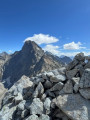
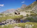
The Frozen Waterfall Circular Trail in Saint-Maurice-en-Valgaudemard

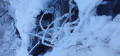
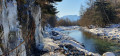
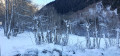
A short walk at the bottom of the Valgaudemard valley, which is narrow, steep-sided and largely in the shade for three months of the winter. A real treat for anyone who loves snow-covered landscapes and frozen waterfalls – with no significant elevation gain! Starting near Saint-Maurice, this circular route takes you through the snow and amongst frost-covered trees; it’s not Lapland, but there’s a certain family resemblance.

Details

n°67981595
Creation:
Last update:
Last review:
  • Walking
    Activity: Walking
  • ↔
    Distance: 3.95 mi
  • ◔
    Average duration: 2h 00 
  • ▲
    Difficulty: Easy

  • ⚐
    Back to start: Yes
  • ↗
    Ascent: + 256 ft
  • ↘
    Descent: - 276 ft

  • ▲
    Highest point: 3,333 ft
  • ▼
    Lowest point: 3,104 ft

Photos

Description of the walk

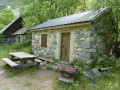
Car park at a place called Le Roux.

(S/E) Cross the departmental road with care and take Rue de l’École opposite. Then head right between the houses and follow the path heading north-east. Cross the bridge over the Torrent de Colombeugne to quickly reach a crossroads.

(1) Turn left, then right about fifty metres further on, and walk past a farm.

(2) At the fork in the road, take the path on the right. Further on, leave the houses of La Loubière on your right and carry on straight ahead to join the RD985a.

(3) Cross the departmental road with care, walk a few dozen metres to the left, then turn right to cross the bridge over the Séveraisse. At the end, turn right, heading south-west, to begin the return leg of the circular route. Head towards the frozen waterfalls: watch out for slippery patches.

(4) Continue along the path to Les Garrets, where you’ll rejoin the tarmac road.

(5) Follow the road, passing the chapel on your right, and carry on to the junction.

(6) Take the small road on the right, cross the Séveraisse again at the Pont du Roux and rejoin the departmental road.

(7) Turn right and follow the road carefully back to the car park where you started (S/E).
Waypoints

  1. S/E : mi 0 - alt. 3,153 ft - Car park at Le Roux
  2. 1 : mi 0.66 - alt. 3,278 ft - Junction, on the left
  3. 2 : mi 1.08 - alt. 3,317 ft - Fork in the road, turn right
  4. 3 : mi 1.5 - alt. 3,287 ft - Junction with the departmental road. Towards the Pont de la - Séveraissette (rivière)
  5. 4 : mi 2.36 - alt. 3,205 ft - Frozen waterfalls
  6. 5 : mi 2.94 - alt. 3,199 ft - Route des Garrets
  7. 6 : mi 3.27 - alt. 3,159 ft - Road junction, on the right
  8. 7 : mi 3.55 - alt. 3,120 ft - Back on the departmental road, turn right
  9. S/E : mi 3.95 - alt. 3,153 ft - Car park at Le Roux

Notes

If you’re doing this walk this summer before I do, please leave a comment to let me know if it’s just as beautiful and if it’s safe to walk near the stream.

Reviews and comments

5 / 5
Based on 1 review

Reliability of the description
5 / 5
Ease of following the route
5 / 5
Route interest
5 / 5
mbabi
mbabi

Good news!
Thanks for letting me know.

Machine-translated

Mathilde1789
Mathilde1789

Overall rating : 5 / 5

Date of your route : Mar 25, 2025
Reliability of the description : ★★★★★ Very good
Ease of following the route : ★★★★★ Very good
Route interest : ★★★★★ Very good
Very busy route : No

I went in mid-March – unfortunately, it was already too hot to see the waterfalls – but whatever the case, this route is really brilliant and absolutely stunning. I highly recommend this short walk.

Machine-translated

Other walks in the area

For more walks, use our search engine .

The GPS track and description are the property of this route's author. Please do not copy them without permission.