


eltofes

 Visorando Member
 Premium user
 - Location: Batz-sur-Mer (44740)
- Gender: man
Sign up:
Published route(s)
 Walk in the bocage countryside in Pornichet
 7.12 mi
 +190 ft
 -180 ft
 3h 25
3h 25
 Moderate
 Departure from Pornichet (Loire-Atlantique)
This route allows you to explore the lesser-known areas behind Pornichet than the coastal path.
Between land and sea at Pont Mahé
7.00 mi
+66 ft
-72 ft
3h 15
Moderate
Departure from Assérac (Loire-Atlantique)
This route forms a circular loop between Pont Mahé Bay and Pen Bé Bay.
Circular route between the Arzal Dam and Ferel
8.17 mi
+197 ft
-197 ft
3h 55
 Easy
Departure from Camoël (Morbihan)
Easy
Departure from Camoël (Morbihan)
This circular walk allows you to enjoy the scenery along the River Vilaine, the woodland on the way to Ferel, and finally a return journey through the countryside around Camoël.
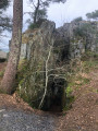
The Ardoisières Route between Rochefort-en-Terre and Malansac
 13.64 mi
+623 ft
-617 ft
6h 50
13.64 mi
+623 ft
-617 ft
6h 50
 Difficult
Departure from Rochefort-en-Terre (Morbihan)
Difficult
Departure from Rochefort-en-Terre (Morbihan)
This hike is circular, taking forest paths and roads on the return journey, via the Circuit des Ardoisières, the Circuit des Pins, and passing through the village of Malansac.