


 Country:
 City:
City:


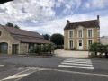
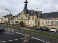
Park in the car park at Moult Town Hall, Rue Robert Hamelin.
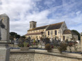
(S/E) With your back to the town hall, head towards Rue Robert Hamelin, cross it and then turn left. Continue along Rue Pierre Cingal, turn right and walk down to the edge of the next junction. Cross Rue Pierre Cingal using the pedestrian crossing, continue to the junction and turn left into Rue de Verdun. Walk down Rue de Verdun, turn left at the corner by the cemetery, then walk up Rue de l’Église Sainte-Anne on the left-hand pavement. As you approach the Caen–Lisieux road (D613), walk up to the left until you reach the pedestrian crossing and cross Route de Paris with great care.
(1) Turn right and, a few metres further on, turn left onto Chemin des Écuries. Follow the path for about 500 metres, negotiate the left-hand bend and reach Rue Maréchal Joffre (D37). Turn right, walk alongside the René Maginier municipal stadium and continue to thefirst street on the right.
(2) Turn right towards the emergency services centre and technical services, take Rue Gustave Flaubert and, keeping to the right-hand side, follow it all the way to the end. At the junction, keep right into Rue du Champ de Foire, cross Rue du Vérignier and carry on to the next crossroads. Ignore Rue de Croissanville on your left, cross the Muance and turn slightly right onto Chemin du Coudray. Follow the path to the crossroads.
(3) Leave the Chemin du Coudray, which continues to the right; ignore the Chemin de la Côte Sainte-Catherine opposite, and turn left onto the Chemin des Vignes. Walk for about fifty metres, then turn right onto the Chemin du Val Meslier and follow it uphill (quite a steep climb) to the top. Turn left and take the Chemin des Crêtes, ignoring the paths on both the right and the left. Follow the meandering path, passing the Chemin Saint-Julien and the Chemin du Puchot in turn. Walk past the water tower (on the left, underground), ignore the path on the right and continue to the road.
(4) At the junction, turn left onto the Route de la Jaunière, walk for about 150 metres and, before the high-voltage power lines, turn right. Walk for about 200 metres, then turn right onto the first track; the second one, about twenty metres further on, is a private road. Follow the track on the right for about 500 metres, turn left and walk for about 200 metres until you reach a wooden footbridge. Turn right, cross the footbridge and follow the track for about 700 metres until you reach a road.
(5) Cross the Route de la Jaunière, continue straight ahead and walk for about 300 metres. Just before the bend, turn right, pass between the two rocks and continue for about 500 metres, ignoring the path on the right. At the end of the path, turn right, take the Chemin des Crêtes and follow it for about 250 metres until you reach a crossroads and the Chemin de la Côte Sainte-Catherine.
(6) Turn left and head down the Chemin de la Côte Sainte-Catherine towards the valley until you reach the junction with the Chemin du Coudray, which you passed on the way out.
(3) Turn left, keeping the River Muance on your right, and follow the Chemin du Coudray for about 1 km until you reach the Route de Paris (Caen–Lisieux road – D613).
(7) Turn right, take the side road and head back up towards the village. Cross Rue Simone Veil, then Chemin des Écuries, to reach the pedestrian crossing at the junction you passed on the way out.
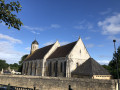
(1) Turn left, cross the Route de Paris (D613) very carefully, then turn left onto Rue de l’Église Sainte-Anne. Walk down to the church and the cemetery, then turn right into Rue de Verdun. Walk up Rue de Verdun to the next junction, turn right to the pedestrian crossing and cross the road. Turn right, walk up Rue Pierre Cingal on the left-hand pavement and turn left into Rue Robert Hamelin. Follow Rue Robert Hamelin for about fifty metres, then cross it to reach the town hall car park (S/E).


 Visorando Member

 Moderate
