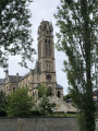
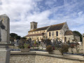
The Chemin des Saulniers in Sannerville

Sannerville is the easternmost of the communes in Caen-la-Mer. This village, which was completely razed to the ground in 1944, is now influenced by Caen’s population growth whilst remaining in the countryside, which gives it a quality of life much appreciated by its residents. Sannerville lies on the edge of the Pays d’Auge.

Details

17576110
Creation:
Last update:
Last review:
  • Walking
    Activity: Walking
  • ↔
    Distance: 5.43 mi
  • ◔
    Average duration: 2h 30 
  • ▲
    Difficulty: Easy

  • ⚐
    Back to start: Yes
  • ↗
    Ascent: + 46 ft
  • ↘
    Descent: - 46 ft

  • ▲
    Highest point: 98 ft
  • ▼
    Lowest point: 26 ft
  • ⚐ Country: France
  • ⚐ City: Sannerville (14940)
  • ⚑
    Start/End: N 49.180654° / W 0.222585°
  • ❏
    IGN map(s): Ref. 1612OT
  • Hour-by-hour weather

Photos

Description of the walk

Park in the car park at Place Exminster, between Rue du Stade and the post office.

(S/E) With Rue du Stade on your right and the Marthe and Michel Las School on your left, walk between the trees, cross the square and join Rue de la Libération (D226). Use the pedestrian crossing to cross this road with great care, turn left and then right into Rue de la Renaissance. Follow this road, then turn right into Allée des Bouquets and follow it to the end.

(1) Cross Rue Pasteur carefully, then turn right and walk a good fifty metres before turning left onto Chemin de la Londe. Follow this path to the road and cross it carefully. Turn left into Rue du Muguet – note the wash house a little further on to the right – and follow it for about 200 metres to the next junction.

(2) Turn right onto rural track no. 9 and follow it to the D227 road near the water tower. Cross Rue de la Fief Ferme (D227) with care and continue along the track opposite for about 300 metres until you reach Rue de la Libération (D226).

(3) Cross with extreme caution – there is no pedestrian crossing – and carry on straight ahead along Rue du Mont du Saule until you reach a roundabout. Go round the roundabout on the right, then immediately turn right onto Rue du Mont du Saule, cross Rue des Colombes and continue straight ahead until you reach a track. Take this grassy track across the plain and follow it for about 1 km until you reach a track running at right angles to it.

(4) Turn right onto the track (Chemin Saulnier) and follow it for about 400 m until you reach the D226. Cross with the utmost caution and continue straight ahead heading north. After about 300 m, having passed the Touffréville concrete plant and reached the entrance to the construction and public works waste recycling site, turn right onto Chemin de la Grosse Tour towards Touffréville. Continue for about 1.2 km until you leave Rue Ted Eaglen and reach Rue du8e Parachutiste Bataillon (D227).

(5) Turn right; proceed with great caution, keeping to the hard shoulder, for about a hundred metres, then cross the road carefully to join Rue de l’Église. Follow this street until you reach a Fork in the road, then take the right-hand branch into Rue du Bout Roulant (C1) towards La Grande Bruyère. Leave the built-up area and continue until you reach the first track on the right.

(6) Turn right towards the south, pass close to the water treatment plant and continue to the Haras du Maizeret and the road at the corner of which it is situated; note the wash house a little further on to the right. Cross Rue du Muguet with care and continue straight ahead onto Rural Track No. 4 (Chemin de la Bruyère). Follow this rural track to the junction at the end of the bend; continue straight ahead, then a few dozen metres further on, veer slightly to the left, passing through the pasture. Continue for about 500 m, keeping to the right-hand side of the hedge, until you reach, at the edge of the meadow, a junction with a track running perpendicular to it.

(7) Turn right towards Foltot and carry on to the farm buildings and houses in the hamlet. At the large house, turn left onto Chemin de Foltot. Carry on towards Sannerville, negotiate the right-hand bend around a large plane tree and continue to Rue des Métiers.

(8) Cross Rue des Métiers carefully, turn left and walk carefully along Rue de Caen (D675), using the footpaths as much as possible. Follow this road at a distance via the parallel street, Rue des Charrons, then use the pedestrian crossing to cross Rue de la Ferronnerie. Keep to the left to follow Rue du Maréchal Leclerc, walking past the shops on your right, then cross Rue de la Libération (D226) carefully via the pedestrian crossing. Keep to the left to continue walking past the shops on your right along Rue du Maréchal Leclerc, and stop just before it joins Route de Rouen (D675).

(9) At the end of Rue du Maréchal Leclerc, at the corner where the car park meets the hairdresser’s, turn right into the small passageway between the houses and continue along Rue Beauséjour. Turn left into Rue des Clématites and follow it to the skate park. Turn right and walk past the town hall buildings on your right, then continue to the right along the side road of the Esplanade François Mitterrand until you reach Rue du Stade. Turn right onto this street, walk a good hundred metres, then use the pedestrian crossing to carefully cross the Pue du Stade and reach Place Exminster and the car park (S/E).


Waypoints

  1. S/E : mi 0 - alt. 52 ft - Car park at Place Exminster
  2. 1 : mi 0.19 - alt. 46 ft - Rue Pasteur
  3. 2 : mi 0.6 - alt. 36 ft - Country Lane No. 9
  4. 3 : mi 1.04 - alt. 56 ft - Rue de la Libération (D226)
  5. 4 : mi 1.84 - alt. 89 ft - The Saulnier Path
  6. 5 : mi 2.96 - alt. 52 ft - Rue du 8ème Parachutiste Bataillon (D227)
  7. 6 : mi 3.38 - alt. 39 ft - Road to the Touffréville sewage treatment works
  8. 7 : mi 4.25 - alt. 30 ft - Road to Foltot
  9. 8 : mi 4.77 - alt. 33 ft - Rue des Métiers
  10. 9 : mi 5.12 - alt. 46 ft - Crossing at the end of Rue du Maréchal Leclerc
  11. S/E : mi 5.43 - alt. 52 ft - Car park at Place Exminster

Worth a visit

The Chemin Saulnier and the salt village
Sannerville takes its name from salt production. Passing near the hamlet of Lirose, the Chemin Saulnier runs through the commune. It is an ancient Gallo-Roman road once used to transport salt extracted at the mouth of the River Orne in Sallenelles. Two Gallo-Roman villas have been uncovered along the road. On 6 June 1944, it was used by British paratroopers and served the Allies following Operation Goodwood. In 2004, the local council renamed it the “Chemin Saulnier de la Liberté”.

Troarn Abbey
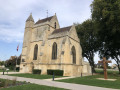
In the 11th century, the parishes of Sannerville, Lirose and Foltot were separate entities. Each had its own church and parish priest. The patronage of the Church of Notre-Dame de Sannerville belonged to Saint-Martin Abbey in Troarn, which owned extensive lands within the parish. The abbey received a third of the tithe, whilst the remainder was left to the parish priest. On one of the corners of the church tower, one can see a curious, crudely carved figure. Who is he? It remains a mystery…

Monumental 14th-century gateway
This is one of the medieval remains of Troarn Abbey, which was moved in 1843 to the entrance of the grounds of Banneville Castle, on the D 675 coming from Caen, on the border between Sannerville and Banneville-la-Campagne.

British military cemetery
It is situated next to the gate and contains 2,175 graves, including 2,150 British, 11 Canadians, 5 Australians, 2 New Zealanders, 5 Poles and two unidentified soldiers.

Reviews and comments

4 / 5
Based on 3 reviews

Reliability of the description
4.3 / 5
Ease of following the route
4 / 5
Route interest
3.7 / 5
ClaudeG14
ClaudeG14

Overall rating : 4 / 5

Date of your route : Jan 25, 2026
Reliability of the description : ★★★★☆ Good
Ease of following the route : ★★★★☆ Good
Route interest : ★★★★☆ Good
Very busy route : No

A good route to do in dry weather.
We chose the wrong time to do it, as 2 or 3 km of the paths were too wet.

Machine-translated

Jean-Paul BUTEAU
Jean-Paul BUTEAU

Hello Aimelle,
Thank you for taking the time to post your comment. I hope you’ll also enjoy some of the other walks I’ve posted.

Machine-translated

aimelle
aimelle

Overall rating : 4 / 5

Date of your route : Jan 01, 2022
Reliability of the description : ★★★★☆ Good
Ease of following the route : ★★★★☆ Good
Route interest : ★★★★☆ Good
Very busy route : No

Clear and precise directions: there’s no chance of taking a wrong turn.
A very easy walk; it’s completely flat throughout.

Machine-translated

Jean-Paul BUTEAU
Jean-Paul BUTEAU

Hello JR,
Thank you for taking the time to share your feedback. I understand that you would have preferred a drier route and a richer, more accessible architectural heritage, and I’m truly sorry to hear that. Every route has its limitations and its strengths, but certain aspects depend on the weather and the season. This walk is probably more charming in the warmer months.

Machine-translated

JR
JR

Overall rating : 4 / 5

Date of your route : Dec 31, 2021
Reliability of the description : ★★★★★ Very good
Ease of following the route : ★★★★☆ Good
Route interest : ★★★☆☆ Average
Very busy route : No

Hello
A well-explained and easy route; the paths were very muddy, which slowed down our walking pace. We completed the hike on a sunny afternoon.
No particular tourist attractions. The church was closed.
Thanks to Visiorando

Machine-translated

Other walks in the area

For more walks, use our search engine .

The GPS track and description are the property of this route's author. Please do not copy them without permission.