The Sainte-Radegonde Fountain
In the past, this spring was known throughout the region for its therapeutic properties in treating skin conditions; its water was also used to treat eye infections. During the fountain’s restoration in 1998, the manufacturer’s enamelled plaque was discovered: “DUMAS, stonemason and rock carver, Rue Écuyère, Caen”, which enabled its construction to be dated. It was erected between 1826 and 1868 by Casimir Edmond Costé, Marquis of Triquerville and mayor of Cagny from 1851 to 1866. Within the reconstruction of a grotto made of artificial rocks stands the statue of Saint Radegonde, carved from Caen stone in 1998 by the Caen-based sculptor Roland Moulin. At her feet, three shelf-like ledges provide space for flowers, candles and offerings. Almost at ground level, on the right, inscribed on the wall, are the opening lines of a poem:
“In these times darkened by the ashes of the past
What is this ray plunging into the deep water
Drawing in, captivating all these weary people
It is your royal sceptre, Saint Radegund
O Queen, O Saint, O Mother, protector of the suffering
Angel of the fatherland...’
The rest is broken. It was signed by a lady, perhaps the lady of Cagny or one of her relatives.
On two occasions since its creation, the fountain has escaped destruction. Whilst it survived the disaster of the air raids of 18 July 1944, which were intended to obliterate the heart of Cagny, it still bears the scars of that event in the chips on its walls. When the terrible storm of 26 December 1999 toppled large trees, some sixty years old, as if they were straws, the fountain and the statue of the saint were once again spared, as if by a miracle.
Operation Goodwood
On 18 July 1944, the most massive attack yet launched by the British since the start of operations began. The launch area for Operation Goodwood was the Ranville region. The axis ran west of Cagny, towards Bourguébus. Between 5 and 7 o’clock in the morning, 2,000 aircraft dropped 8,000 tonnes of bombs. Cagny alone took 650 tonnes of bombs – that is, one tonne of bombs per 300m²! The damage was considerable. Numerous German vehicles were put out of action. The psychological impact was enormous. The battle would involve around a thousand tanks. By 10.30 am, the tanks ofthe 2nd Fife and Forfar Yeomanry of the11th Armoured Division had advanced as far as the Caen–Paris railway line without any particular incident. At that moment, the3rd Squadron, which was behind them between Cagny and Le Mesnil Frémentel, was decimated by a German 88 mm battery firing from Cagny. Twelve tanks were destroyed in a matter of seconds. The advance was halted. It was not until 4.00 pm that the village of Cagny fell into the hands of the men of the British Guards Division. The front then stabilised between Cagny and Frénouville. Along the line of attack, following fierce fighting at Hubert-Folie and Bourguébus in particular, the tanks of the7th British Armoured Division did not reach the Bourguébus ridge until the following evening. Casualties totalled 4,000 killed or wounded. The number of British tanks put out of action was considerable (400, of which 250 were a total loss). A very comprehensive tourist information panel can be viewed in the centre of Cagny. During the battle, an intrepid Irish Guard, realising that his tank’s gun was jammed, drove his Sherman at full speed into the German Tiger facing him, thereby putting it out of action. A monument dedicated to him stands on the D 225.
The hamlet of Le Poirier
The hamlet of Le Poirier was incorporated into the commune of Frénouville in 1927.
The Chapel of Le Poirier
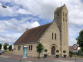
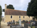
Rebuilt in a ‘modern’ style, the Chapel of Notre-Dame du Poirier was founded around 1160. It was restored in 1781, as evidenced by two stones set into the top of the interior walls on either side, bearing the inscription: ‘This stone marks the division between the nave and the chancel, 1781.’ An acoustic system was installed during this restoration. It comprised two sound pipes embedded in the walls, on either side of the nave and facing each other. A crucifix carved from pear wood also remains. Above the entrance, a small belfry houses a bell cast in 1902.
A Site of the Resistance
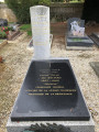
During 1944, from Saturday 10 June onwards, the chapel served as the headquarters of the F.F.I. (French Forces of the Interior) headquarters, which is why Commander Gille, in accordance with his wishes, was buried in the cemetery on 26 January 1971. He commanded the Fred Scamaroni Company, named after the prefect who had been involved in the Resistance since 1940 and who had taken his own life in prison rather than reveal anything to his Italian torturers. The main street in Le Poirier now bears his name.
The Villa des Emalés
Around 1960, the schoolteacher Bernard Martin discovered the baths of a Gallo-Roman villa in the meadow situated to the west of the path leading from Le Poirier to La Hogue. It was a fairly luxurious villa with decorated interior walls and rooms heated by a hypocaust. It was probably burnt down during the invasions of the 3rd century, rebuilt on a smaller scale, and finally destroyed in the 5th or 6th century during the barbarian invasions.
The Cagny sugar factory
On Wednesday 31 March 2021, Saint-Louis Sucre announced the permanent closure of the Cagny sugar refinery site, near Caen.
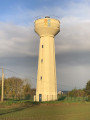
The sugar factory had been based in Cagny since 1951. Between the end of September and the end of December, it extracted an average of 1,250 tonnes of top-quality sugar per day from the 10,000 tonnes of beet supplied to it from the departments of Orne, Eure and Calvados by around 1,500 growers. Part of the syrup was stored to be processed during a one-month ‘mini-campaign’ in the spring. Around 100 permanent staff worked there, along with approximately 75 seasonal workers. 80 per cent of the production was destined for the Nassandres factory (Eure), which packages the sugar in tins for the retail trade. The remainder was supplied to local food manufacturers.
45 km of pipes
The sugar factory recovered the water contained in the beetroot and used it in the production process for washing and transporting the beetroot within the factory. This meant that the groundwater table was not drawn upon. During the sugar-making season, 24 hours a day, 7 days a week, 4,000 m³ of muddy water was pumped daily to the surrounding fields via a network of 45 km of pipes. To ensure a flow rate of 100 m³/h over a distance of up to 9 km, an initial pressure of 20 bar was required. At a rate of 150 g per litre of water, the irrigation sprinklers thus returned to the soil the silt, fertilisers (potash, nitrogen, lime, etc.), as well as the unwanted seeds brought to the sugar factory with the beetroot.
Saint-Germain Church
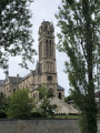
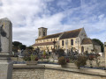
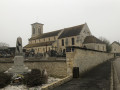
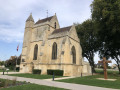
In the early 12th century, Saint-Germain was the mother church of the five churches situated within the territory of Cagny. At the start of the Hundred Years’ War, in the second half of the 14th century, Aimart Bourgoise, Viscount of Caen, shared his wealth with the village. It is to him that we owe the tower and chancel of Saint-Germain de Cagny, the listed part of the church that we still see today. Partially destroyed in July 1944, the church was restored and a new nave built in 1960. Beneath the cornice, a single corbel with a grimacing face remains of those that once seemed to mock passers-by. They are accompanied by chimeras with human heads. Two dogs at the corners of the chancel gable guard the sanctuary. The sundial was made in 1692, probably on the initiative of Suzanne de Monginot, Lady of Cagny, who wished in this way to mark the return of the Mesnage family to the Roman Catholic Church after a century and a half of membership of the Reformed Church. It was restored in 1994. The following inscription is engraved on its upper band: “ASTRA REGUNT HOMINES SED DEUS ASTRA REGIT” (“The stars rule men, but God rules the stars”). As the Earth rotates irregularly on its axis, a correction curve has been added. In addition to the clock’s small bell, which strikes the hours, the belfry houses two larger bells dating from 1818. They are named after the ladies of the family of the lord of the manor, Louis Mesnage. The largest, Antoinette, weighs 340 kg. The other, Pauline, weighs 190 kg. The heads of the statues of Saint Germain and Saint Radegonde, which flanked the altar at the beginning ofthe 20th century, are now on display at the chancel end of the new nave.
The Calvary
A granite Calvary had been erected in 1899 at the eastern edge of the village. Only its plinth survived the bombings of July 1944. Owing to the war damage, the parish council had a wooden Calvary erected behind the chevet of the church in 1960. As this Calvary had deteriorated over time, it was replaced in 2004 by a new one, created on a voluntary basis by Antoine Lagarigue, a sculptor who was then employed at the sugar factory.



 Country:
 City:
City:



 Visorando Member